New development lacking transit options

Residents encouraged to provide feedback to Transit Master Plan

Advertisement

Advertise with us

Hey there, time traveller!
This article was published 28/03/2019 (2630 days ago), so information in it may no longer be current.

Construction in West Transcona is booming. But some residents of the new development areas are finding themselves without easy access to transit.
“My understanding is Winnipeg Transit is looking to add transit to those areas,” Coun. Shawn Nason (Transcona) told The Herald. 
Currently, the closest bus stop for residents of new developments along Transcona Boulevard is on Peguis Street, which is serviced all day by route 44. According to Winnipeg Transit’s Navigo app, the average walking time from the corner of Transcona Boulevard and Veteran’s Way developments is approximately six minutes.
To ride a bus to the new Transcona Library at 1 Transcona Blvd., or the new Ted’s No Frills across the street in the Park City Commons development, residents would need to walk to Peguis Street, take a No. 44 to the bus route at Kildonan Place and transfer to a route servicing Plessis Road. Alternately, a person without mobility issues could walk in about 20 minutes, according to Google Maps, or bike in about five minutes.
However, some residents requiring the use of Winnipeg Transit Plus (formerly Handi Transit) are finding themselves completely out of luck.
“There are a few homes in that belt who currently don’t have access,” Nason added.
For a City of Winnipeg resident to access Transit Plus, their residence needs to be located within 500 metres of a bus route. Nason said he has heard from two residents whose new homes along Veteran’s Way fall outside of the 500-metre radius. For example residents along Tackaberry Way in Devonshire Park are up to one kilometre from the nearest bus stop.
“My understanding is there are some new areas, such as Waverly West and others in St. Vital, that are in the same position,” Nason added. “We need to make sure people moving into these new areas will still receive service.”
A City spokesperson encouraged area residents to take part in ongoing consultations regarding the City’s Transit Master Plan. 
“Any consideration of route changes to better serve Transcona Boulevard will form part of the Winnipeg Transit Master Plan,” the spokesperson wrote in an email. 
In the future, Nason added, there are plans for Devonshire Drive to connect to the new development, which could provide further options for routes. 
“My hope is residents of Transcona voice their opinion as to what their needs for Transit will be, and we’ll strive to meet those needs,” he said.
More information on the City’s Transit Master Plan can be found at winnipegtransit.com/en/major-projects/transit-master-plan

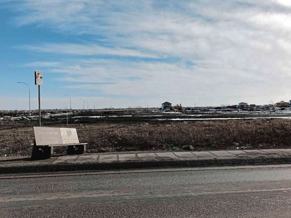
Construction in West Transcona is booming. But when it comes to accessing Transit, some residents of the new development areas are finding themselves out in the cold.

“My understanding is Winnipeg Transit is looking to add transit to those areas,” Coun. Shawn Nason (Transcona) told The Herald

Sheldon Birnie
Currently, there are no bus stops along Transcona Boulevard, a regional collector road servicing new developments in West Transcona. The nearest bus stops are on Peguis Street, which is up to one kilometre away from homes along Tackaberry Way in Devonshire Park. (SHELDON BIRNIE/CANSTAR/THE HERALD)
Sheldon Birnie Currently, there are no bus stops along Transcona Boulevard, a regional collector road servicing new developments in West Transcona. The nearest bus stops are on Peguis Street, which is up to one kilometre away from homes along Tackaberry Way in Devonshire Park. (SHELDON BIRNIE/CANSTAR/THE HERALD)

Currently, the closest bus stop for residents of new developments along Transcona Boulevard is on Peguis Street, which is serviced all day by route 44. According to Winnipeg Transit’s Navigo app, the average walking time from the corner of Transcona Boulevard and Veteran’s Way developments is approximately six minutes.

To ride a bus to the new Transcona Library at 1 Transcona Blvd., or the new No Frills grocery store across the street in the Park City Commons development, residents would need to walk to Peguis Street, take a No. 44 to Kildonan Place and transfer to a route servicing Plessis Road. Alternately, a person without mobility issues could walk in about 20 minutes, according to Google Maps, or bike in about five minutes.

However, some residents requiring the use of Winnipeg Transit Plus (formerly Handi Transit) are finding themselves completely out of luck.

“There are a few homes in that belt who currently don’t have access,” Nason added.

For a City of Winnipeg resident to access Transit Plus, their residence needs to be located within 500 metres of a bus route. Nason said he has heard from two residents whose new homes along Veteran’s Way fall outside of the 500-metre radius. For example residents along Tackaberry Way in Devonshire Park are up to one kilometre from the nearest bus route.

Sheldon Birnie
This southbound bus stop on Peguis Street, just south of Transcona Boulevard/Ravelston Ave. W is the closest bus stop for residents of Devonshire Park to connect to other routes headed into downtown Winnipeg or throughout Transcona. It is located over 400 metres from the entrance to the development. (SHELDON BIRNIE/CANSTAR/THE HERALD)
Sheldon Birnie This southbound bus stop on Peguis Street, just south of Transcona Boulevard/Ravelston Ave. W is the closest bus stop for residents of Devonshire Park to connect to other routes headed into downtown Winnipeg or throughout Transcona. It is located over 400 metres from the entrance to the development. (SHELDON BIRNIE/CANSTAR/THE HERALD)

“My understanding is there are some new areas, such as Waverly West and others in St. Vital, that are in the same position,” Nason added. “We need to make sure people moving into these new areas will still receive service.”

A City spokesperson encouraged area residents to take part in ongoing consultations regarding the City’s Transit Master Plan. 

“Any consideration of route changes to better serve Transcona Boulevard will form part of the Winnipeg Transit Master Plan,” the spokesperson wrote in an email. 

In the future, Nason added, there are plans for Devonshire Drive to connect to the new development, which could provide further options for routes. 

“My hope is residents of Transcona voice their opinion as to what their needs for Transit will be, and we’ll strive to meet those needs,” he said.

Sheldon Birnie
This northbound bus stop on Peguis Street across from the Prairie Crocus housing development will likely see an uptick in riders when the Devonshire Park development is complete. (SHELDON BIRNIE/CANSTAR/THE HERALD)
Sheldon Birnie This northbound bus stop on Peguis Street across from the Prairie Crocus housing development will likely see an uptick in riders when the Devonshire Park development is complete. (SHELDON BIRNIE/CANSTAR/THE HERALD)

More information on the City’s Transit Master Plan can be found at winnipegtransit.com/en/major-projects/transit-master-plan

Sheldon Birnie

Sheldon Birnie
Community Journalist

Sheldon Birnie is a reporter/photographer for the Free Press Community Review. Email him at sheldon.birnie@freepress.mb.ca or call him at 204-697-7112

Our newsroom depends on a growing audience of readers to power our journalism. If you are not a paid reader, please consider becoming a subscriber.

Our newsroom depends on its audience of readers to power our journalism. Thank you for your support.

Report Error Submit a Tip

The Herald

LOAD THE HERALD ARTICLES