


A tale of two perimeter roads

Advertisement
Hey there, time traveller!
This article was published 06/07/2022 (1466 days ago), so information in it may no longer be current.
In the early 1950s, the province wanted to construct a perimeter road around Greater Winnipeg to help alleviate regional traffic congestion expected in the coming decades. Due to the number of bridges, overpasses, and cloverleaf intersections required, the project would cost tens of millions of dollars and was expected to stay in the planning stages for many years to come.
That changed in 1956 when the federal government sweetened its 50-50 cost-sharing agreement with the provinces for Trans Canada Highway-related construction to include a 90 per cent subsidy for short stretches of more complicated roadwork. The province decided to apply for the new grant to build a Trans Canada Highway bypass around the south end of Greater Winnipeg that would double as the south section of its perimeter road.
The province had to scramble to change its original route, admitting that in 1955 it had underestimated the rate of suburban growth in the municipalities around Winnipeg. If the road was going to significantly alleviate regional traffic congestion it had to be moved further out.
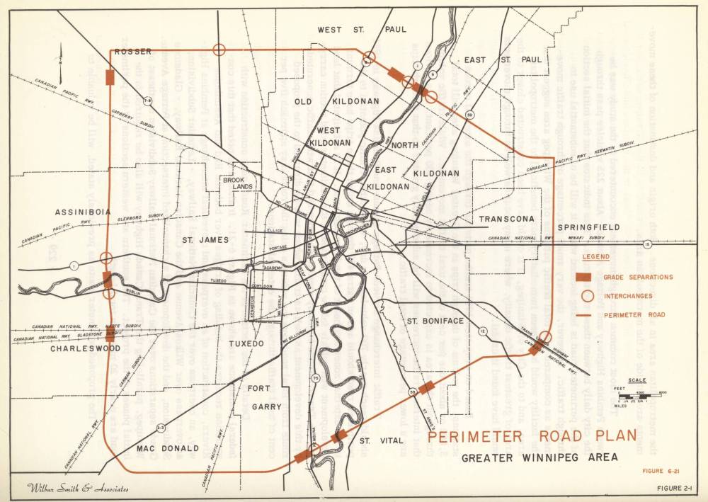
As the land for the new route was being assembled, the feds approved the application for a 30-kilometre-long stretch of highway with three major bridges.
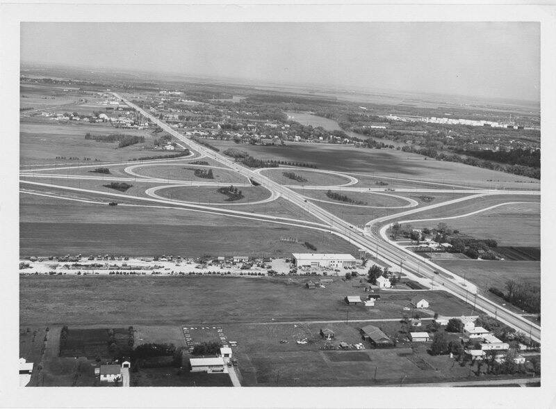
Construction began on the new road in spring 1957 and most of the south section was open by 1962. By then, work had already begun on some legs of the north section.
By April 1968, all but eleven of the loop’s original 89 kilometres were completed. (This total did not include a loop around Transcona as Highway 59 was rebuilt so that it could connect the north and south sections. The Transcona loop was eventually built in the late 1990s.)
Because the highway was under construction for well over a decade it does not appear to have had an official opening. It simply slipped into existence piece by piece.
The province stuck to its policy of giving numbers, not names, to its highways and urban routes. The south section and official bypass for the Trans Canada Highway became Provincial Trunk Highway 100 while the north section became PTH 101. For most, however, it was simply “the Perimeter” after the term used in planning documents and the media since the project’s inception.
As for the original route of the perimeter road, the province held onto the land for use as a hydro corridor and in the mid-1960s proposed a beltway road that would connect St. Vital and Fort Garry.
Unlike the Perimeter, which was built on farmland, the beltway was in the midst of a rapidly developing residential district and many did not want an urban freeway running through it. The project got bogged down in citizen opposition and cost delays but a decade later construction finally began. Route 165 and its Fort Garry Bridge opened in July 1978.
By this time, the province had less say in urban development projects as the municipalities of Greater Winnipeg had united into a single City of Winnipeg. The city decided that the stretch of road needed a name and chose Bishop Grandin Boulevard, as Bishop Grandin School had to be demolished to make way for one of the approaches.
Christian Cassidy
Christian Cassidy is a Manitoba Historical Society council member and a proud resident of the West End. He has been writing about Winnipeg history for more than a decade on his blog, West End Dumplings.
Our newsroom depends on a growing audience of readers to power our journalism. If you are not a paid reader, please consider becoming a subscriber.
Our newsroom depends on its audience of readers to power our journalism. Thank you for your support.
Advertisement Advertise With Us
Advertisement Advertise With Us