


New plan to protect Winnipeg’s green spaces

Advertisement
Hey there, time traveller!
This article was published 27/11/2024 (410 days ago), so information in it may no longer be current.
During my bike rides through FortWhyte Alive and occasionally the Assiniboine Forest, I’ve often wondered if there was any consideration to protecting these important natural corridors in the city – not just for us cyclists, but for the wildlife species that move through the city.
I was pleased to discover that work is underway to develop a green space and natural corridors plan for Winnipeg. According to the City of Winnipeg, this would be its “first comprehensive, over-arching plan to address public and private greenspaces, natural corridors and biodiversity in the city.”
Urban development typically results in reducing and isolating pockets of important natural habitat. Initiatives such as Winnipeg’s land dedication reserve fund have been massively beneficial in maintaining areas of open space for more than 50 years, but it hasn’t always been clear whether a bigger picture perspective was being applied.
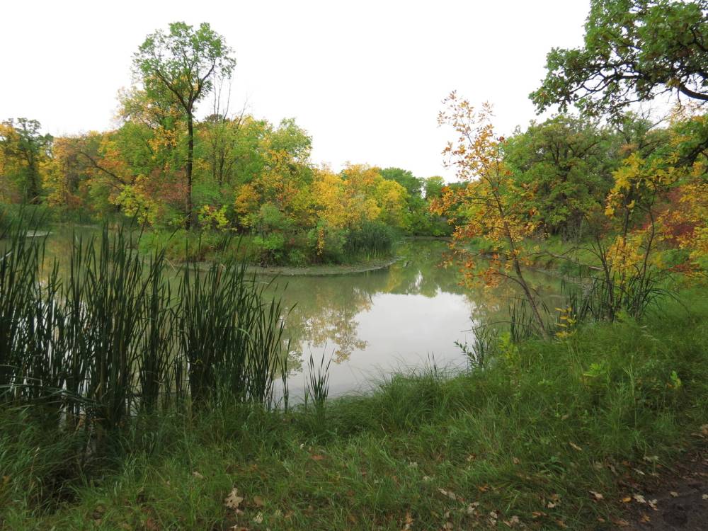
Supplied photo by Michele Kading
The City of Winnipeg is in the midst of developing a master plan for management of its green spaces and natural corridors.
In 2021, the City determined that there are 3,533 hectares of natural areas in the city. The longest stretches of non-fragmented habitat typically occur along urban watercourses, such as Bunn’s Creek in the northeast, the Seine River in the east, and of course, the Red and Assiniboine rivers. Volunteer community organizations such as Save Our Seine have helped to restore the natural values of some of these river-bottom forest areas.
There are also several stretches of natural terrestrial habitat corridors. My bike rides take me about eight kilometres through the native prairie at Whyte Ridge Community Centre and FortWhyte Alive, then into the aspen forest areas of the Assiniboine Forest. Another example is the Awasisak Meskanow Greenway – almost five kilometres of naturalized area established between the Red and Seine rivers, running parallel to Abinojii Mikanah Boulevard. The downside of these terrestrial areas is that they’re bisected by roads, which reduces their value as travelways for wildlife.
The new green space and natural corridors plan builds on several other City of Winnipeg planning documents. OurWinnipeg 2045 includes a policy to “create a master green space and natural corridor plan bylaw that enables conservation, management, restoration, and enhancement of the inherent value and ecological functioning of parks, waterways, natural areas and systems year-round, to support the environment, advance climate change adaptation and mitigation, and increase quantity of such lands by 1,000 acres (405 hectares) that can be accessed for recreation, social interaction, active living and connection of people and nature with nature, as population growth occurs.”
The Winnipeg parks strategy states that the City will “prioritize protection of natural areas designated as ecologically significant lands within parks over recreational uses where those uses may negatively impact the long-term health of the area being protected,” and will “preserve natural vegetation and habitats and promote wildlife passage corridors through parks and natural areas, where possible.”
The vision statement of the City of Winnipeg’s ecologically significant natural lands strategy calls for Winnipeg to be a “city which has protected important pockets of natural flora and fauna representative of the original natural ecosystems and lands susceptible to damage from flooding or erosion for the enrichment of the quality of life of the citizens of Winnipeg.”
The green space and natural corridors plan will include a 10-year strategic plan, management principles, an implementation plan, and a monitoring framework that will facilitate the planning, management and acquisition of greenspace and natural corridors. The development process includes a review of existing regulations, policies and existing baseline information, as well as current management practices related to greenspace and natural areas acquisition, protection, enhancement, management, and decision-making.
An initial step will be to examine existing baseline data, and map the current greenspace and natural corridor areas, so that planning can begin to meet the 405-hectare goal for new areas.
One interesting component is a commitment to engage and collaborate with Indigenous groups to help address biodiversity, greenspace and natural corridor protection, management and enhancement. Winnipeg has committed to forming a co-development team with several Indigenous partners, including the Assembly of Manitoba Chiefs, Manitoba Keewatinowi Okimakanak, Manitoba Métis Federation, Southern Chiefs’ Organization, Treaty One Nation, and the Tunngasugit – Inuit Resource Centre. The intent is that Indigenous stakeholders, elders and knowledge carriers can provide important perspectives regarding Indigenous knowledge of the land, community and ecology, and that the outcomes of this work can help to advance reconciliation and align with the City’s Indigenous Accord.
Key outputs will be the development of a biodiversity policy and a green space and natural corridor plan bylaw that will guide and co-ordinate the protection, management, enhancement and restoration of natural environments, so that as Winnipeg continues to grow, these important areas aren’t adversely impacted by development, climate change and other factors that could threaten their health and sustainability.
Exciting times ahead.
Nick Barnes
Whyte Ridge community correspondent
Nick Barnes is a community correspondent for Whyte Ridge.
Our newsroom depends on a growing audience of readers to power our journalism. If you are not a paid reader, please consider becoming a subscriber.
Our newsroom depends on its audience of readers to power our journalism. Thank you for your support.
Advertisement Advertise With Us
Advertisement Advertise With Us