


Room to improve on strong cycling foundation
Northeast Winnipeg’s cycling infrastructure: the good, the bad, the ugly

Advertisement
Hey there, time traveller!
This article was published 21/06/2019 (2570 days ago), so information in it may no longer be current.
They say that “if you build it, they will come.” But how do you get there in the first place?
For Bike to Work Day on June 17, Transcona city councillor Shawn Nason cycled the 14 kilometres from his home in the Park City to City Hall at the urging of Robb Massey.
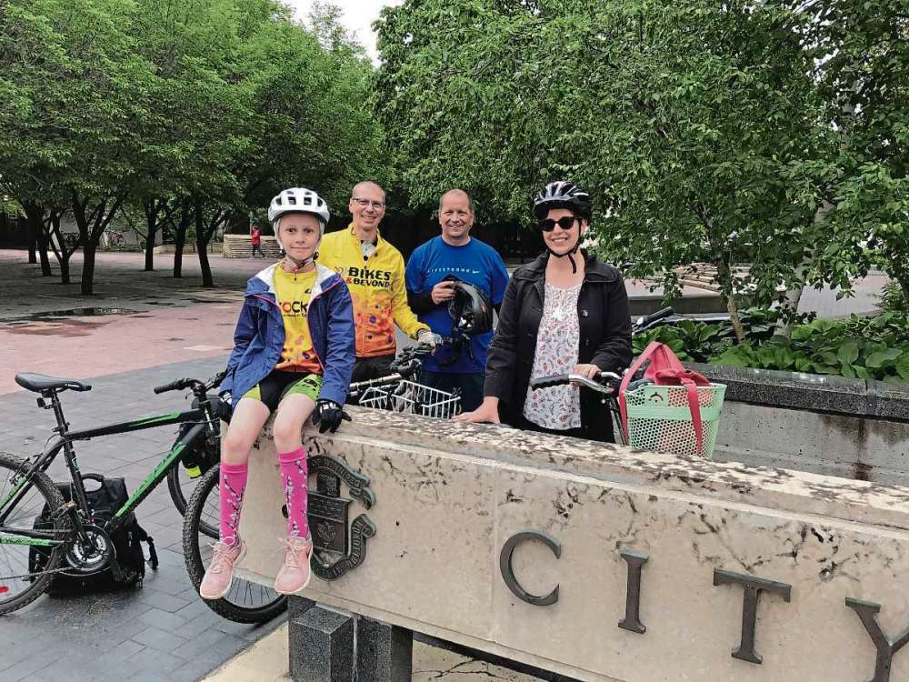
“I survived,” Nason said with a smile on the steps of 555 Main St. “I’m probably 15 to 20 years removed from being an active cyclist. This was fun. It’s rejuvenating. I’m arriving here at a reasonable hour, and reasonably awake. We’ll see how I’m doing around three o’clock when I have to start thinking about the ride home.”
Massey, a cycling advocate who ran unsuccessfully against incumbent Elmwood-East Kildonan councillor Jason Schreyer in the civic election last year, reached out to Nason as a means of highlighting how inconsistent cycling infrastructure is in northeast Winnipeg is.
“It was a nice ride,” said Massey, whose daughters Olivia and Sinéad joined the ride on their way to school. “We didn’t see too many cyclists out there, which I think speaks to some of the challenges we have riding from the northeast to downtown.”
The wide, tree-lined avenues in northeast Winnipeg are inviting to cyclists. The area is also home to an array of active transportation projects and pathways — from the Disraeli Active Transportation Bridge to the Transcona Trail — that residents and City staff alike can look to with pride. But getting from one route to another safely can be challenging.
That lack of connection is a constant complaint among cycling advocates and enthusiasts. Nason acknowledged as much.
“It was a fairly disjointed ride,” Nason admitted. “We saw the greater part of Elmwood-EK to get here, but overall it felt fairly safe.”
The good
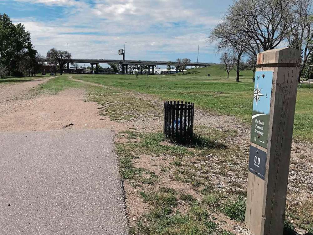
The Northeast Pioneers Greenway, which runs parallel to Gateway and Raleigh from Talbot Avenue in Elmwood north to East St. Paul, provides a sheltered, scenic thoroughfare for cyclists and pedestrians. The 6.5-kilometre paved pathway is a former CPR rail line and is often touted as a successful example of active transportation infrastructure.

“The Greenway is wonderful,” said Emma Durand-Wood, a member of the Glenelm Neighbourhood Association who joined Massey and Nason on their ride in Elmwood. “But the problem is there’s not a lot to get to on the Greenway. It’s a great way to get to Superstore, or the park way up north. It’s a great piece of cycling infrastructure, but it doesn’t get us to the library, or the drug store, or Sobeys.”
While the Greenway does connect to a number of east-west on-street routes that the City’s Public Works department lists as low- to medium-stress routes for cyclists, there are some outstanding issues, particularly in connecting to AT paths in St. Boniface to the south.
“Finishing some of those connections aren’t necessarily huge capital costs, but they’re important,” Coun. Jeff Browaty (North Kildonan) admitted. “Those small improvements would go a long way.”
Coun. Schreyer agreed, adding that he believes that repurposing the aging Louise Bridge as an active transportation bridge is an idea that council should at least consider.
“Sooner or later they’ve got to deal with it,” he said.
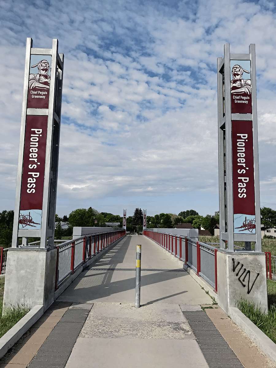
The Chief Peguis Trail in North Kildonan runs east from Main Street over the Kildonan Settlers Bridge to Lagimodière Boulevard, connecting to the Northeast Pioneers Greenway and the Bunn’s Creek Trail at Gateway Road. The extension of the Chief Peguis Trail west to McPhillips includes a major active transportation link to northwest Winnipeg.
Transcona, meanwhile, is home to over 22 kilometres of paved active transportation trails, many more limestone neighbourhood trails, and a number of low- to medium-stress street routes for cyclists.
“We have a lot of multi-purpose trails, we’re very fortunate,” said Val Cousineau, president of the Transcona Trails Association. “Because so much new development is happening now we have a chance to get a really amazing system in there.”
“We have a lot of new subdivisions, especially in Transcona, where it’s part of the development agreement that AT is built in,” Nason explained.
The bad
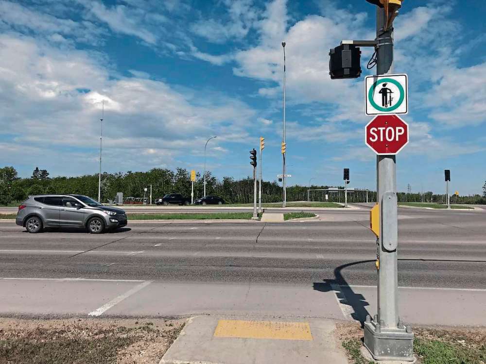
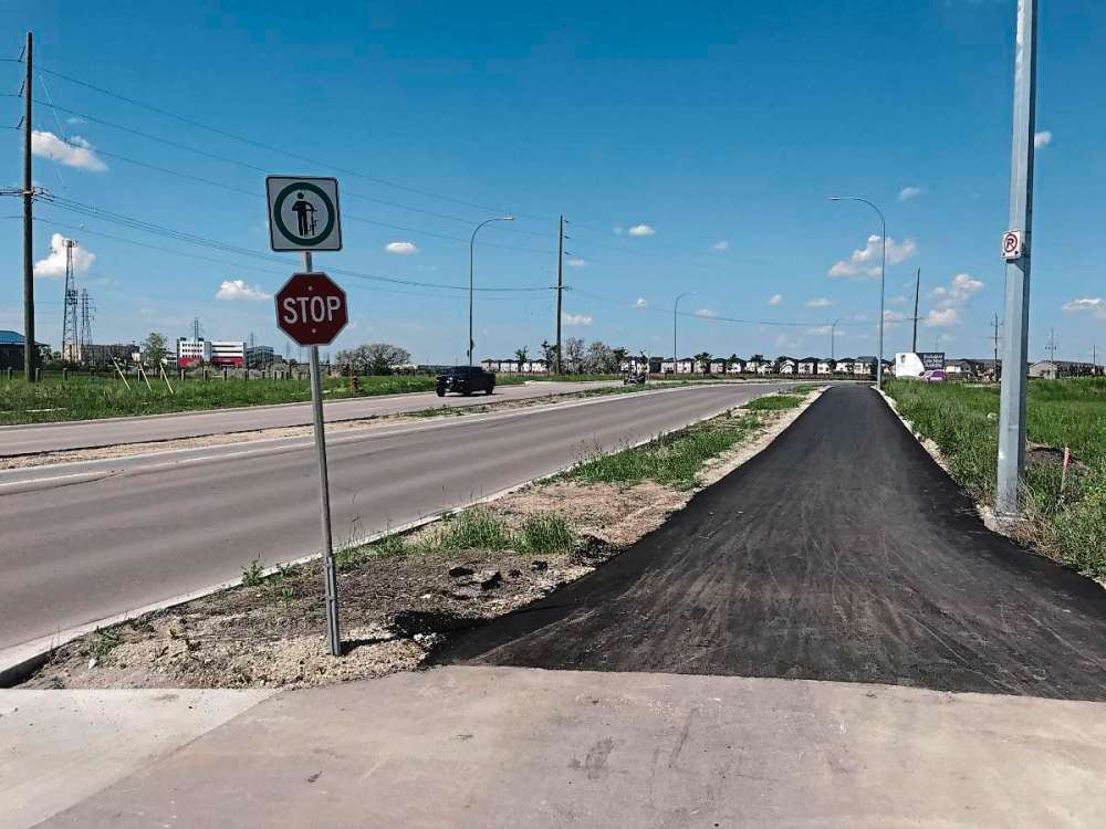
While designated active transit pathways like the Transcona Trail and the Northeast Pioneers Greenway offer ideal conditions for cyclists, the reality is most cyclists need to use city streets to get where they’re going.
“When people don’t feel safe on the roads, or when motorists feel squeezed or frustrated, that creates challenges,” Massey said.
Sometimes, the streets the City has designated as a bike route don’t make sense to commuters, Massey argued.
“We’ve designated Roch (Street) as a bike route, but it’s not connected,” he said by way of example. Instead, commuters favour Brazier Street.
Wayfinding signage directing cyclists to AT pathways and designated on street bike routes is an issue Cousineau and Nason would like to see improved.
“I think what City needs to do now is wayfinding for cyclists,” Cousineau said. “There should be safe cycling routes throughout the city.”
Durand-Wood and her husband have three children between the ages of two and nine years old. They recently sold their car and rely on public transportation, cycling, or walking to get around.
“We tend to try to find routes that allow for the adults to ride on a low-traffic street and the kids to ride on the sidewalk, which is doable,” Durand-Wood said. “But the crossing at the major streets like Henderson and Johnson are very scary.”
Durand-Wood said she would like to see more separated bike lanes on major streets, or at least have active transportation considered when major streets like Johnson and Munroe are up for renewal.
“If it’s not safe enough for me to ride with my children, it’s not that safe,” she said. “I don’t really foresee being able to increase the amount of cycling until that happens.”
“There are all sorts of little things that don’t have to cost a lot of money that would make people safer,” Massey suggested. “Like painting green lines through the intersections, cars would be aware that there could be cyclists.”
“Having protected, designated bike lanes on some of our major streets would be well supported,” Nason said “(But) these are all projects that take considerable capital. It has to be a priority of council and the budget working group, of which I am currently not a part of. In the meantime, hopefully they’ll see the way and continue to improve our cycling network.”
The ugly
Although Transcona boasts a series of active transportation paths that would be the envy of many neighbourhoods in the city, getting out of the Park City itself can be difficult — if not downright daunting — for cyclists.
“There are short gaps in cycling infrastructure throughout the city, but they’re key gaps,” Cousineau said. “It’s those little key links between communities that are so important.”
“We have to make sure that these ATs are connected to something,” Nason added. “We have to find a way there.”
Lagimodière Boulevard separates Transcona from the rest of the city, as do the CN rail line that runs parallel to Regent/Nairn Avenue in the south and the CPR, which cuts southwest from Gunn Road to Panet Road. As a result, opportunities for safe, low-stress cycling routes are limited.
“We’re advocating to complete the Transcona Trail, over to Panet and Mission,” Cousineau said. “That’s a high priority for us. Those links to Elmwood and East Kildonan are important.”
According to Nason, an AT connection along that route had been included in an early draft budget for 2019, but was cut.
“I’ve asked (council) to go back, to see if there’s a way we can do it, to find a separated bike path,” Nason said.
“I have patience for the system on this,” Schreyer said regarding connecting Transcona to East Kildonan. “It’s not simple, but it’s not off the agenda. Those routes are being developed fairly, I believe.”
The Chief Peguis Trail and AT paths in and around Kilcona Park are separated only by Lagimodière. Though controlled, the intersection is listed by the City’s Public Works department as an area of caution. Browaty said that while a better connection between the Chief Peguis Trail and Kilcona Park has been discussed over the years, it was not a high priority of his.
“There are a number of things in Kilcona Park that need improvement first,” he said. “But it would be nice.”
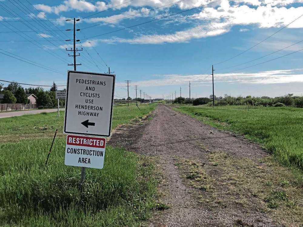
A higher priority for Browaty is improving or adding sidewalks on routes like DeVries Avenue or Henderson Highway north of Chief Peguis.
“It’s not easy to add active transportation on Henderson,” Browaty added. “The saving grace is there are some parallel routes that have had some active transportation additions to them.”
“Sidewalks are 90 per cent of the active transportation system,” Schreyer added. “If we’re serious about active transportation, we have to maintain our sidewalks in the winter time.”
Sheldon Birnie is the managing editor of the Free Press Community Review. Email him at sheldon.birnie@freepress.mb.ca or call him at 204-697-7112
Our newsroom depends on a growing audience of readers to power our journalism. If you are not a paid reader, please consider becoming a subscriber.
Our newsroom depends on its audience of readers to power our journalism. Thank you for your support.
Interest in AT strong in ESP
North of the Perimeter, the RM of East St. Paul is also home to a network of paved and unpaved active transportation pathways that continues to grow.
“Anytime we have development coming forward, we’re always looking for that connectivity,” mayor Shelley Hart said. “We continue to upgrade our trail system.”
The TransCanada Trail runs through the RM, and a paved AT path runs parallel to Hoddinott Road from Henderson Highway to Birds Hill.
“That path gets a ton of use,” Hart said, adding that lights were recently added along the route.
Currently, Hart said the municipal council is looking to pave the path that would connect Hoddinott to the Northeast Pioneers Greenway.
“There’s a lot of room there,” Hart said. “We’re looking to turn it into a linear park, with places for people to stop and be engaged in different activities.”
While Hart could not specify a date of completion for the project, she did say that council is eagre to see it move along.
“I’d like to see some progress this year. We’re just looking at costs and possibilities for funding to allow us to do more sooner.”
Sheldon Birnie is the managing editor of the Free Press Community Review. Email him at sheldon.birnie@freepress.mb.ca or call him at 204-697-7112
Our newsroom depends on a growing audience of readers to power our journalism. If you are not a paid reader, please consider becoming a subscriber.
Our newsroom depends on its audience of readers to power our journalism. Thank you for your support.
Advertisement Advertise With Us
Advertisement Advertise With Us