Maps of Winnipeg’s proposed new transit routes
Read this article for free:
or
Already have an account? Log in here »
To continue reading, please subscribe:
Monthly Digital Subscription
$0 for the first 4 weeks*
- Enjoy unlimited reading on winnipegfreepress.com
- Read the E-Edition, our digital replica newspaper
- Access News Break, our award-winning app
- Play interactive puzzles
*No charge for 4 weeks then price increases to the regular rate of $19.00 plus GST every four weeks. Offer available to new and qualified returning subscribers only. Cancel any time.
Monthly Digital Subscription
$4.75/week*
- Enjoy unlimited reading on winnipegfreepress.com
- Read the E-Edition, our digital replica newspaper
- Access News Break, our award-winning app
- Play interactive puzzles
*Billed as $19 plus GST every four weeks. Cancel any time.
To continue reading, please subscribe:
Add Free Press access to your Brandon Sun subscription for only an additional
$1 for the first 4 weeks*
*Your next subscription payment will increase by $1.00 and you will be charged $16.99 plus GST for four weeks. After four weeks, your payment will increase to $23.99 plus GST every four weeks.
Read unlimited articles for free today:
or
Already have an account? Log in here »
Hey there, time traveller!
This article was published 04/06/2024 (568 days ago), so information in it may no longer be current.
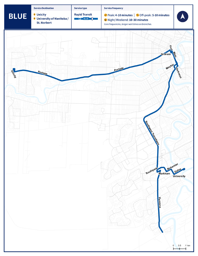
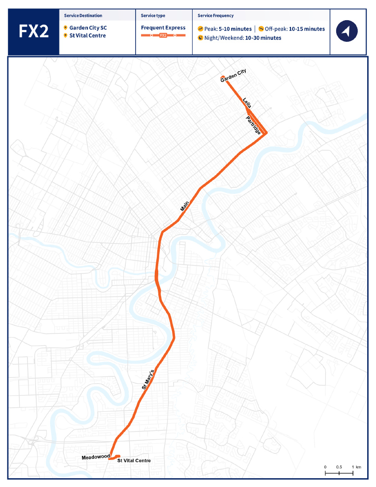
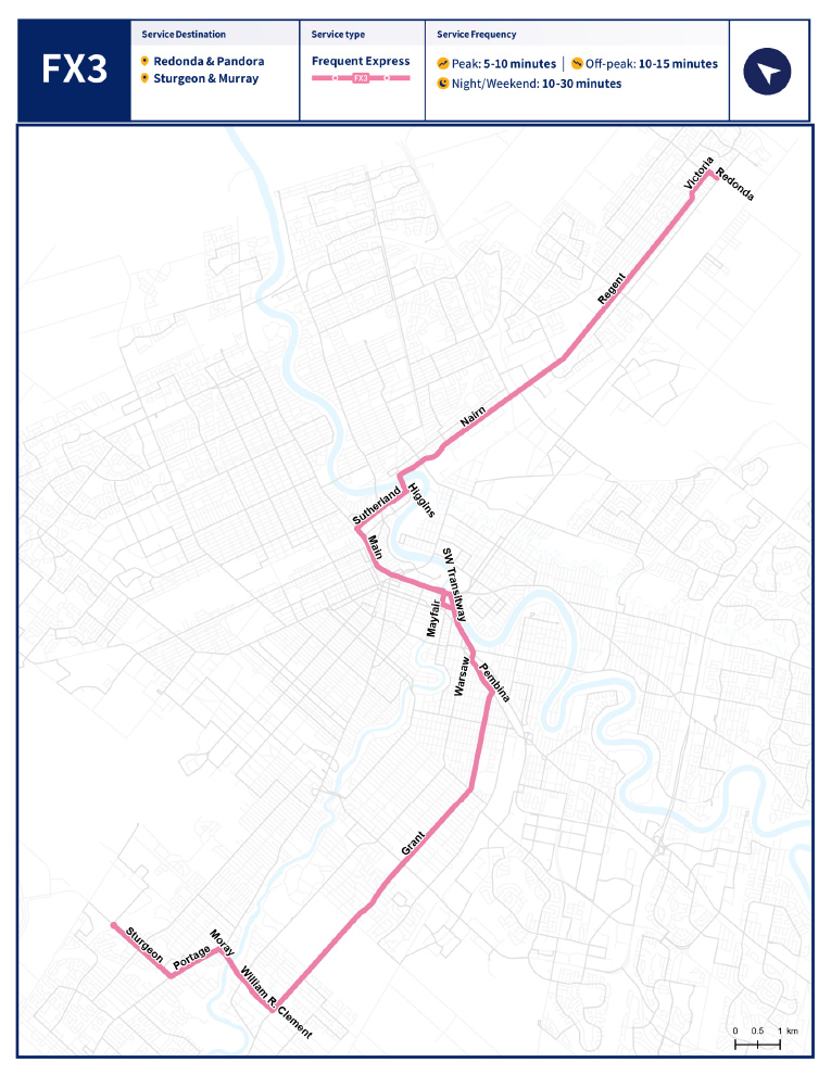
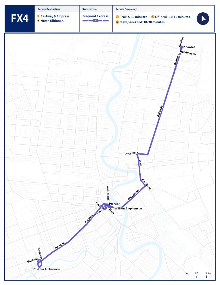
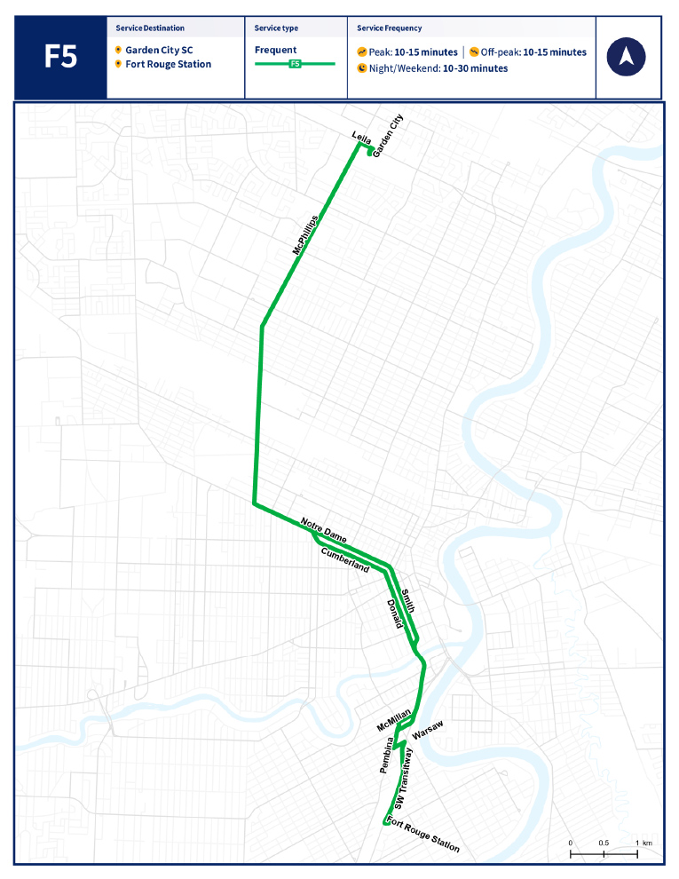
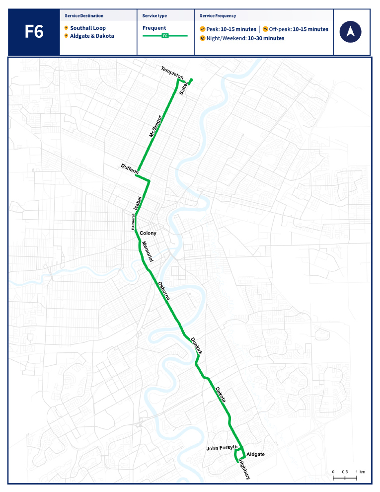
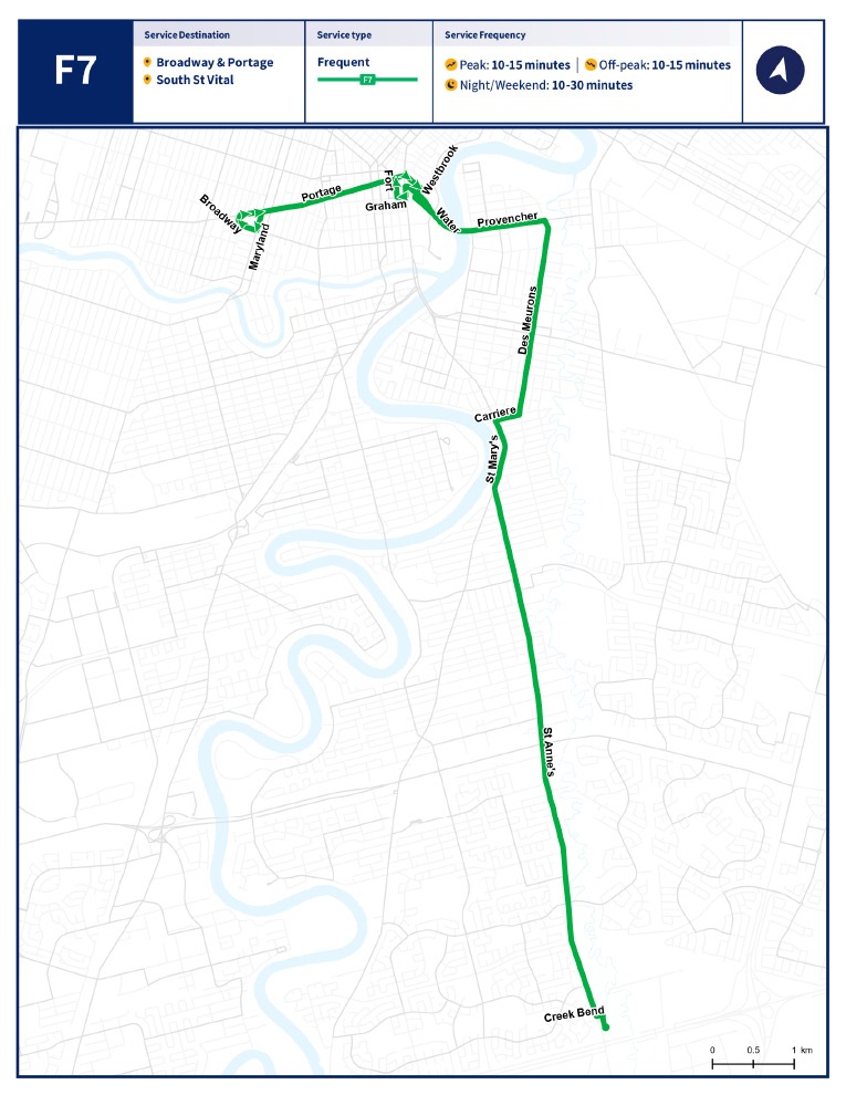
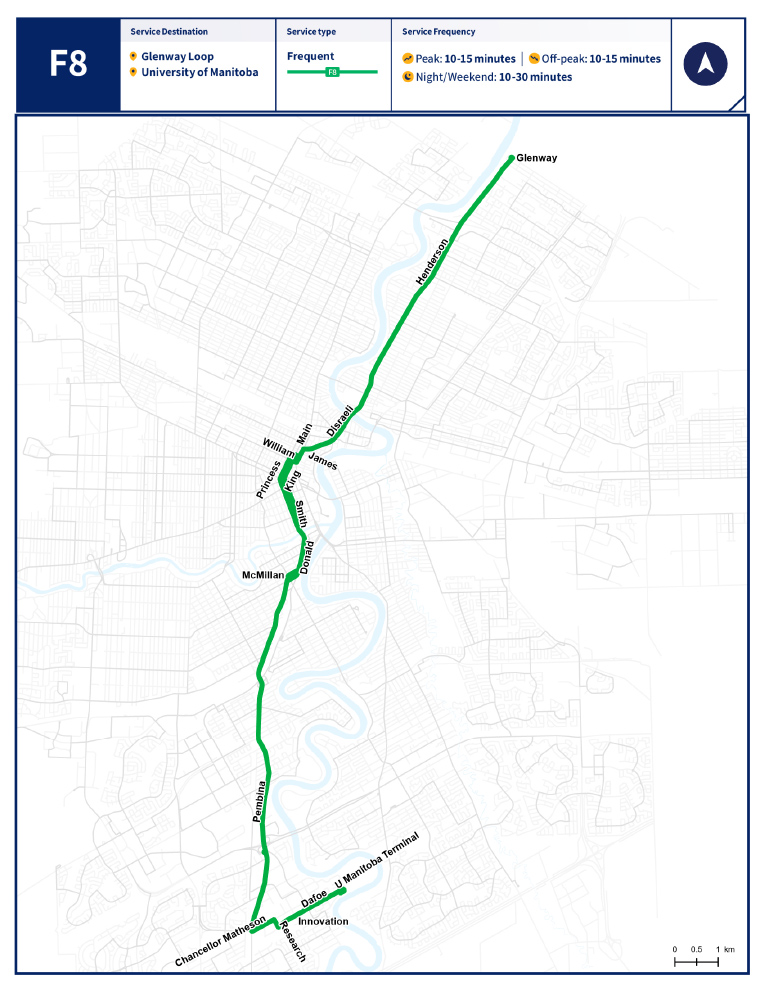
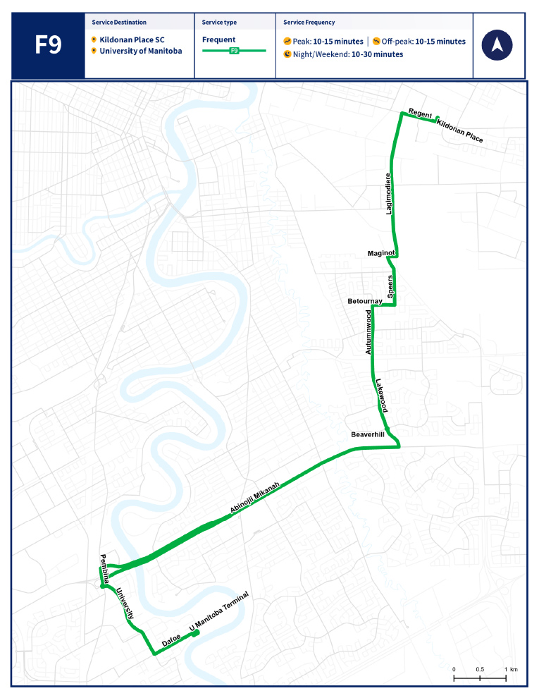
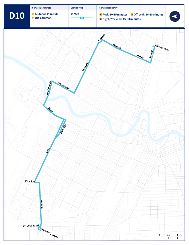
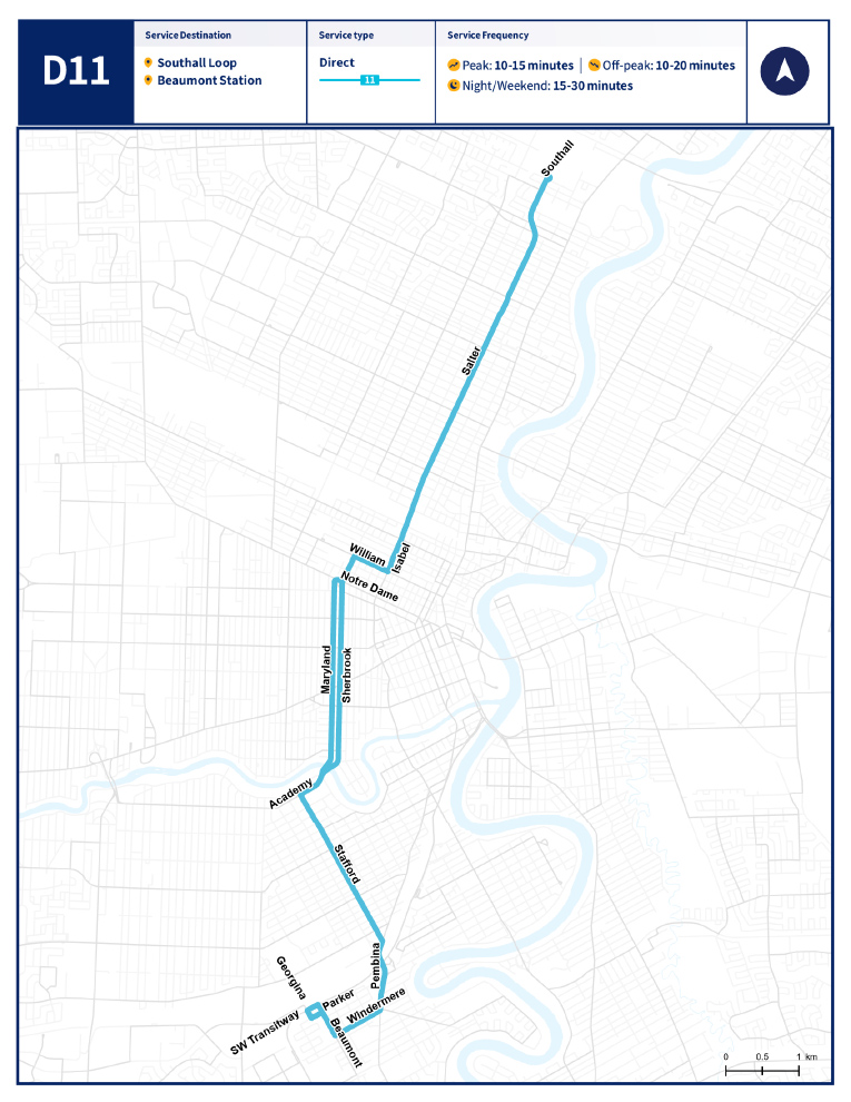
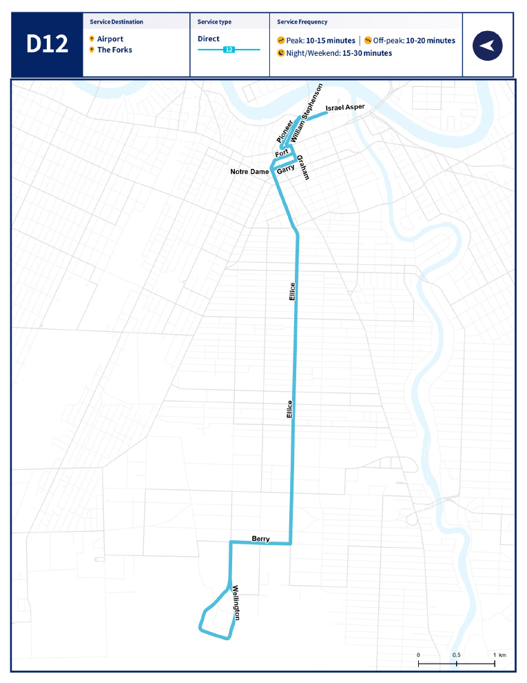
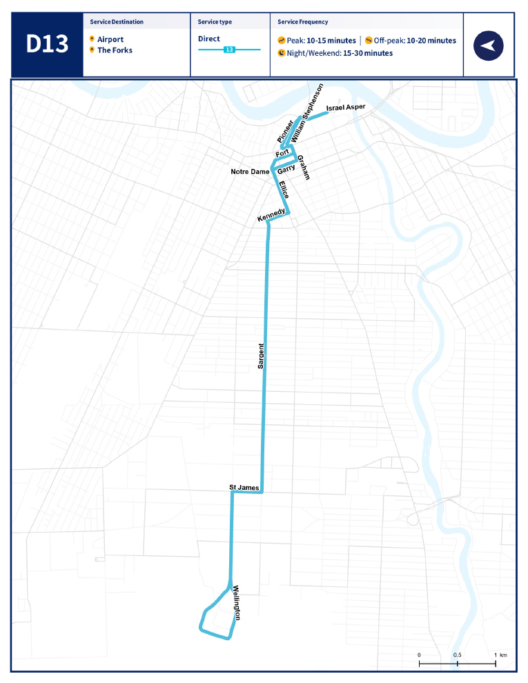
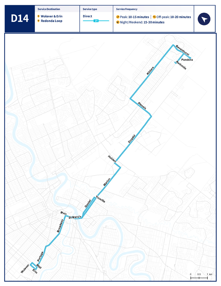
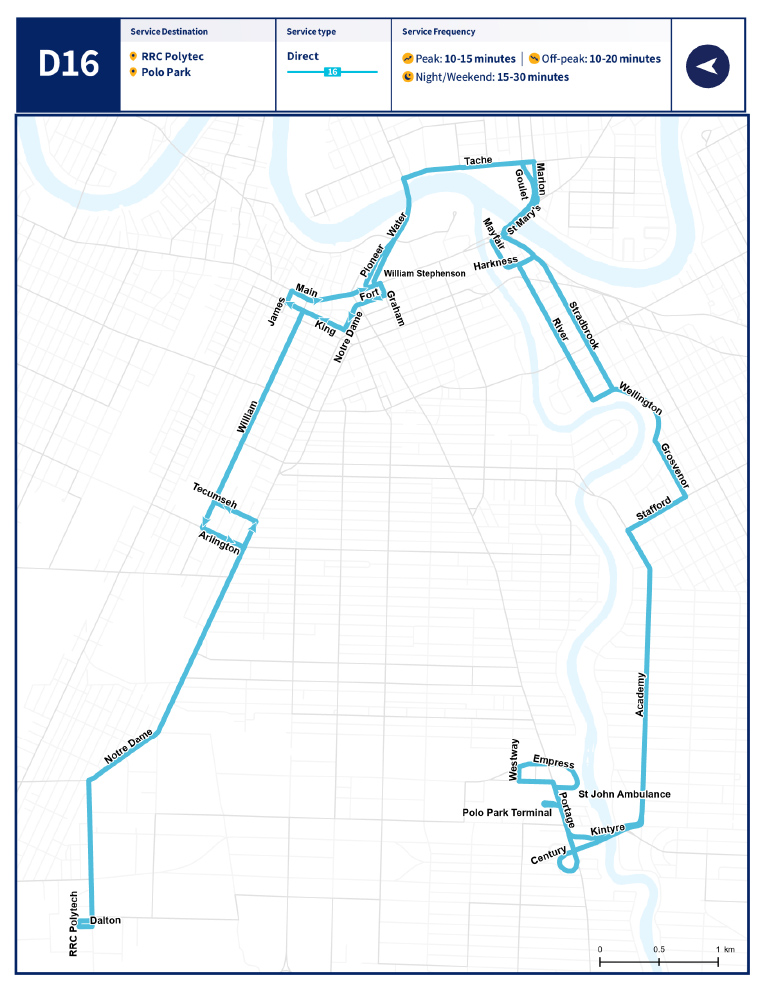
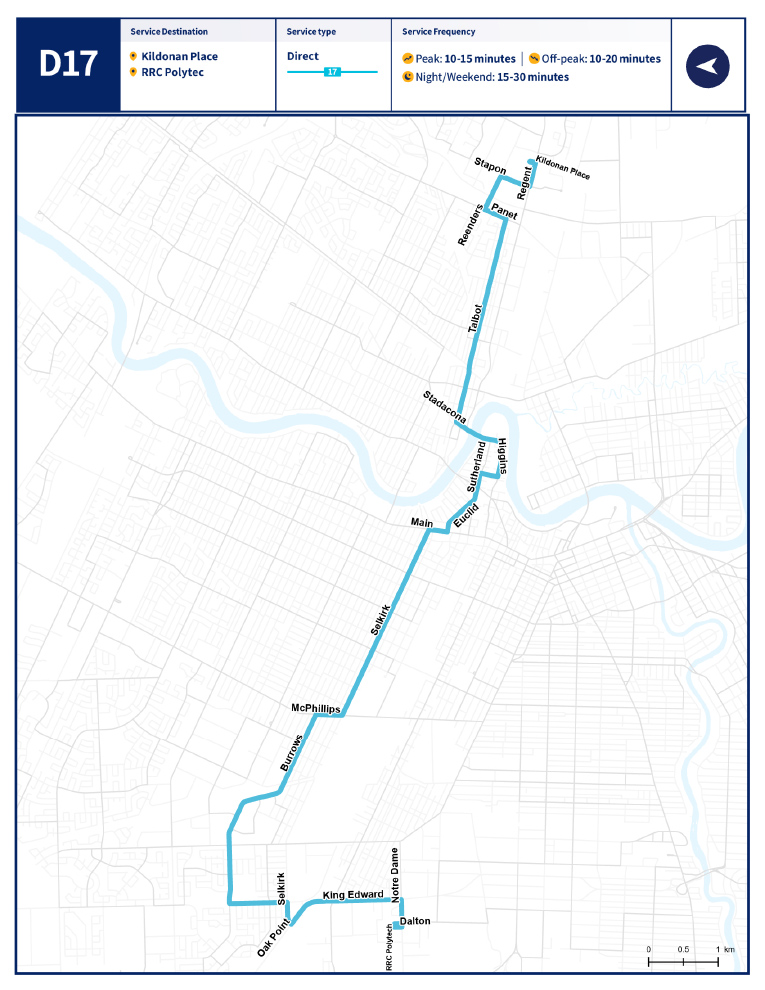
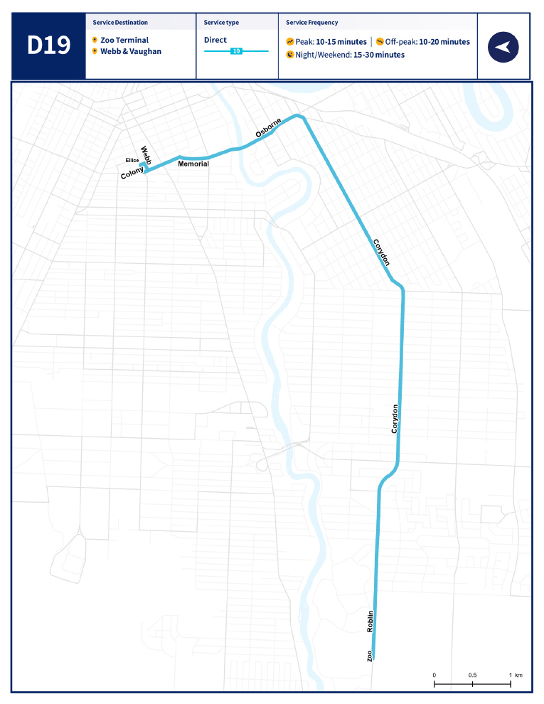
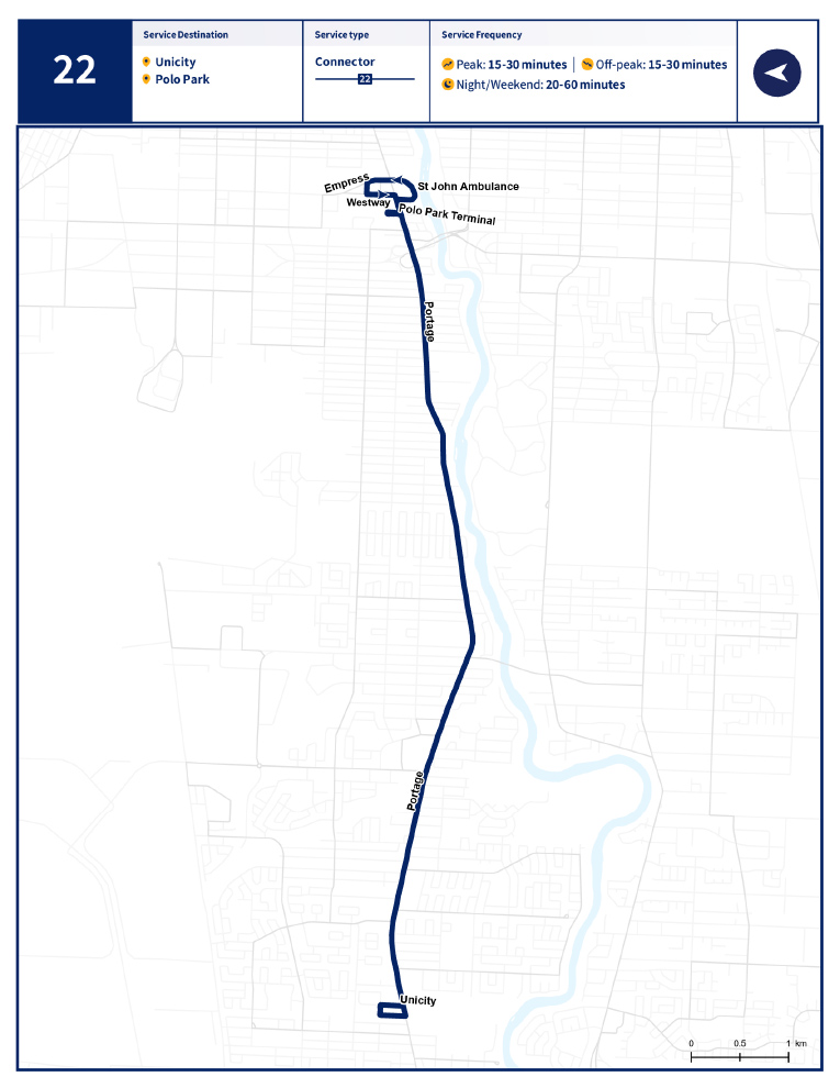
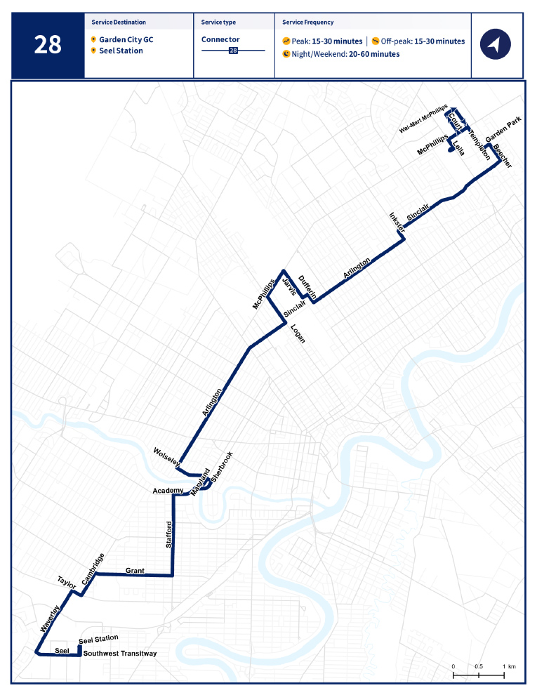
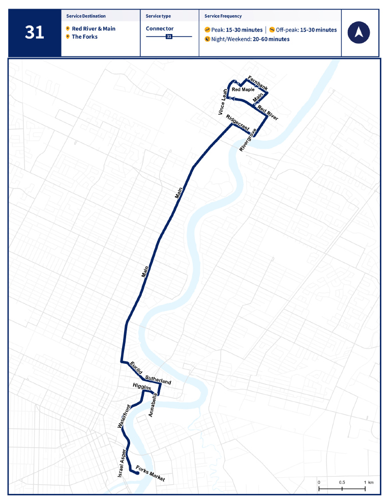
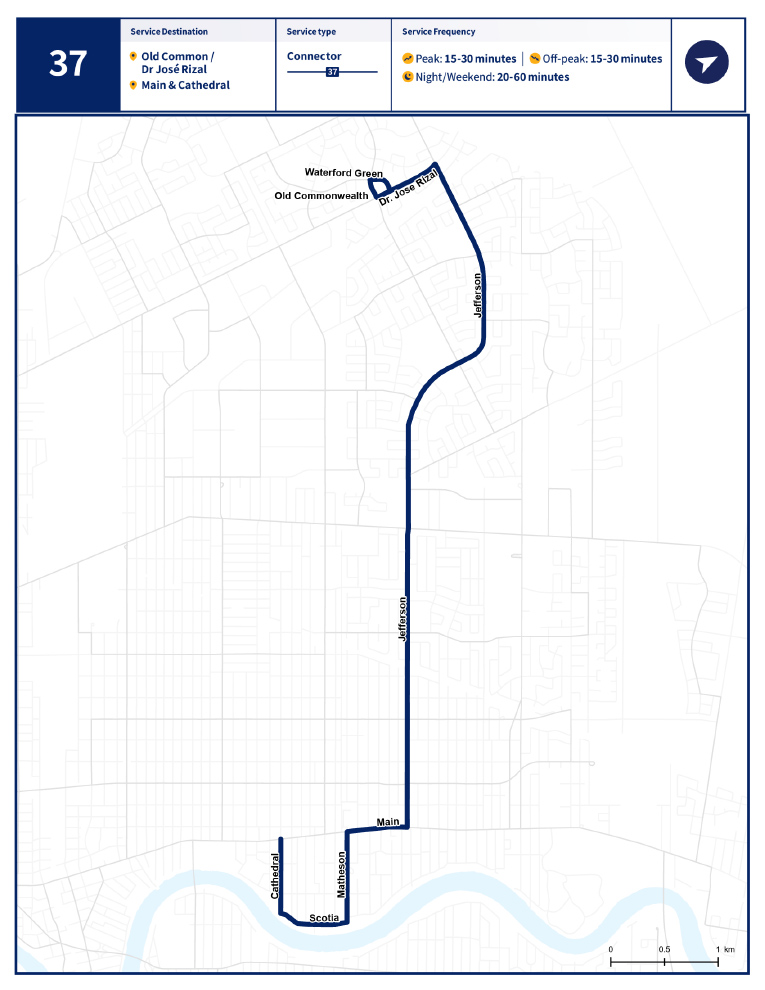
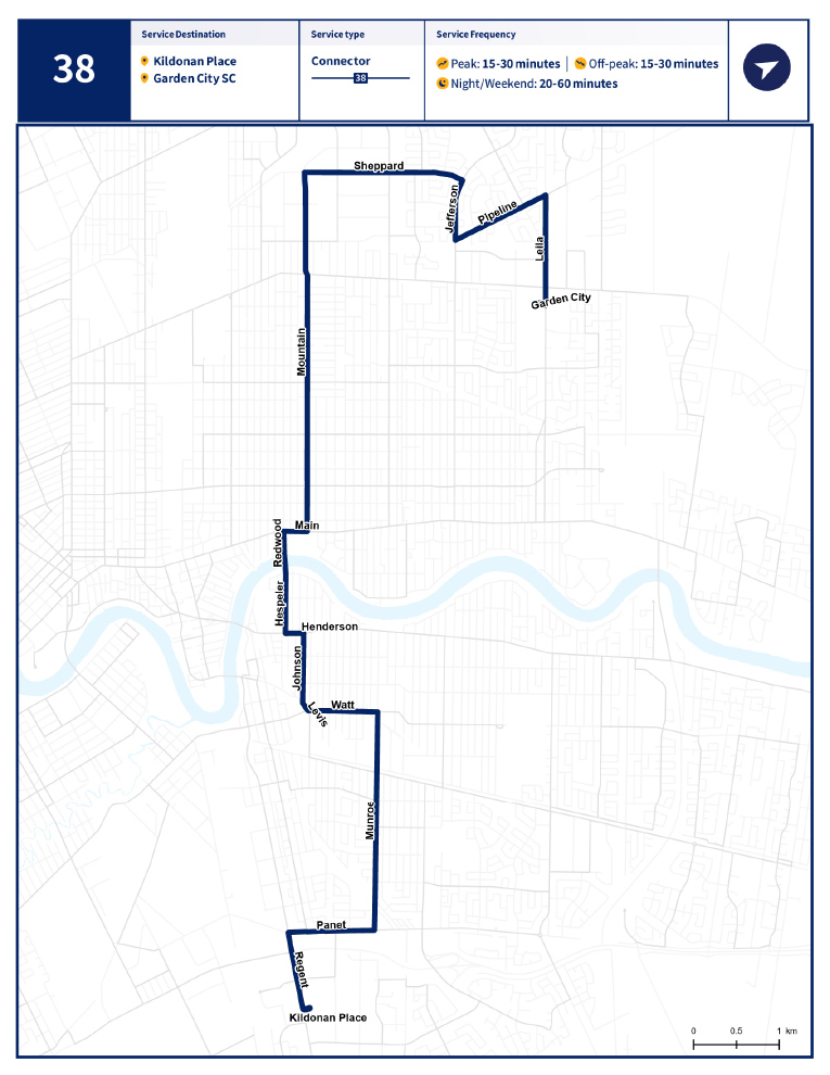
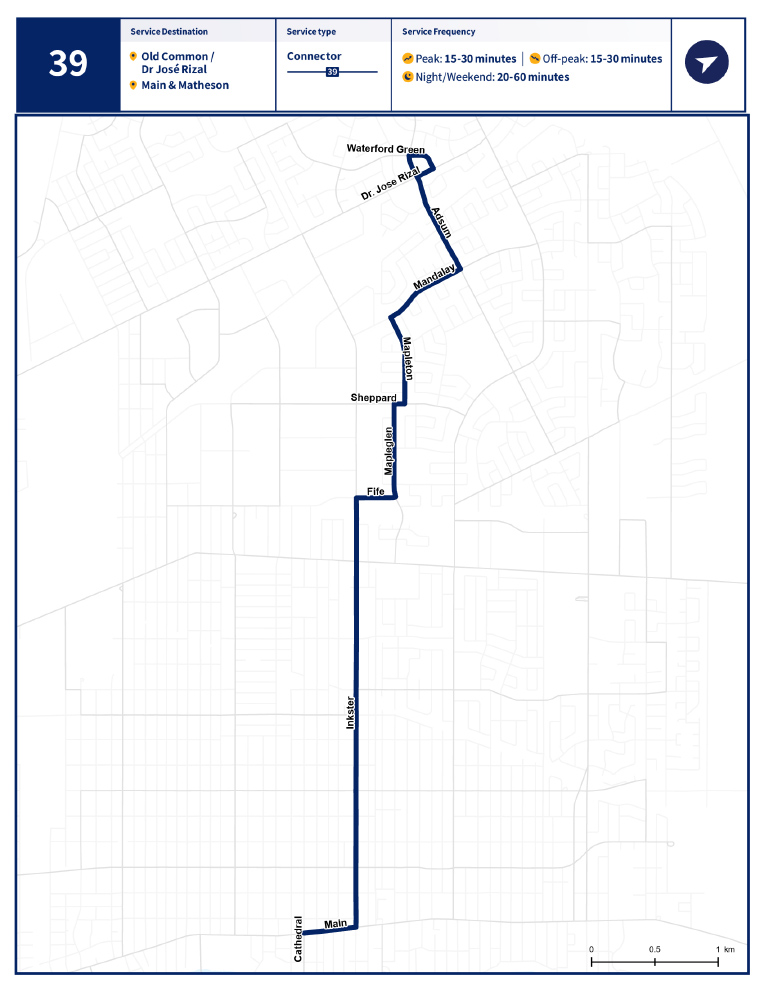
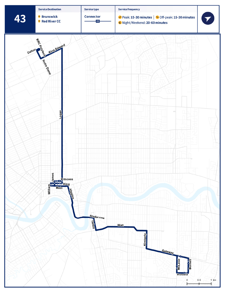
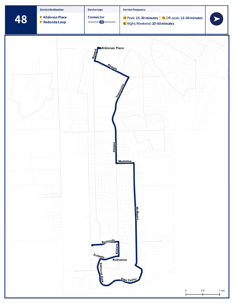
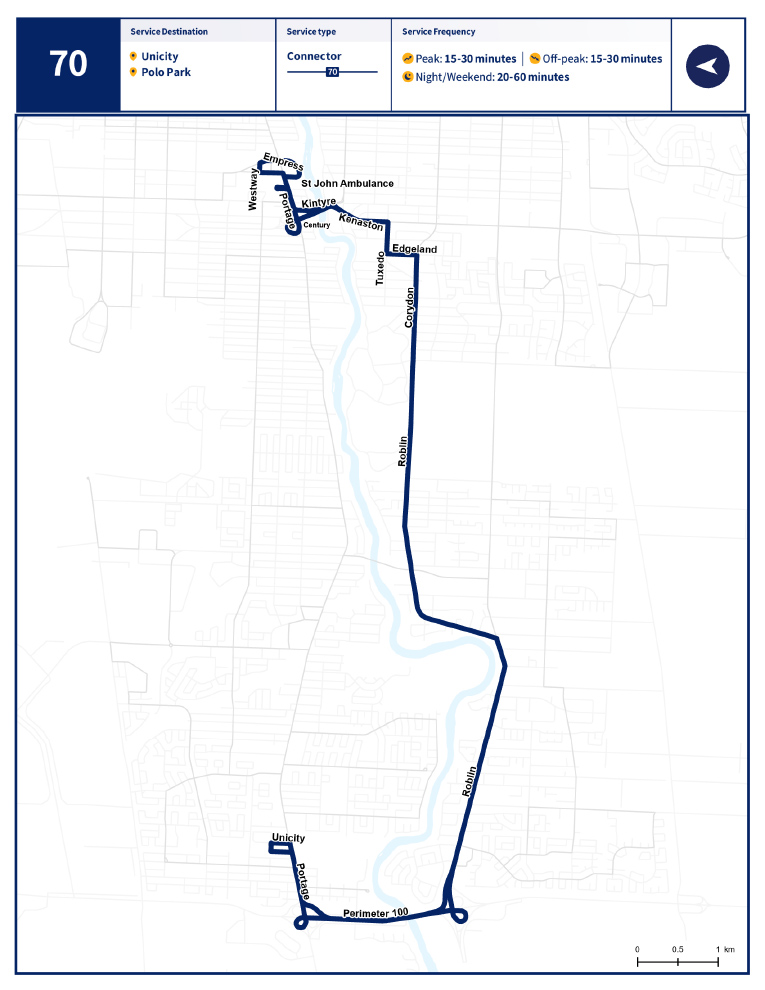
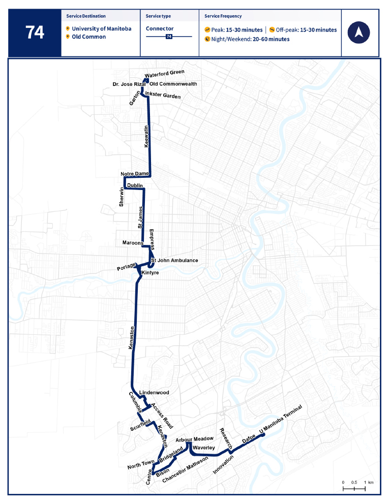
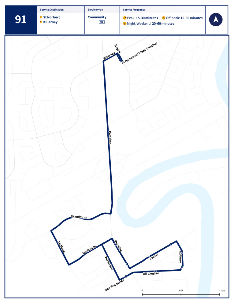
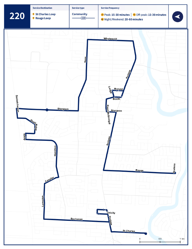
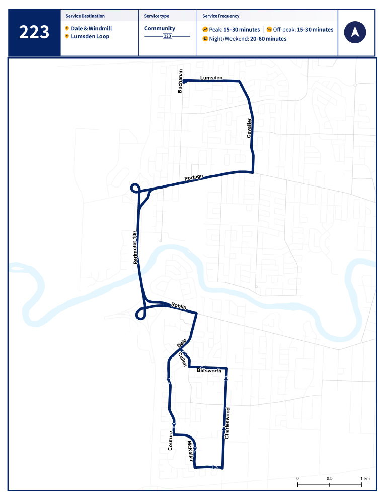
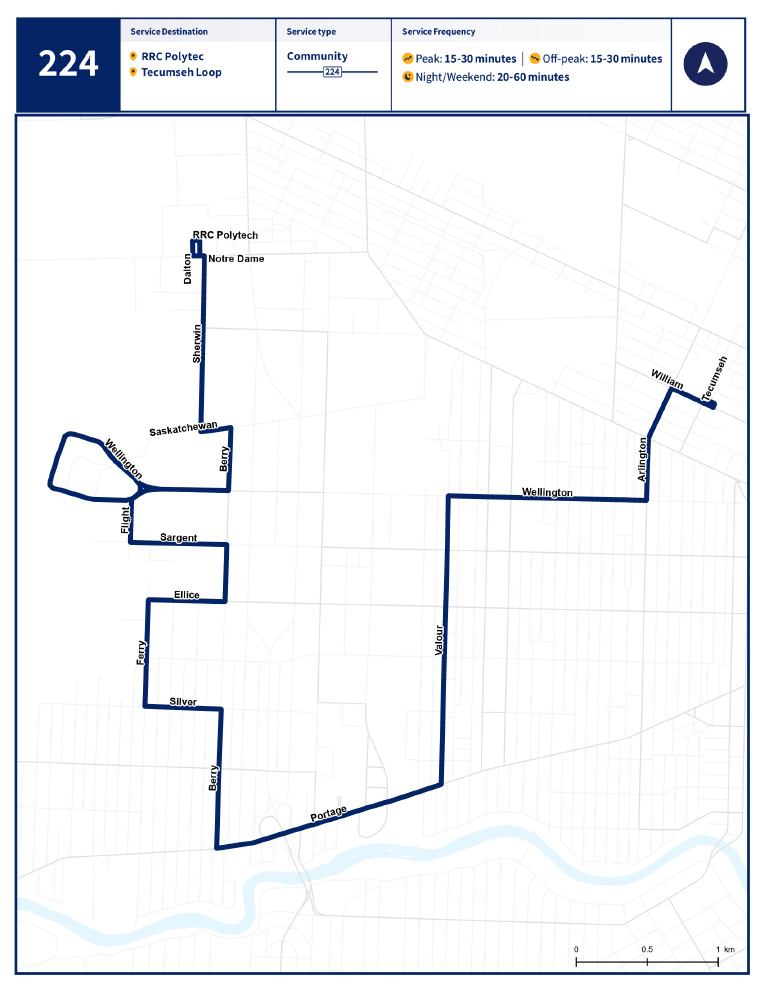
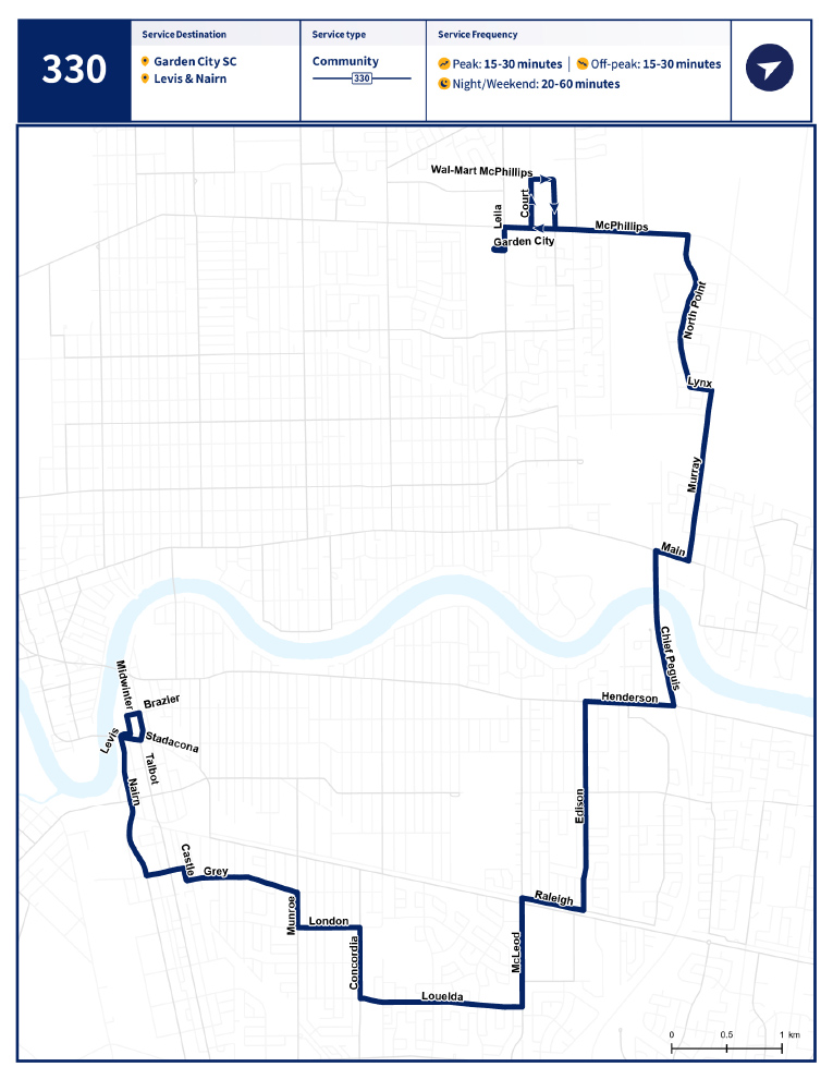
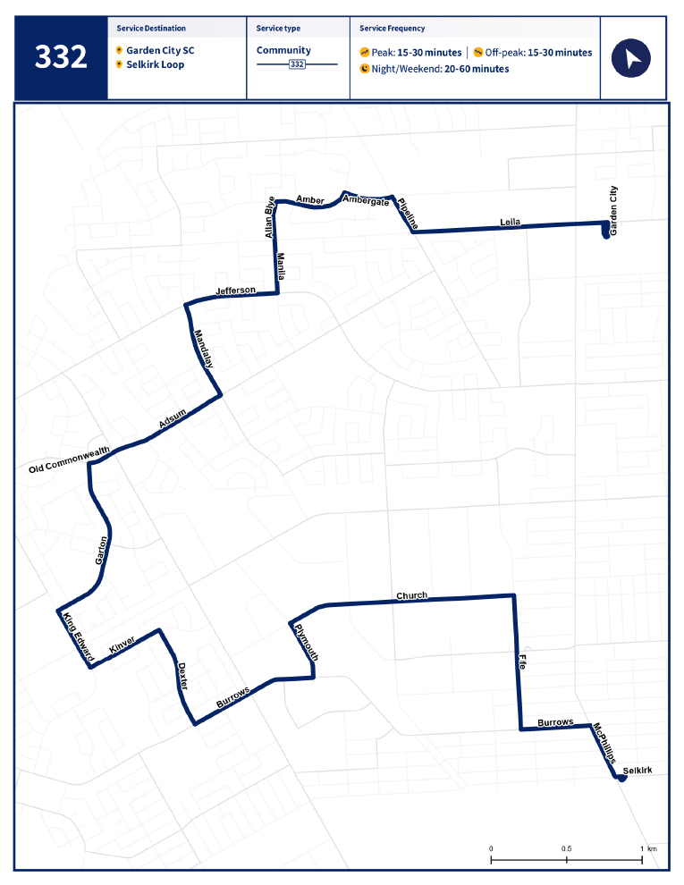
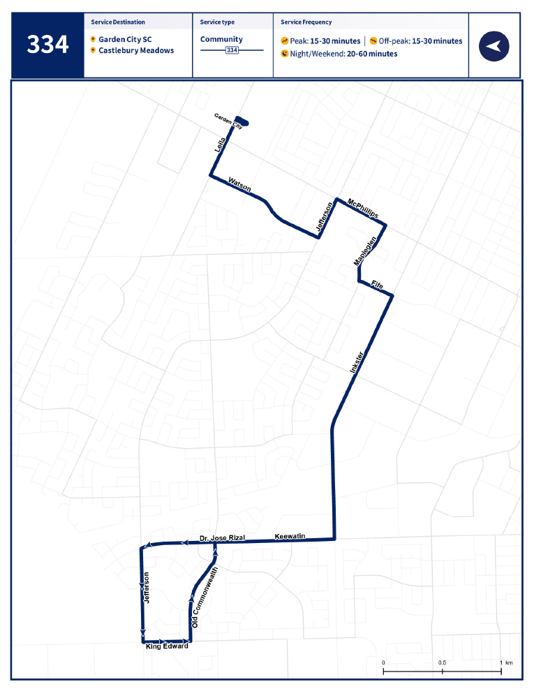
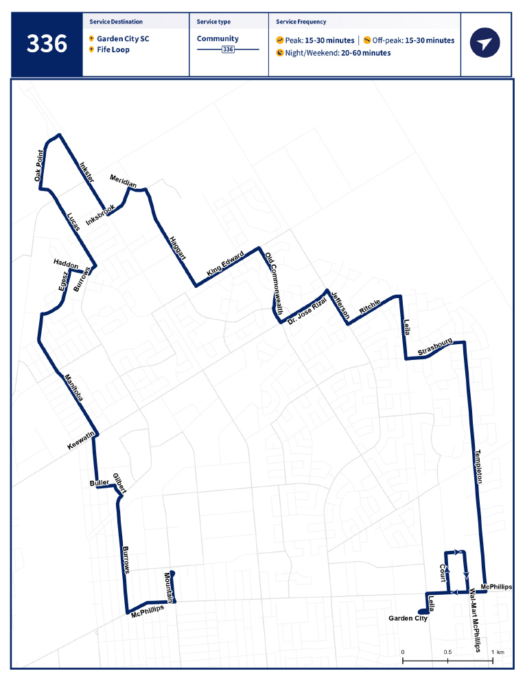
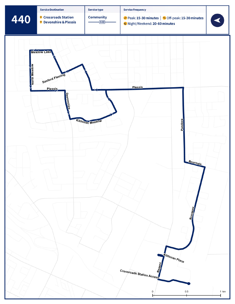
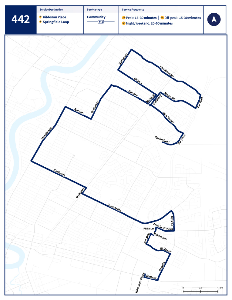
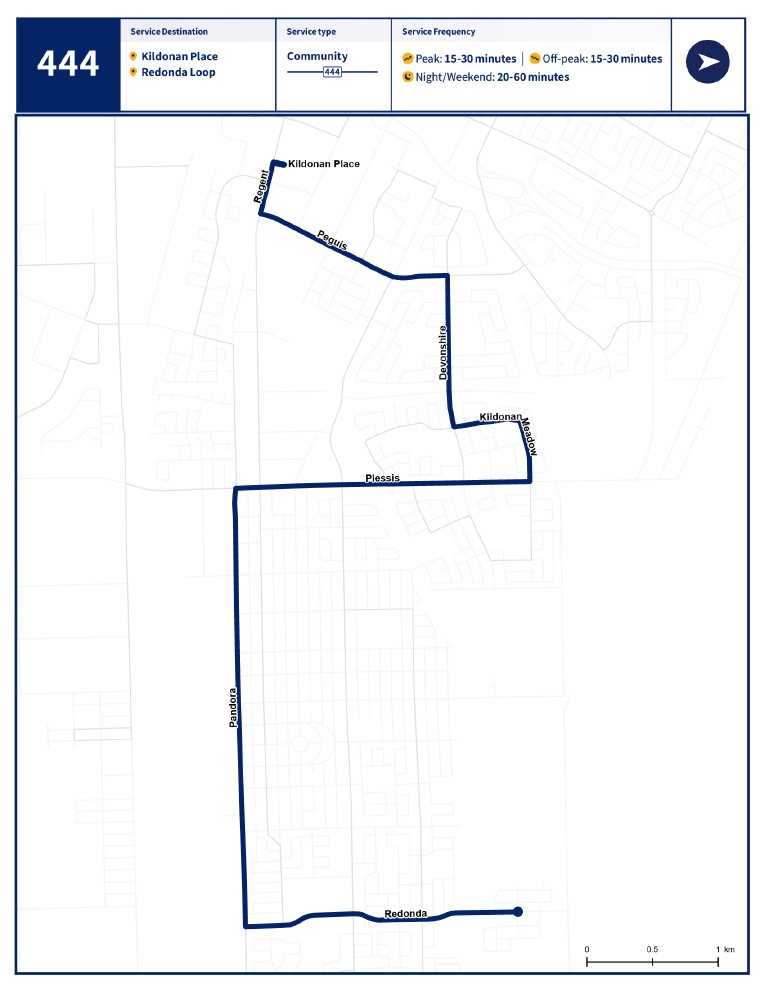
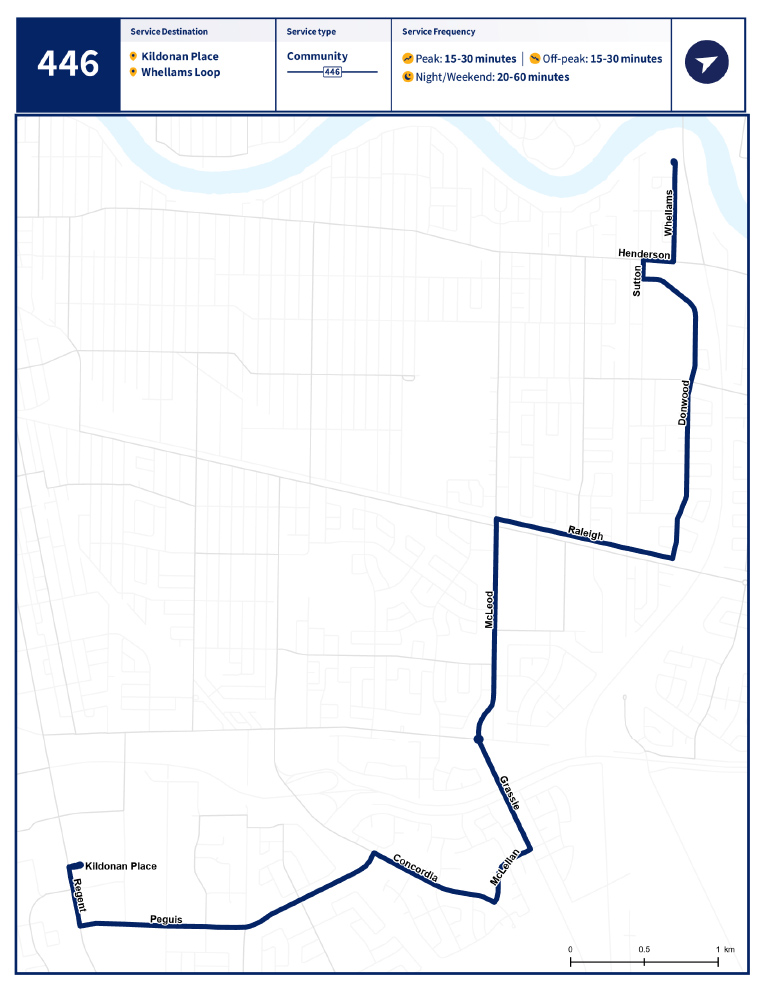
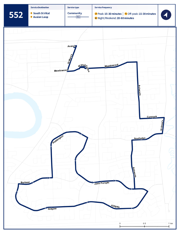
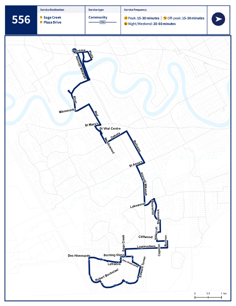
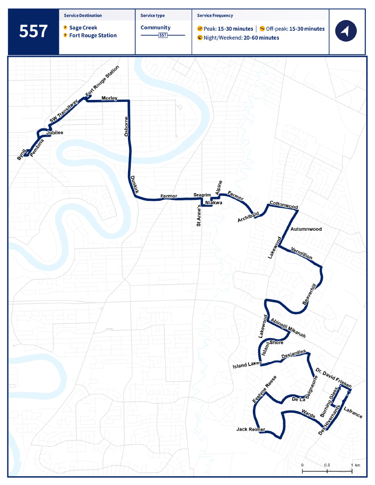
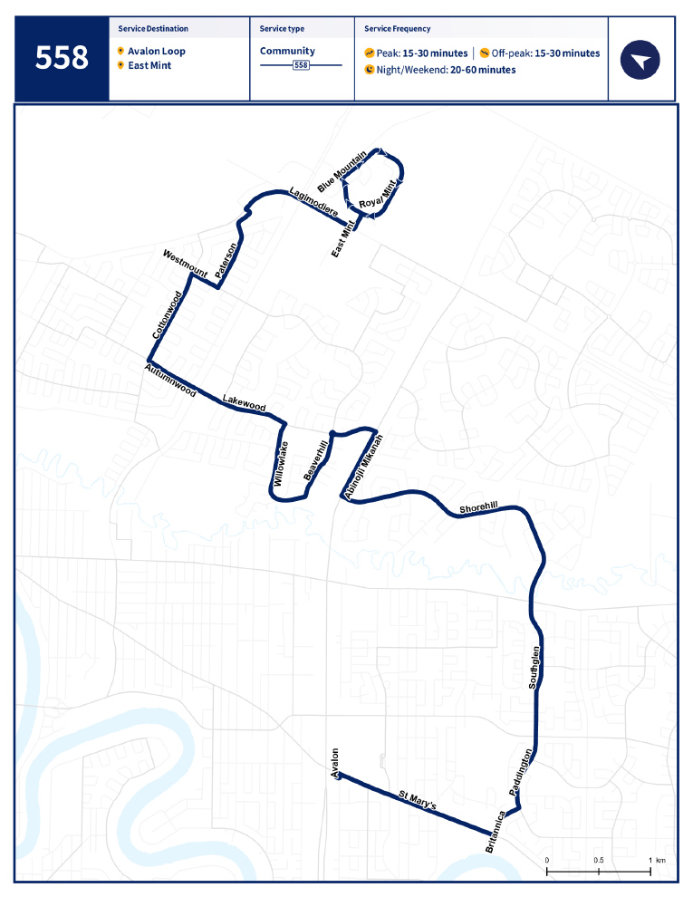
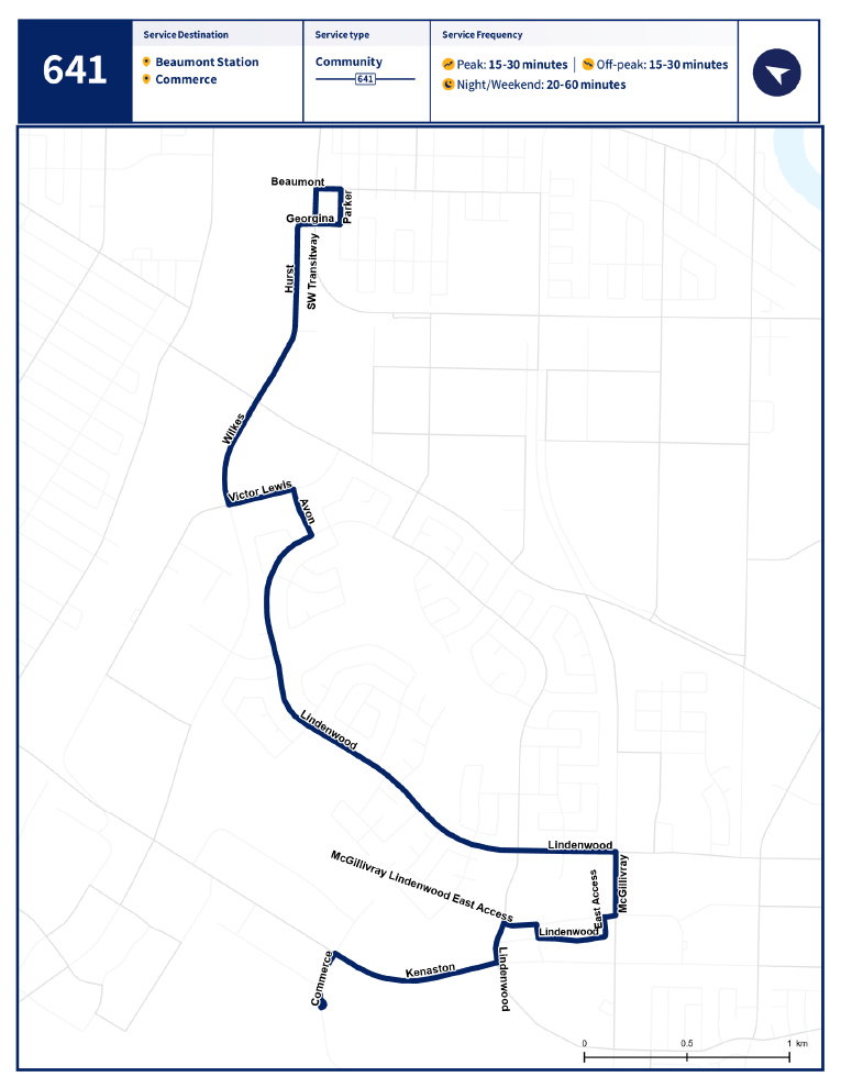
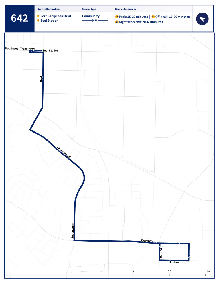
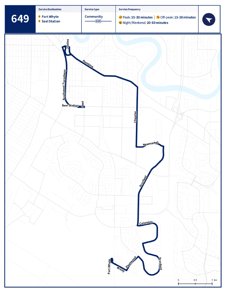
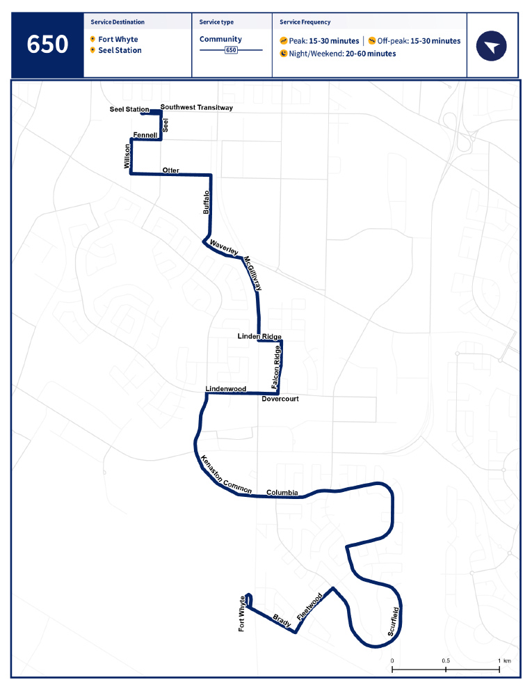
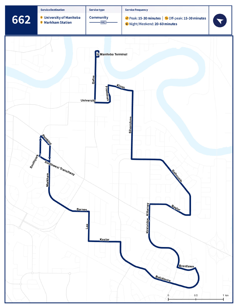
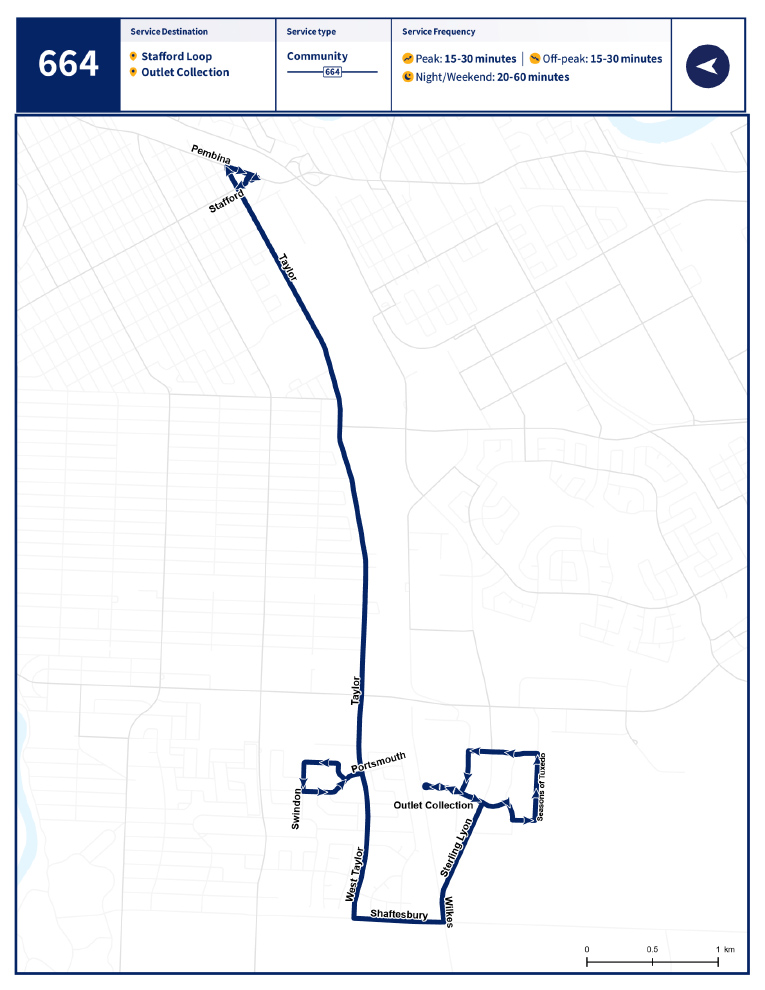
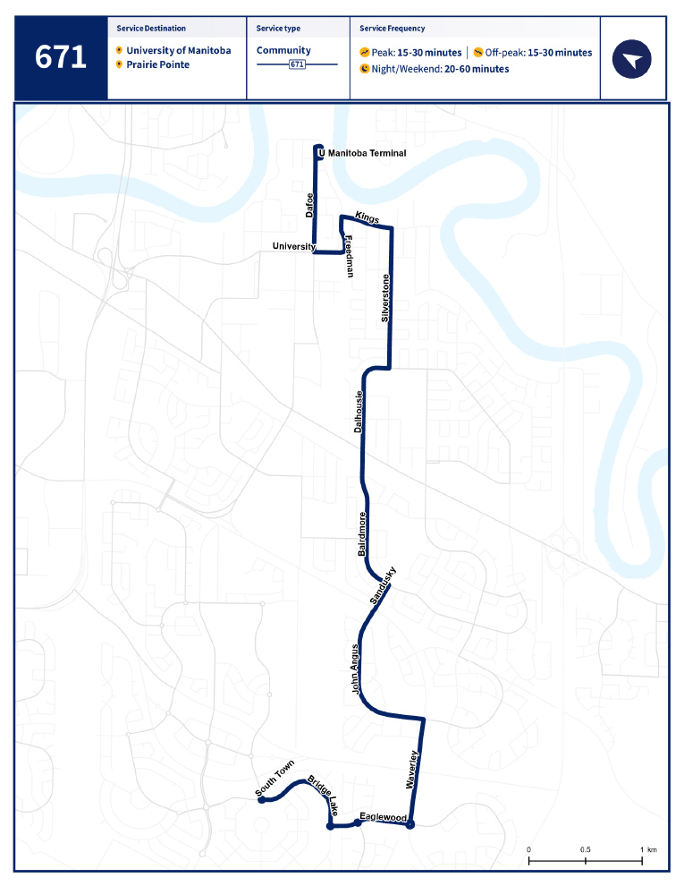
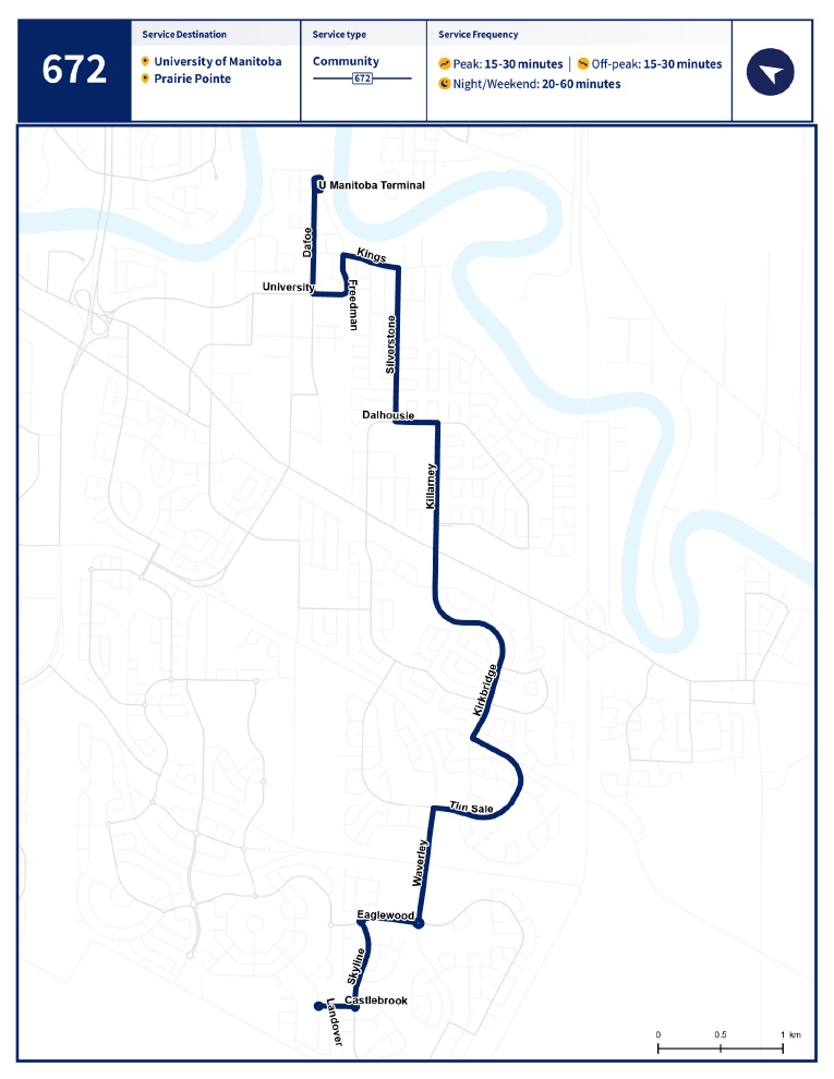
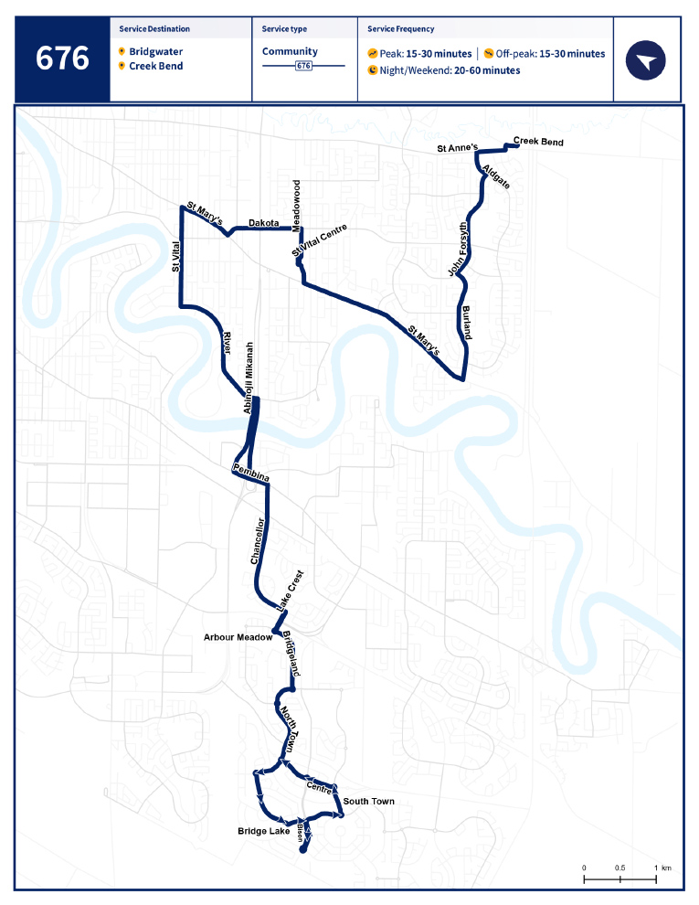
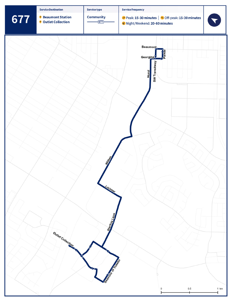
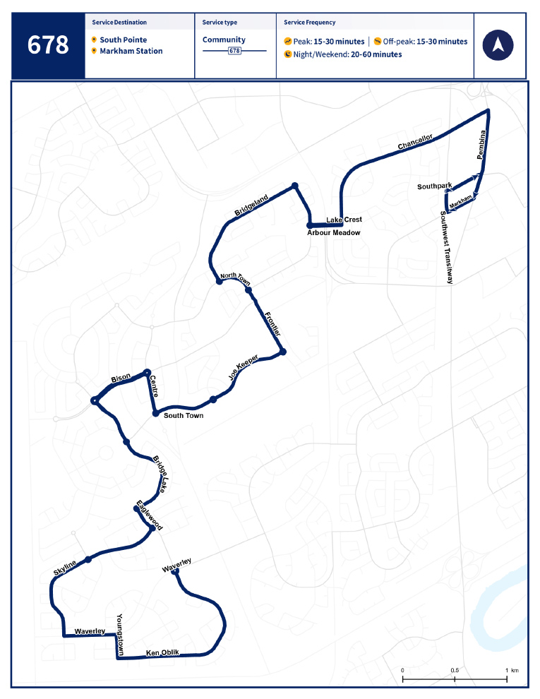
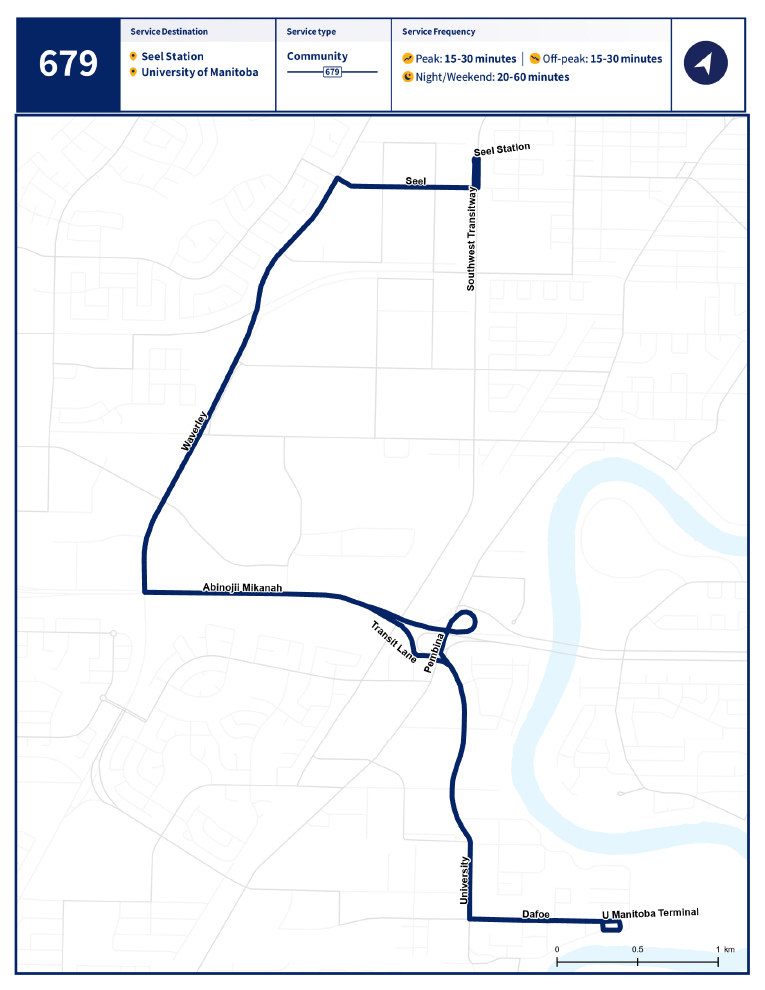
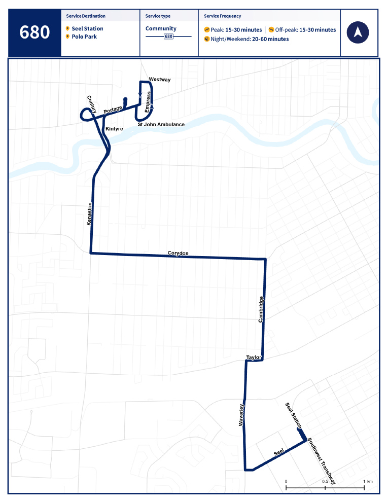
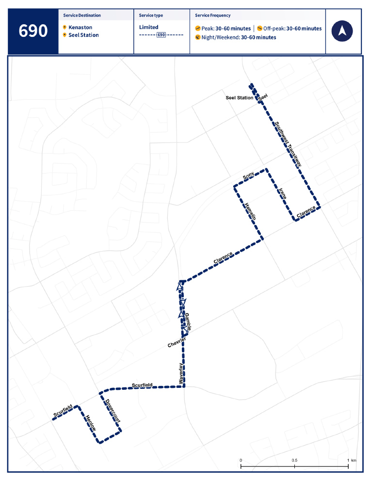
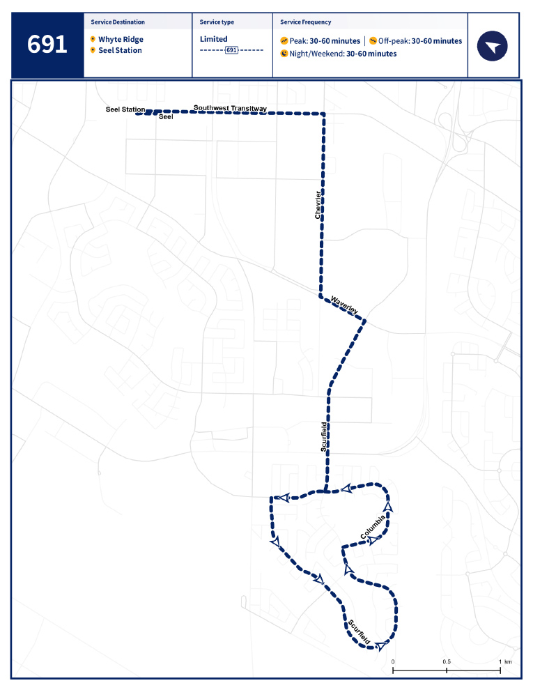
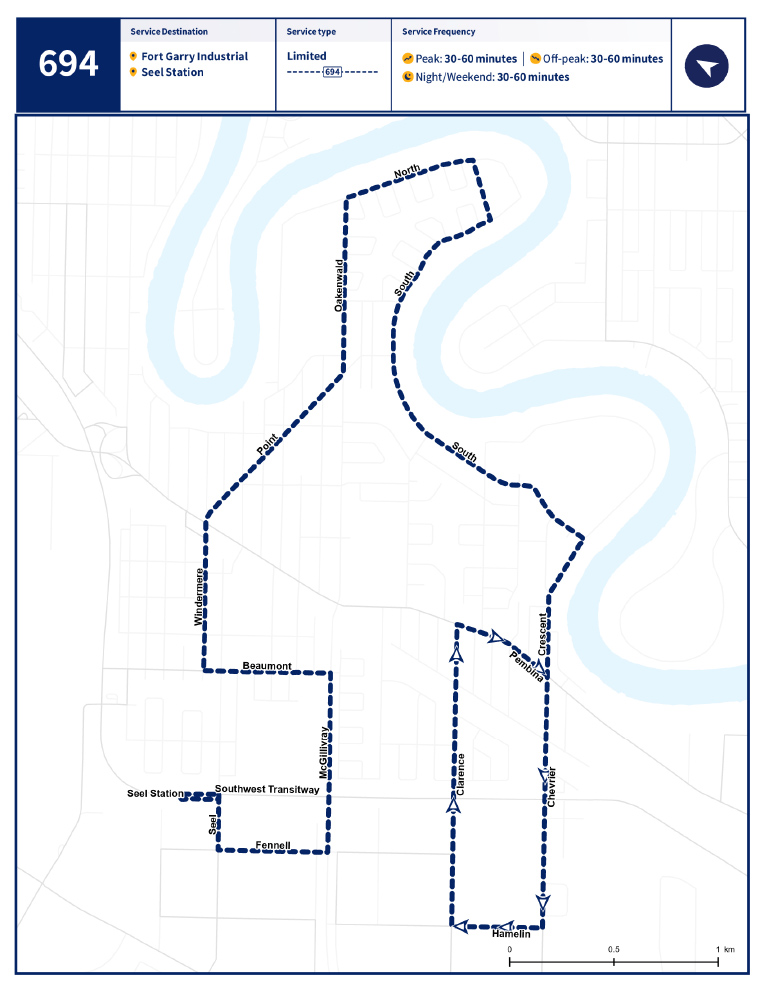
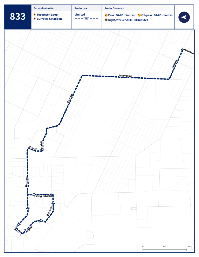
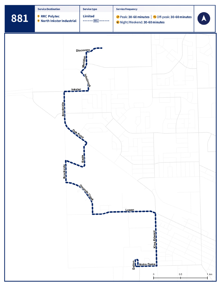
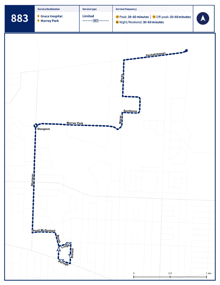
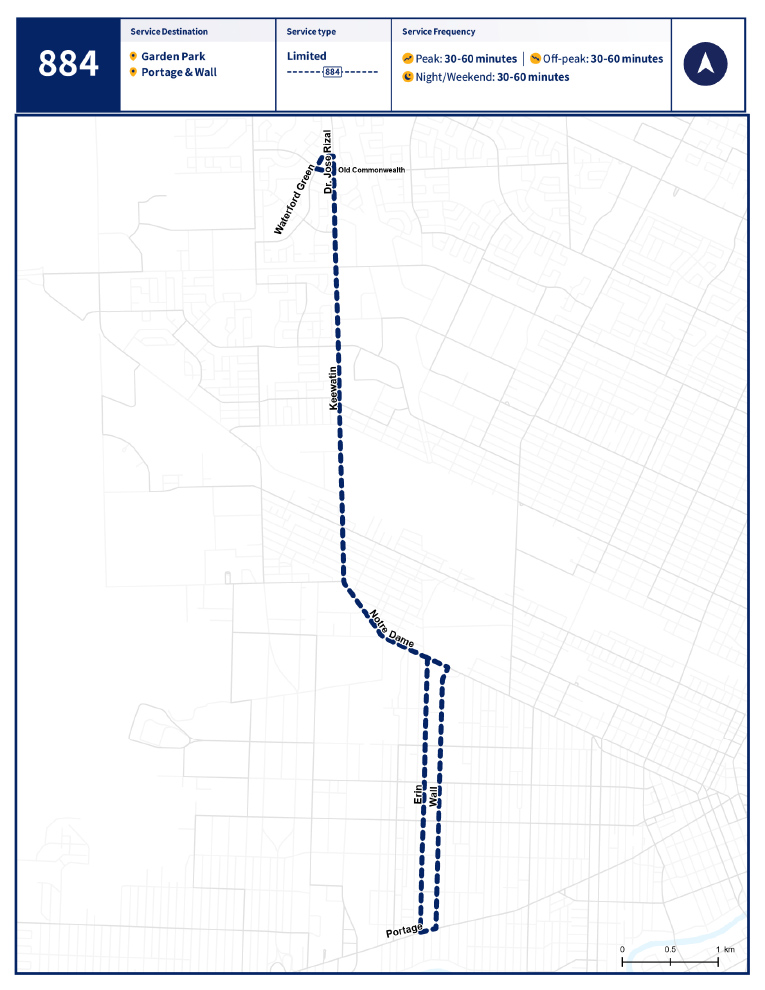
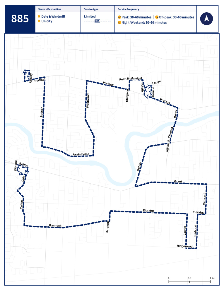
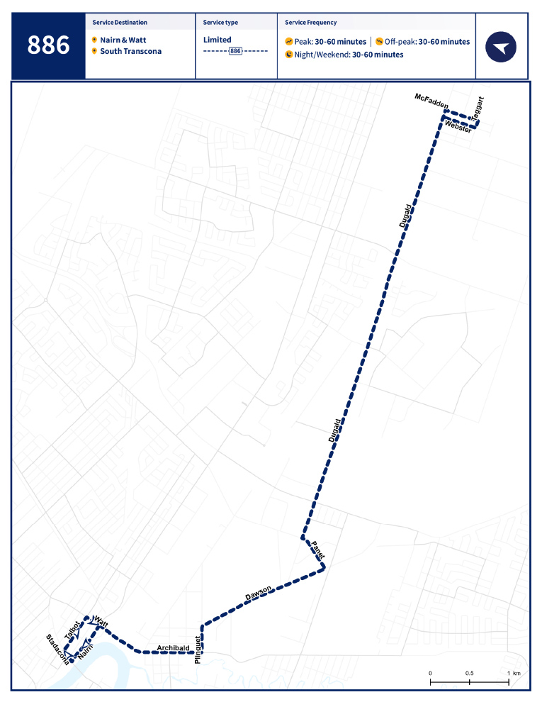
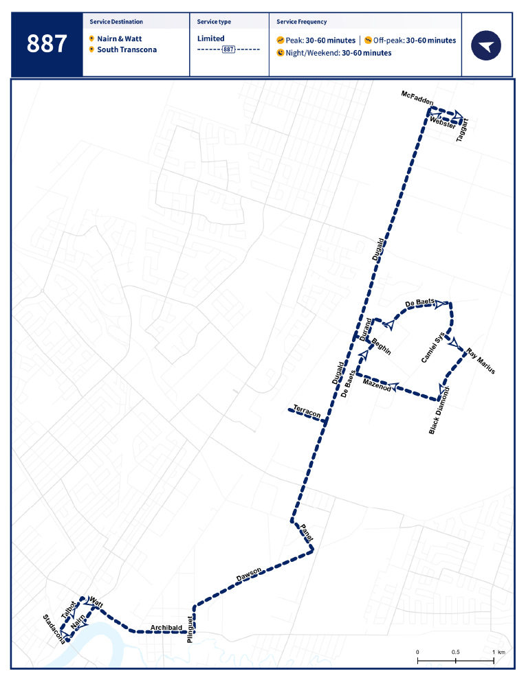
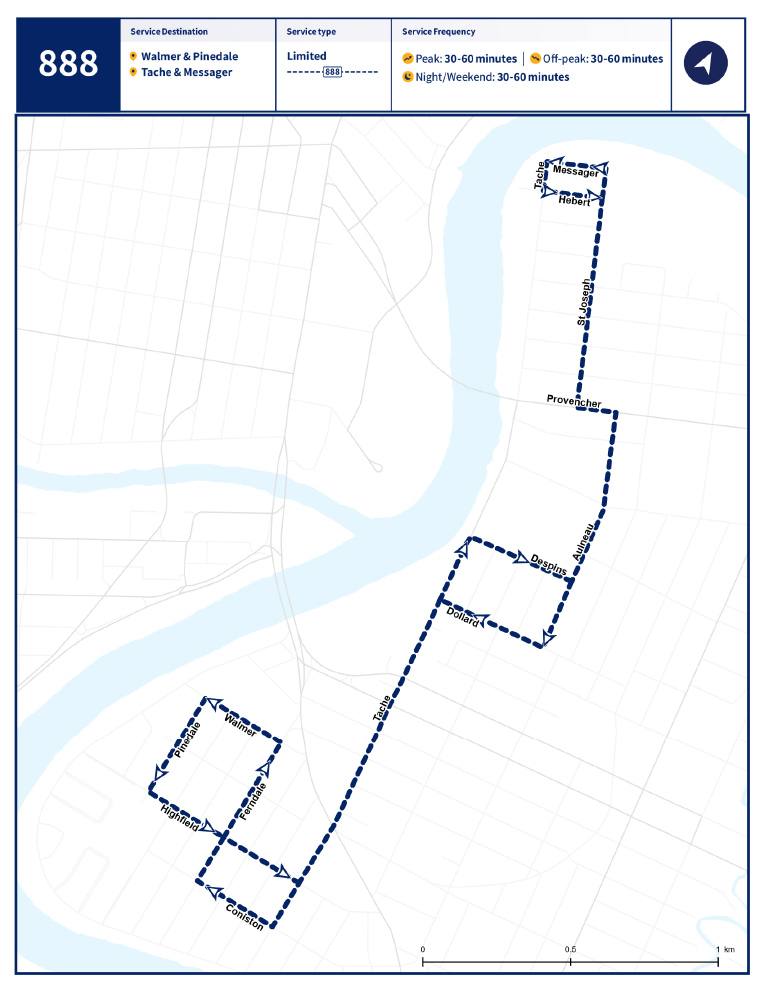
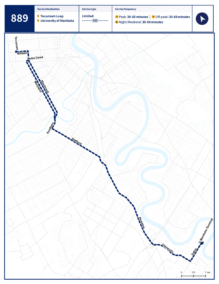
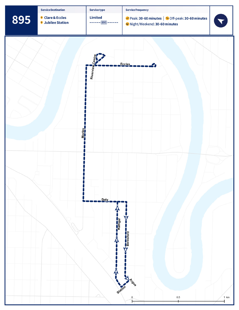
The City of Winnipeg plans to change almost every transit route in the city in June 2025, during a major overhaul of the transit service.
All told, there will be 142 changes to bus routes in the city during a switch to a “spine-feeder model.”
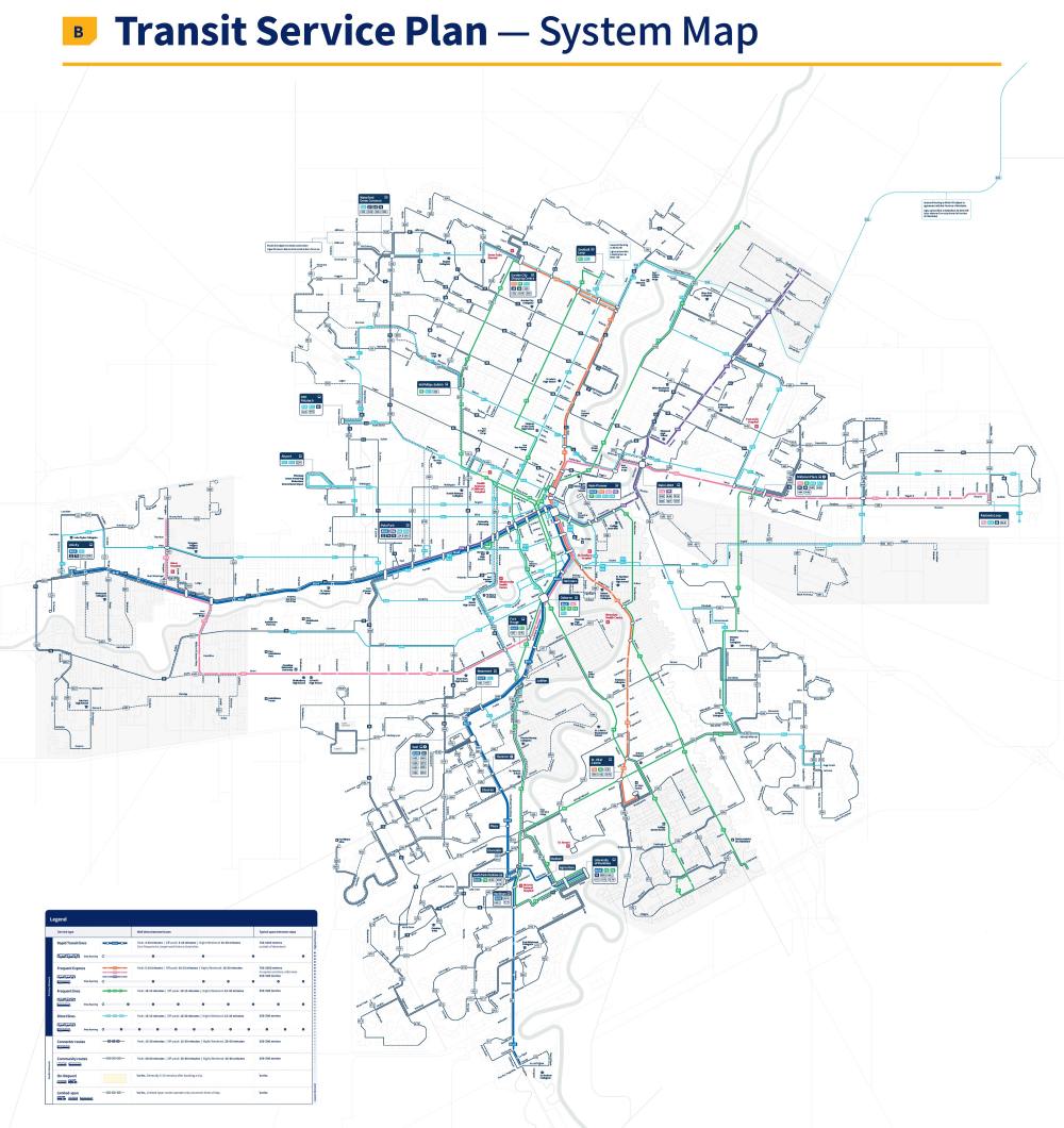
Instead of every bus in the city ending up downtown, there will be a network of major routes and less frequently served feeder routes that bring passengers to the main bus routes.
A city report included maps of each of the new proposed bus routes. View them below.
If you’d like to zoom in even closer on the route maps — or see an overview of the total network and proposed service levels — detailed maps are available in PDF format (note: the files are quite large):
- Read the full transit master plan (20 MB PDF)
- See detailed maps of every proposed transit route (70 MB PDF)


Related Articles
Transit set for transformative route overhaul just over a year from now