

Walk this lovely little way
Winnipeg's picturesque parkways city's best-kept secret
Advertisement
Read this article for free:
or
Already have an account? Log in here »
To continue reading, please subscribe:
Monthly Digital Subscription
$0 for the first 4 weeks*
- Enjoy unlimited reading on winnipegfreepress.com
- Read the E-Edition, our digital replica newspaper
- Access News Break, our award-winning app
- Play interactive puzzles
*No charge for 4 weeks then price increases to the regular rate of $19.00 plus GST every four weeks. Offer available to new and qualified returning subscribers only. Cancel any time.
Monthly Digital Subscription
$4.75/week*
- Enjoy unlimited reading on winnipegfreepress.com
- Read the E-Edition, our digital replica newspaper
- Access News Break, our award-winning app
- Play interactive puzzles
*Billed as $19 plus GST every four weeks. Cancel any time.
To continue reading, please subscribe:
Add Free Press access to your Brandon Sun subscription for only an additional
$1 for the first 4 weeks*
*Your next subscription payment will increase by $1.00 and you will be charged $16.99 plus GST for four weeks. After four weeks, your payment will increase to $23.99 plus GST every four weeks.
Read unlimited articles for free today:
or
Already have an account? Log in here »
Hey there, time traveller!
This article was published 28/06/2011 (5254 days ago), so information in it may no longer be current.
Shhhhhh.
It’s Winnipeg’s prettiest little secret, and we wouldn’t want word to get out.
It’s not marked on city maps, not even the trail maps.
And there’s precious few signs pointing the way.
But unbeknownst to most Winnipeggers, there’s a web of six parkways that link park to park to park along the city’s rivers, following quiet streets where necessary, but mainly hugging the riverbanks.
And if you venture just north of the corner of Glenwood Crescent and Harbison Avenue West, you’ll discover perhaps the most picturesque spot of all of Winnipeg’s parkways, Elmwood Park, part of the Kildonan Parkway.
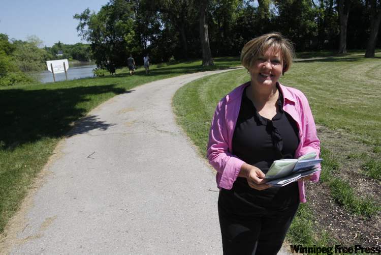
“I can’t believe no one, either media or just a person, has asked about this,” said Janice Lukes, manager of special projects with the Winnipeg Trails Association and Rivers West, Red River co-ordinator. “But no one has.”
Many people may be travelling the parkways in bits and pieces but don’t realize they all join up. On a recent sunny day, cyclists were whizzing through Elmwood Park and south along the parkway, while a couple walked two enormous dogs and some would-be explorers checked out two mysterious staircases near the river.
The Kildonan Parkway, where it wends through Elmwood, might be the most pleasant of the parkways, given to leisurely meandering, snaking along tree-shaded neighbourhoods and sun-dappled parks by the river.
The parkways all end at The Forks — or start there, depending on how you look at it. The South Winnipeg Parkway runs south of The Forks, west of the Red, and the Boni-Vital Parkway, also running south, is east of the Red. There’s the North Assiniboine Parkway and South Assiniboine Parkway, their directions self-explanatory. The North Winnipeg Parkway runs north of The Forks on the west side of the river, and the Kildonan Parkway runs north on the Red’s east side.

The parkway system was started 20 years ago by a forward-thinking city with a vision to make the most of its rivers, Lukes says. There were 18 smaller trails then, a very confusing labyrinth of paths, but officials organized them into six parkways to keep things simple.
Until trailheads and route maps are placed on the parkways — planned for this fall, along with signs indicating points of interest, a very pleased Lukes reports — bikers, hikers and dog-walkers need to be a little creative to find the parkways in many spots. They are signed, but signs are small and placement is a bit sketchy.
It’s worth seeking the signs because, really, a whole other world within Winnipeg opens up once you set foot or wheel on a parkway.
julie.carl@freepress.mb.ca
Dropping In is a ‘random act of journalism’ that starts with a thumbtack on a city map and ends with a story from the street. See more Dropping In articles using the map below.