

Informative, entertaining trip through map-making
Advertisement
Read this article for free:
or
Already have an account? Log in here »
To continue reading, please subscribe:
Digital Subscription
One year of digital access for only $75*
- Enjoy unlimited reading on winnipegfreepress.com
- Read the E-Edition, our digital replica newspaper
- Access News Break, our award-winning app
- Play interactive puzzles
*Billed as $5.77 plus GST every four weeks. After 52 weeks, price increases to the regular rate of $19.95 plus GST every four weeks. Offer available to new and qualified returning subscribers only. Cancel any time.
Monthly Digital Subscription
$4.99/week*
- Enjoy unlimited reading on winnipegfreepress.com
- Read the E-Edition, our digital replica newspaper
- Access News Break, our award-winning app
- Play interactive puzzles
*Billed as $19.95 plus GST every four weeks. Cancel any time.
To continue reading, please subscribe:
Add Free Press access to your Brandon Sun subscription for only an additional
$1 for the first 4 weeks*
- Enjoy unlimited reading on winnipegfreepress.com
- Read the E-Edition, our digital replica newspaper
- Access News Break, our award-winning app
- Play interactive puzzles
*Your next Brandon Sun subscription payment will increase by $1.00 and you will be charged $17.95 plus GST for four weeks. After four weeks, your payment will increase to $24.95 plus GST every four weeks.
Read unlimited articles for free today:
or
Already have an account? Log in here »
Hey there, time traveller!
This article was published 12/01/2013 (4878 days ago), so information in it may no longer be current.
Like a large, colourful map that reveals unexplored and even unsuspected worlds, this fascinating book jump-starts a reader’s imagination.
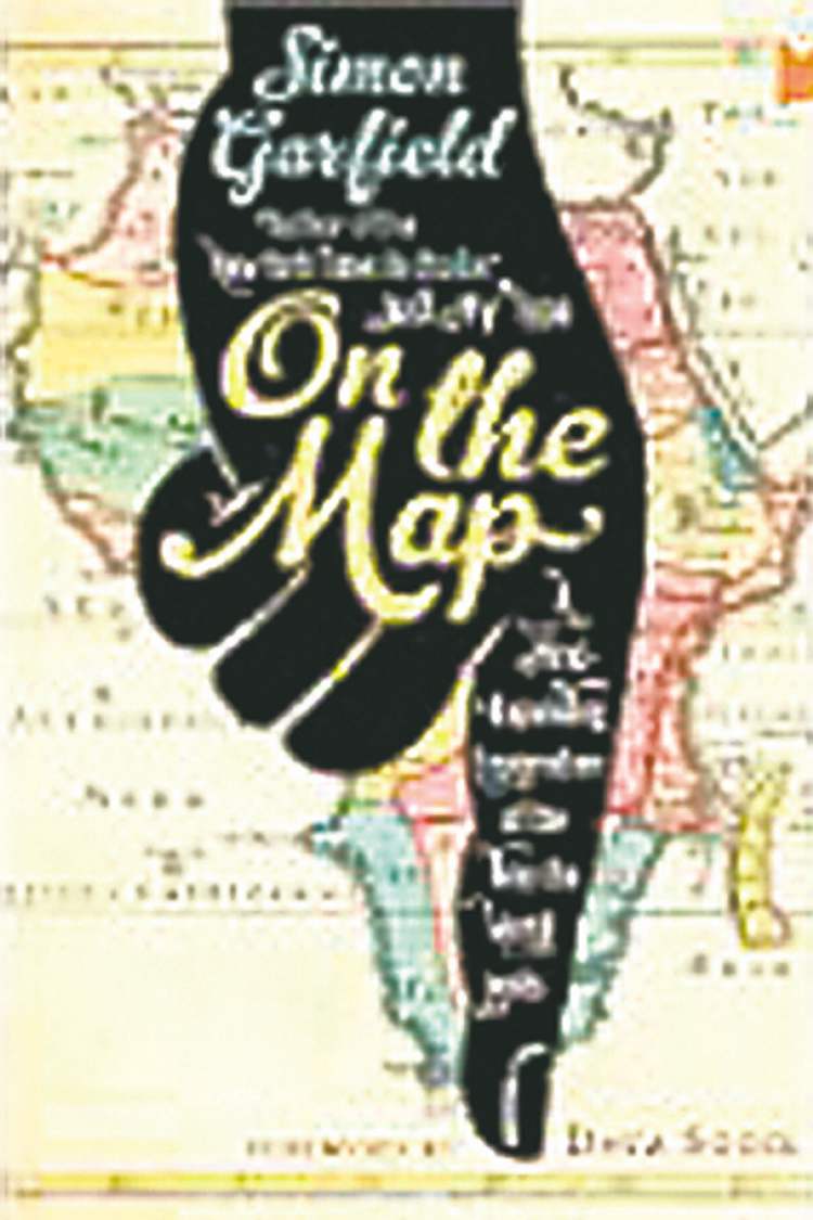
British author Simon Garfield conducts an informative and entertaining tour of the history, theory and practice of map-making, emphasizing the delightful without trivializing the significant.
The book, Garfield’s 14th, delivers on the promise of its subtitle. Not only does it expand the reader’s mind, but the author demonstrates how maps expand the views of the world — or the universe, or even the neighbourhood — of their makers and users.
From a stone tablet found in northern Spain, apparently depicting mountains, rivers and hunting areas and believed to have been drawn about 14,000 BCE, to the latest satellite-based information, maps reveal their makers’ distinct experiences and assertions. Reproductions of many maps brighten the text while demonstrating this point.
Other highlights of the book include “pocket maps,” brief essays on topics as diverse as a 19th-century murder map, gerrymandering — manipulating maps for political advantage — and the art of imposing drawings of animals on maps. One of these shows “a dead parrot sketched over the United States, although it’s supposed to be more of an eagle.”
This is not the only Monty Python allusion. Garfield’s British humour enlivens even such topics as phrenology, the 19th-century pseudo-science that purported to predict a person’s behaviour and character traits by studying the skull.
Displaying a phrenologically generated map of the brain identifying such areas as causality, mirthfulness and calculation, Garfield comments, “Oddly, no space for sex or shopping.”
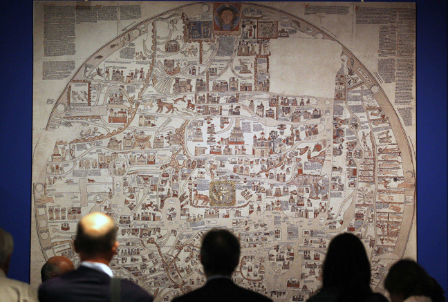
Such irreverence where appropriate highlights the book’s respect for genuine map-making achievements such as the fascinating mappa mundi, circa 1290, “a large shank of tough hide” that a British cathedral nearly sold in the 1980s to raise money to fix a leaking roof.
Mappa mundi’s medieval creators rejected the view of the world laid out 1,000 years earlier by Ptolemy’s rules of cartography, based on his study of astronomy.
“Gone is the careful science of co-ordinates and gridlines, longitude and latitude. And in their place is, essentially, a morality painting, a map of the world that reveals the fears and obsessions of the age. Jerusalem stands at its centre, Paradise and Purgatory at its extremes, and legendary creatures and monsters populate the faraway climes.”
Maps such as this were not designed to help travellers reach a destination, at least not a physical one, Garfield notes. “Rather, they were statements of philosophical, political, religious, encyclopaedic and conceptual concerns.”
This weaving together of many intellectual threads reveals as much about the spirit of that time as does the intense focus but sometimes dubious credibility of a modern satellite guidance system.
By the way, the U.S. government website that explains GPS, the Global Positioning System, displays quite a defensive attitude about a common complaint, while perhaps inadvertently revealing the importance of a more traditional craft: “Do GPS devices show your house or business in the wrong place? Don’t blame the GPS satellites … contact the map-makers!”
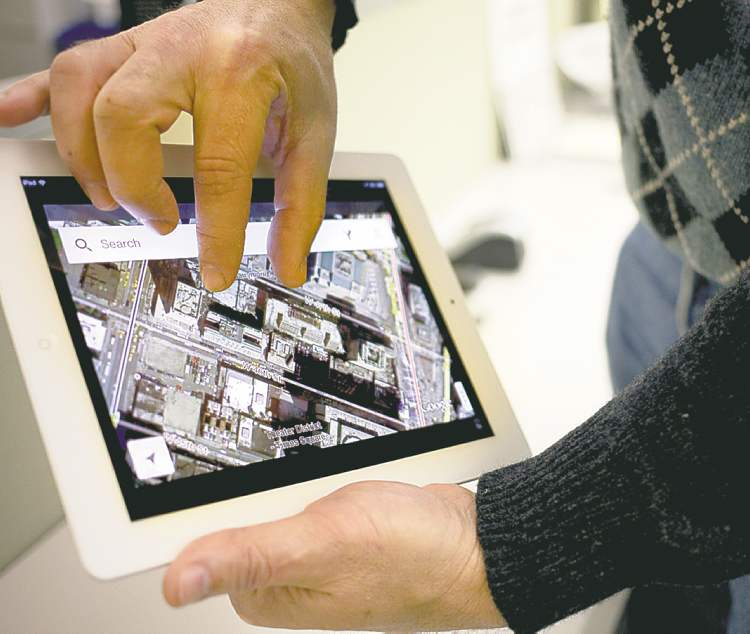
Although Garfield admires the work of cartographers of previous centuries, he does not reject current technology.
Modern people should of course use online maps as well as versions on paper or in atlases, he says, but we should also understand how the technology of mapping pervades our lives. “GPS is now such a significant part of our lives that the effects of failure would be catastrophic.”
There follows the only passage in the book that feels unreasonable. After listing air traffic control and timekeeping as services that would be harmed by failure of the GPS, Garfield sails close to the edge of the known world.
“Everything would stop. We would be practically blind. We would not be able to stock our shops and feed ourselves. Only those who knew how to plow a field like they did in the Middle Ages would have a chance.”
Fortunately, he quickly reorients himself and sets out on a simple explanation of how GPS works.
Garfield allows himself to speculate on many people’s current preference for what he calls “sat navs” — satellite navigation — over cheaper and more reliable paper maps. “Perhaps it is just that we have lost the pleasure and challenge of traditional maps, and like to have someone do the map reading for us. In other words: laziness.”
He accepts, though, that relying on satellite navigation, especially in cars, may cut down on those legendary disagreements over directions between women and men.

So, after surveying 16,000 years of mapmaking, what does this map-lover conclude?
“There is, of course, quite a lot to be said for getting lost.”
On the Map is a wonderful book in which to do just that.
Duncan McMonagle charts his course at Red River College, where he teaches journalism. Follow him on Twitter @dmcmonagle.
History
Updated on Saturday, January 12, 2013 1:13 PM CST: replaces photo, adds fact box