

Better than a bird’s-eye view of the flood
Advertisement
Read this article for free:
or
Already have an account? Log in here »
To continue reading, please subscribe:

Digital Subscription
One year of digital access for only $205*
- Enjoy unlimited reading on winnipegfreepress.com
- Read the E-Edition, our digital replica newspaper
- Access News Break, our award-winning app
- Play interactive puzzles
*First annual payment billed as $205.00 + GST for one year. This annual subscription will automatically renew at $233.00 + GST every 52 weeks (10% off the regular annual price of $259.35). Offer available to new and qualified returning subscribers only. Cancel any time.
To continue reading, please subscribe:
Add Free Press access to your Brandon Sun subscription for only an additional
$1 for the first 4 weeks*
- Enjoy unlimited reading on winnipegfreepress.com
- Read the E-Edition, our digital replica newspaper
- Access News Break, our award-winning app
- Play interactive puzzles
*Your next Brandon Sun subscription payment will increase by $1.00 and you will be charged $17.95 plus GST for four weeks. After four weeks, your payment will increase to $24.95 plus GST every four weeks.
Read unlimited articles for free today:
or
Already have an account? Log in here »
Hey there, time traveller!
This article was published 11/07/2014 (4473 days ago), so information in it may no longer be current.
The full extent of the river’s wrath is hard to grasp from a dike, a sandbagging line or the altitude of a helicopter.
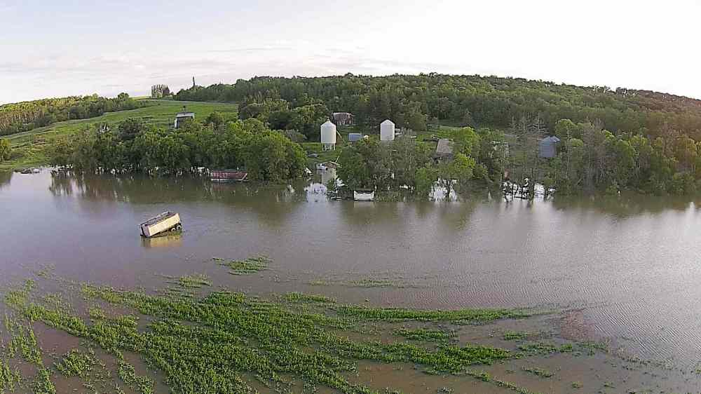
But in this close-up, eye-in-the-sky video from a camera-carrying drone, the flood comes into focus in a way we’ve never before seen.

This drone’s-eye view of jetskis blasting across what should be fields of canola, farmsteads becoming islands and the murky churn of the Assiniboine River as it swallows all that’s in reach provides a new and startling perspective of Manitoba’s surprise summer flood.
Three things a drone reveals about the flood: