

Flood Watch
Advertisement
Read this article for free:
or
Already have an account? Log in here »
To continue reading, please subscribe:
Monthly Digital Subscription
$1 per week for 24 weeks*
- Enjoy unlimited reading on winnipegfreepress.com
- Read the E-Edition, our digital replica newspaper
- Access News Break, our award-winning app
- Play interactive puzzles
*Billed as $4.00 plus GST every four weeks. After 24 weeks, price increases to the regular rate of $19.95 plus GST every four weeks. Offer available to new and qualified returning subscribers only. Cancel any time.
Monthly Digital Subscription
$4.99/week*
- Enjoy unlimited reading on winnipegfreepress.com
- Read the E-Edition, our digital replica newspaper
- Access News Break, our award-winning app
- Play interactive puzzles
*Billed as $19.95 plus GST every four weeks. Cancel any time.
To continue reading, please subscribe:
Add Free Press access to your Brandon Sun subscription for only an additional
$1 for the first 4 weeks*
*Your next subscription payment will increase by $1.00 and you will be charged $16.99 plus GST for four weeks. After four weeks, your payment will increase to $23.99 plus GST every four weeks.
Read unlimited articles for free today:
or
Already have an account? Log in here »
Hey there, time traveller!
This article was published 15/04/2009 (6186 days ago), so information in it may no longer be current.
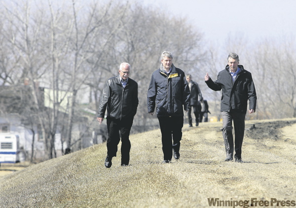
Trouble spots: Higher crests and overland flooding caused by frozen, saturated soil is causing unprecedented water levels from the Red River Valley to the Interlake.
Crests from St. Jean Baptiste to the Winnipeg floodway inlet will exceed 1979 levels by half a foot, making it the third-worst flood in Manitoba in the last 100 years.
Once rivers crest, water levels are expected to remain high for several weeks.
Levels along the Souris River are rising rapidly, and overflows in the Coulter area will spread further north by late next week. The Pembina Valley is expected to flood, and actions to protect Gretna from overflows are underway.
The crest of the Fisher River will be lower than 2006, but low-lying portions of the river are expected to flood significantly. Dikes are being built at Peguis River, and 14 residents have been moved out of Peguis First Nation. Residents of 10 homes around Rock Lake have voluntarily left their homes.
In the RM of St. Clements, overland flooding is an ongoing problem, and pumps are saving about 30 homes at the Pine Ridge Trailer Park. West St. Paul residents are continuing to sandbag and install water tubes to protect against overland flooding.
Melt water has caused the sewage lagoon at Riverton to overflow its banks, and Manitoba Conservation officials are investigating the impact of the situation.
Developments:
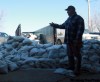
The city issued a call Tuesday for 500 to 600 volunteers to build sandbag dikes at 60 new properties along the Red, Seine and Assiniboine rivers and raise 40 existing sandbag dikes along the Red north of The Forks.People interested in volunteering are asked to call 311.
The province urged motorists to be extremely cautious since overland flooding has washed out many roads and highways. Highway 75 from Morris to St. Jean Baptiste is closed and is inaccessible to emergency vehicles. Numerous highways in the Interlake area have water on the road, and caution is advised on Highway 6 near St. Laurent.
U.S. Customs and Border Protection advised that the border crossing north of Neche at Gretna is closed to commercial traffic. The border crossing at Pembina will remain open, but it was anticipated that Highway 75 in Minnesota would be closed north of the city of Humboldt by last night.
In Winnipeg, Ness Avenue between Valley View Drive and School Road is closed due to flooding. Only local traffic is allowed.
Road conditions are changing rapidly, and anyone travelling is advised to check updated highway conditions at www.manitoba.ca/mit/roadinfo or call 1-877-627-6237.
Residents in flood-affected areas who refuse to comply with mandatory evacuation orders could face fines in the future, a senior provincial official said. "I understand that people might want to stay behind and protect their homes, but at some point they have to understand why the evacuation is ordered," said Don Brennan, executive director of Manitoba Emergency Measures Organization.
Brennan made his comments following the weekend flooding at Breezy Point where a small number of residents ignored a voluntary evacuation order and then had to be rescued as the Red River spilled over the dikes and large ice sheets damaged homes and properties.
Weather impact:
Warmer temperatures are causing a rapid melt that is helping raise river levels. Provincial officials said a quick melt combined with overland flooding, run-off from swollen tributaries and ice jams has produced unprecedented flooding across the province.
Manitoba Water Stewardship spokesman Steve Topping said the melt is simply bad timing.
"It’s a very rapid melt we had and it’s releasing the snow pack," he said. "We can anticipate flash flooding, overtopping of drains, rivers and small creeks."
Flood facts:
A fast winter freeze and prolonged cold temperatures helped blue ice form in the Red River Valley — a complication that made the ice jams difficult to break up.
Emergency Measures Minister Steve Ashton said the blue ice complicated the ice jam problem along the Red River, making it difficult for Amphibex machines and ice cutters to break up the massive ice chunks.
"We were seeing blue ice here, and blue ice forms when you get a very rapid freeze, and very little thaw so it’s not broken up," Ashton said. "That was one of the huge challenges with the ice jams."

Quote of the day:
"It’s the combination of everything at once that really has pushed this to the third worst flood of the century. The kind of challenges we’re seeing right now are in a large geographic area — it’s is not just in the Red River Valley, it’s well into the Interlake."
— Emergency Measures Minister Steve Ashton
— Compiled by Jen Skerritt, Bartley Kives and Aldo Santin
Related Articles
Long-term plan needed for Highway 75: mayor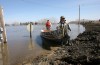


Advertisement Advertise With Us
Advertisement Advertise With Us