Forecasters were caught off guard by Otis’ growth. But warming means more hurricanes like it
Advertisement
Read this article for free:
or
Already have an account? Log in here »
To continue reading, please subscribe:

Digital Subscription
One year of digital access for only $205*
- Enjoy unlimited reading on winnipegfreepress.com
- Read the E-Edition, our digital replica newspaper
- Access News Break, our award-winning app
- Play interactive puzzles
*First annual payment billed as $205.00 + GST for one year. This annual subscription will automatically renew at $233.00 + GST every 52 weeks (10% off the regular annual price of $259.35). Offer available to new and qualified returning subscribers only. Cancel any time.
To continue reading, please subscribe:
Add Free Press access to your Brandon Sun subscription for only an additional
$1 for the first 4 weeks*
- Enjoy unlimited reading on winnipegfreepress.com
- Read the E-Edition, our digital replica newspaper
- Access News Break, our award-winning app
- Play interactive puzzles
*Your next Brandon Sun subscription payment will increase by $1.00 and you will be charged $17.95 plus GST for four weeks. After four weeks, your payment will increase to $24.95 plus GST every four weeks.
Read unlimited articles for free today:
or
Already have an account? Log in here »
Hey there, time traveller!
This article was published 25/10/2023 (1045 days ago), so information in it may no longer be current.
Hurricane Otis turned from mild to monster in record time, and scientists are struggling to figure out how — and why they didn’t see it coming.
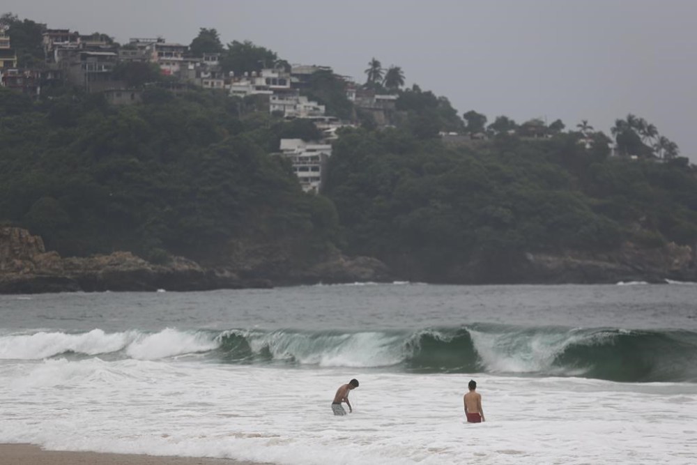
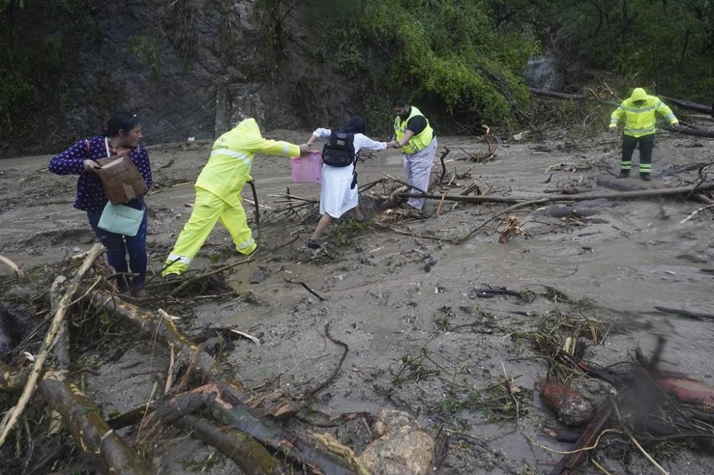
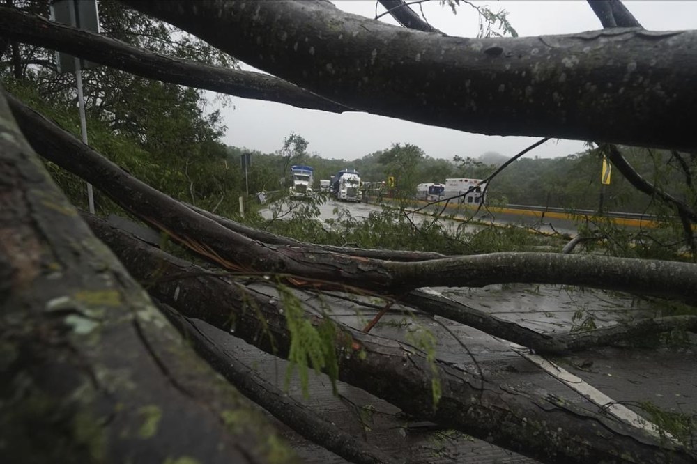
Usually reliable computer models and the forecasters who use them didn’t predict Otis’ explosive intensification, creating a nightmare scenario of an unexpectedly strong storm striking at night. At least 27 people are dead and four missing in the destruction along Mexico’s Pacific coast, with devastation that extends for miles.
All this after Acapulco was told to expect a tropical storm just below hurricane strength. Just 24 hours later, Otis blasted ashore with 165 mph (266 kph) winds, the strongest landfall of any East Pacific hurricane.
In just 12 hours, Otis’ strength more than doubled from 70 mph (113 kph) winds to 160 mph (257 kph), also a record, as it neared the coast. And it got even stronger before it struck. Storms typically gain or lose a few miles per hour in 12 hours, though some outliers gain 30 to 50 mph (48 to 80 kph) in a day.
What happened with Otis was just plain nuts, said University of Miami hurricane researcher Brian McNoldy. But it coincides with a documented trend of hurricanes rapidly intensifying more often in recent decades because of warmer water connected to climate change, scientists said.
Five different hurricane experts told The Associated Press they weren’t quite sure what set Otis off and why it wasn’t predicted, especially since meteorologists have been dramatically improving their intensity forecasts in recent years.
“The models completely blew it,” said MIT atmospheric sciences professor Kerry Emanuel, a hurricane expert.
Experts point to lack of data on the storm and its surroundings and just not completely understanding what makes a storm act like it’s on steroids.
And it really matters because in Otis’ case, the storm was coming ashore when it muscled up.
“It’s one thing to have a Category 5 hurricane make landfall somewhere when you’re expecting it,” McNoldy said. “But to have it happen when you’re not expecting anything to happen is truly a nightmare.”
For example, McNoldy, who lives in Miami, said a tropical storm forecast would prompt him to “do things like move some lightweight furniture in and take down wind chimes and things like that. That’s about it. You’re not preparing for a Category 5 hurricane.”
National Hurricane Center Director Michael Brennan said “that’s a very bad scenario, populated area, rapid intensification very close to landfall, a change in the expectations about the impacts that’s happening on a time scale that doesn’t give people a lot of time to respond.”
Brennan said Otis’ unforeseen buildup was because “it found a much more favorable environment than we were anticipating.” He said one part was warm water, another was that the winds — moving in the right direction and at the right altitude — allowed a somewhat raggedy storm to rapidly develop structure and strengthen.
McNoldy said there may be a mystery ingredient that scientists just don’t know right now, but water is key.
Warm water is fuel for hurricanes. Hot, deep water is like an all-you-can-eat buffet.
Globally, the world’s oceans have been setting monthly surface heat records since April. The surface waters off the Mexican coast were warm but “not crazy warm,” said University at Albany atmospheric scientist Kristen Corbosiero. Bennan and McNoldy said those waters were maybe 1 or 2 degrees above normal.
Below that, the water was much hotter than usual “and there’s just a ton of fuel out there right now,” McNoldy said. Still, the storm didn’t linger and feed on that, which would be expected in rapid intensification, Brennan said.
The heat content in the deeper ocean worldwide has been smashing records. It’s from human-caused climate change, McNoldy and other scientists said, as the oceans act as a sponge to absorb a lot of the excess heat caused by the burning of coal, oil and gas.
Otis and two other historically explosive cases of rapid intensification — Patricia in 2015 and Wilma in 2005 — all happened in the same mid- to late-October time frame, when deeper water and ocean heat content is at its highest, McNoldy said.
Numerous studies have shown globally that there are more cases of rapid intensification of hurricanes than there used to be. An official definition of rapid intensification is a gain in strength of 35 mph (56 kph) in 24 hours. Six storms in 2020 rapidly intensified, many of them just before smacking land. In 2017, two devastating hurricanes, Harvey and Maria, rapidly intensified. Last month in the Atlantic, Hurricane Lee rapidly intensified from 80 mph (129 kph) to 155 mph (249 kph), but didn’t hit anywhere.
“We’re seeing so many more cases of these just astonishing rapid intensification events,” said former National Oceanic and Atmospheric Administration hurricane and climate scientist Jim Kossin, now with the First Street Foundation.
Kossin said that there’s evidence that what’s happening globally over a longer time frame is due in part to human-caused climate change but it’s hard to say that about an individual storm.
But, he added, “this is exactly the kind of thing we would expect to find as the climate warms.”
MIT’s Emanuel said it might be more than just the water’s temperature, but its low salinity, too. Water in that area at this time of year is fresher from heavy rains at the surface, and that changes the mix of water temperature, he said. Normally a hurricane mixes the warm water on the surface with cooler water below. But when the surface water is fresher, a storm pulls up even more hot water from below, which feeds the storm more “and before you know it, you’re in hot water,” Emanuel said.
One key test of that theory is whether Otis leaves warm water in its wake. Usually, hurricanes leave behind cold water. Emanuel hopes satellite images will show it, but it’s not certain whether they’ll get the right view.
Another factor that Brennan and others mention is that perhaps forecasters underestimated Otis’ original strength. That would mean it didn’t intensify as much as it appears because it was stronger to begin with.
“The East Pacific in a lot of ways is a huge data void,” Brennan said. “There’s no buoys. There’s very few land observations. There’s no radars along the west coast of Mexico. So we’re really reliant almost entirely on satellite imagery.”
And sometimes satellites, looking at a storm from high above, cannot get an accurate picture of what’s going on.
Think of it like a jigsaw puzzle and forecasters at times have only 10% of the pieces, Brennan said.
Forecasters have far more tools to see what’s happening in Atlantic storms, he said.
___
Read more of AP’s climate coverage at http://www.apnews.com/climate-and-environment.
___
Follow Seth Borenstein on X, formerly known as Twitter at @borenbears
___
Associated Press climate and environmental coverage receives support from several private foundations. See more about AP’s climate initiative here. The AP is solely responsible for all content.


Advertisement Advertise With Us
Advertisement Advertise With Us