Tropical Storm Keli forms and is second cyclone now in central Pacific Ocean
Advertisement
Read this article for free:
or
Already have an account? Log in here »
To continue reading, please subscribe:

Digital Subscription
One year of digital access for only $205*
- Enjoy unlimited reading on winnipegfreepress.com
- Read the E-Edition, our digital replica newspaper
- Access News Break, our award-winning app
- Play interactive puzzles
*First annual payment billed as $205.00 + GST for one year. This annual subscription will automatically renew at $233.00 + GST every 52 weeks (10% off the regular annual price of $259.35). Offer available to new and qualified returning subscribers only. Cancel any time.
To continue reading, please subscribe:
Add Free Press access to your Brandon Sun subscription for only an additional
$1 for the first 4 weeks*
- Enjoy unlimited reading on winnipegfreepress.com
- Read the E-Edition, our digital replica newspaper
- Access News Break, our award-winning app
- Play interactive puzzles
*Your next Brandon Sun subscription payment will increase by $1.00 and you will be charged $17.95 plus GST for four weeks. After four weeks, your payment will increase to $24.95 plus GST every four weeks.
Read unlimited articles for free today:
or
Already have an account? Log in here »
Hey there, time traveller!
This article was published 28/07/2025 (426 days ago), so information in it may no longer be current.
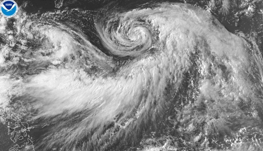
HONOLULU (AP) — Two tropical cyclones were swirling across the ocean southeast of Hawaii after developing on Monday but were not expected to cause any issues for the islands.
Hurricane Iona is the first named storm of the hurricane season in the central Pacific and emerged Sunday from a tropical depression to become a Category 1 hurricane in roughly a day. It was trekking west over warm, open waters.
“It’s pretty high confidence that it’s not going to have any direct impacts on the islands,” said Derek Wroe with the National Weather Service in Honolulu.
The hurricane is centered well south of Hawaii and an indirect impact will be downward pressure winds from the hurricane, creating dry and breezy conditions.
“There’s a lot of upward motion in the hurricane and then there’s usually compensating downward motion,” Wroe said. “That should be the case here as well. So it will be dry, it will be breezy.”
Those were the conditions that were prevalent when Hurricane Dora also passed well south of the islands in August 2023, and the associated winds led to the conditions that exacerbated the deadliest fire in the U.S. in over a century.
The blaze raced through the historic town of Lahaina and resulted in the deaths of 102 people.
He said there are concerns that conditions with Hurricane Iona could be at or near red flag criteria.
“That said … wouldn’t be anything close to what we saw during that time with Hurricane Dora. The situation is just not that strong,” he said.
The pressure gradient created by Hurricane Dora created gusts that clocked in at 50 mph (80 kph) in central Maui and well over 60 mph (96 kph) on the Big Island. There were no instruments in West Maui two years ago to measure wind.
“We don’t expect anything even close to that,” he said, with possible localized gusts of over 40 mph (64 kph) with winds running around 20 mph (32 kph).
On Monday, Iona was about 810 miles (1,303 kilometers) southeast of Honolulu, the U.S. National Hurricane Center in Miami said. No coastal watches or warnings were in effect. Iona is expected to strengthen and become a major hurricane Tuesday before weakening around the middle of the week.
The hurricane has maximum sustained winds of about 85 mph (137 kph). It was moving in a generally westward direction at about 13 mph (21 kph).
A second weather system also formed. Tropical Storm Keli had maximum sustained winds of 40 mph (65 kph).
It was about 1,030 miles (1,658 kilometers) southeast of Honolulu and was moving west at about 12 mph (19 kph). It may strengthen over the next day but, like Iona, should lose power around the middle of the week.
Wroe said he didn’t expect any direct impact from this storm on Hawaii either.
The administrator of the Hawaii Emergency Management Agency on Monday hosted a statewide conference call with all counties, during which the National Weather Service provided an assessment and status of the storms.
“All counties are monitoring,” agency spokesperson Kiele Amundson said in an email.

Another indirect impact from these storms could be swells, but Wroe said they are relatively small and moving westward and won’t create anything significant.
However, a large swell is headed toward Hawaii after being generated several hundred miles east of New Zealand.
It’s expected to arrive in Hawaii about Thursday, about the same time the storms pass the state.
“People might wrongly attribute the swell energy to be from these tropical systems, but they’re actually not,” he said.
He anticipates high surf advisory to be issued for the south shores of the Hawaiian Islands, with a surf of 10 feet (3 meters) or higher.