

Mario weakens to tropical depression off Mexico’s Pacific coast
Advertisement
Read this article for free:
or
Already have an account? Log in here »
To continue reading, please subscribe:
Monthly Digital Subscription
$1 per week for 24 weeks*
- Enjoy unlimited reading on winnipegfreepress.com
- Read the E-Edition, our digital replica newspaper
- Access News Break, our award-winning app
- Play interactive puzzles
*Billed as $4.00 plus GST every four weeks. After 24 weeks, price increases to the regular rate of $19.00 plus GST every four weeks. Offer available to new and qualified returning subscribers only. Cancel any time.
Monthly Digital Subscription
$4.75/week*
- Enjoy unlimited reading on winnipegfreepress.com
- Read the E-Edition, our digital replica newspaper
- Access News Break, our award-winning app
- Play interactive puzzles
*Billed as $19 plus GST every four weeks. Cancel any time.
To continue reading, please subscribe:
Add Winnipeg Free Press access to your Brandon Sun subscription for only
$1 for the first 4 weeks*
*$1 will be added to your next bill. After your 4 weeks access is complete your rate will increase by $0.00 a X percent off the regular rate.
Read unlimited articles for free today:
or
Already have an account? Log in here »
MIAMI (AP) — A tropical storm that formed Friday off the Pacific coast of Mexico has already weakened into a tropical depression, though it could still bring possible flash flooding to parts of the country, forecasters said.
Mario was described as “mini” in the National Hurricane Center’s morning advisory, and by evening had been downgraded to a tropical depression with maximum sustained winds of 35 mph (56 kph).
Mexico’s government lifted a tropical storm watch that had in effect for parts of Michoacan state.
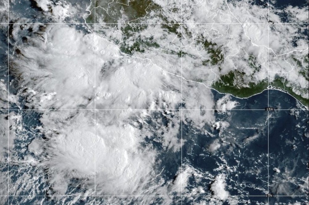
The Miami-based weather service said Mario was centered about 65 miles (105 kilometers) south-southwest of Manzanillo, Mexico. It said the center of the storm would gradually move away from the coast Friday night and into Saturday before dissipating on Sunday.
Rainfall estimates were around 1 to 3 inches (2.5 to 8 centimeters) for Jalisco state. Higher terrain could see flash flooding. Windy conditions were possible through Friday night for coastal areas in Guerrero, Michoacan and Colima states.