

NASA aircraft flies high over B.C. wildfires to study pyrocumulonimbus clouds
Advertisement
Read this article for free:
or
Already have an account? Log in here »
To continue reading, please subscribe:

Digital Subscription
One year of digital access for only $205*
- Enjoy unlimited reading on winnipegfreepress.com
- Read the E-Edition, our digital replica newspaper
- Access News Break, our award-winning app
- Play interactive puzzles
*First annual payment billed as $205.00 + GST for one year. This annual subscription will automatically renew at $233.00 + GST every 52 weeks (10% off the regular annual price of $259.35). Offer available to new and qualified returning subscribers only. Cancel any time.
To continue reading, please subscribe:
Add Free Press access to your Brandon Sun subscription for only an additional
$1 for the first 4 weeks*
- Enjoy unlimited reading on winnipegfreepress.com
- Read the E-Edition, our digital replica newspaper
- Access News Break, our award-winning app
- Play interactive puzzles
*Your next Brandon Sun subscription payment will increase by $1.00 and you will be charged $17.95 plus GST for four weeks. After four weeks, your payment will increase to $24.95 plus GST every four weeks.
Read unlimited articles for free today:
or
Already have an account? Log in here »
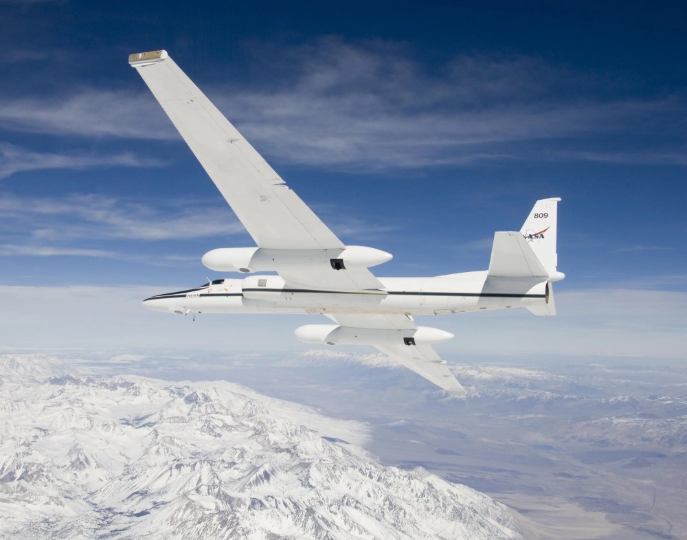
CLINTON, BRITISH COLUMBIA, CANADA – A high-altitude research aircraft from NASA flew over British Columbia’s wildfires over the weekend in a bid to better understand weather events generated by large blazes.
Online aviation tracking shows the ER-2 plane flew back and forth over B.C.’s southern Interior more than a dozen times on Saturday on a flight of more than six hours that took off from Great Falls, Mont.
Data from the Flightradar24 website shows the plane spent about four hours at an altitude of 60,000 feet over the Clinton area, where the massive Pear Lake wildfire has been burning,
It also swung east over Lake Revelstoke before returning to U.S. airspace.
NASA says on its website that the ER-2 is researching pyrocumulonimbus clouds, which it describes as “one of the least understood forms of severe weather on Earth.”
The BC Wildfire Service says the Pear Lake wildfire, the largest in B.C. at almost 1,500 square kilometres, has created such clouds that are formed by extreme smoke and heat and can in turn generate rain, lightning and fire tornadoes.

The ER-2 is a repurposed Cold War spy plane known as the U-2, that has set records for extreme altitude flights up to twice as high as the typical altitude of commercial flights.
NASA says the aircraft is fitted with “state-of-the-art infrared wildfire trackers” to register data on pyrocumulonimbus clouds.
“Smoky and crackling with lightning, these unique storms can create blind spots for aviators above and spark new blazes below,” NASA says in a news release.
“Measuring and mapping the dangerous storms as they develop in real-time will help scientists forecast them in the future.”
This report by The Canadian Press was first published Aug. 10, 2026.
Advertisement Advertise With Us
Advertisement Advertise With Us