

First full-size 3D scan of Titanic shows shipwreck in new light
Advertisement
Read this article for free:
or
Already have an account? Log in here »
To continue reading, please subscribe:
Monthly Digital Subscription
$0 for the first 4 weeks*
- Enjoy unlimited reading on winnipegfreepress.com
- Read the E-Edition, our digital replica newspaper
- Access News Break, our award-winning app
- Play interactive puzzles
*No charge for 4 weeks then price increases to the regular rate of $19.95 plus GST every four weeks. Offer available to new and qualified returning subscribers only. Cancel any time.
Monthly Digital Subscription
$4.99/week*
- Enjoy unlimited reading on winnipegfreepress.com
- Read the E-Edition, our digital replica newspaper
- Access News Break, our award-winning app
- Play interactive puzzles
*Billed as $19.95 plus GST every four weeks. Cancel any time.
To continue reading, please subscribe:
Add Free Press access to your Brandon Sun subscription for only an additional
$1 for the first 4 weeks*
*Your next subscription payment will increase by $1.00 and you will be charged $16.99 plus GST for four weeks. After four weeks, your payment will increase to $23.99 plus GST every four weeks.
Read unlimited articles for free today:
or
Already have an account? Log in here »
Hey there, time traveller!
This article was published 18/05/2023 (968 days ago), so information in it may no longer be current.
LONDON (AP) — Deep-sea researchers have completed the first full-size digital scan of the Titanic, showing the entire wreck in unprecedented detail and clarity, the companies behind a new documentary on the wreck said Thursday.
Using two remotely operated submersibles, a team of researchers spent six weeks last summer in the North Atlantic mapping the whole shipwreck and the surrounding 3-mile debris field, where personal belongings of the ocean liner’s passengers, such as shoes and watches, were scattered.
Richard Parkinson, founder and chief executive of deep-sea exploration firm Magellan, estimated that the resulting data — including 715,000 images — is 10 times larger than any underwater 3D model ever attempted before.
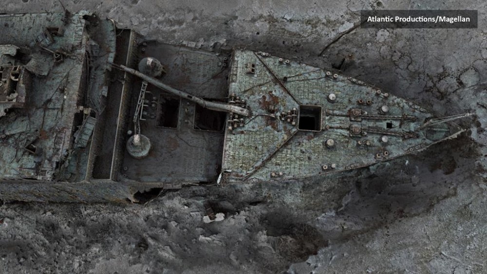
“It’s an absolutely one-to-one digital copy, a ‘twin,’ of the Titanic in every detail,” said Anthony Geffen, head of documentary maker Atlantic Productions.
The Titanic was on its maiden voyage from Southampton, England, to New York City when it hit an iceberg off Newfoundland in the North Atlantic on April 15, 1912. The luxury ocean liner sank within hours, killing about 1,500 people.
The wreck, discovered in 1985, lies some 12,500 feet (3,800 meters) under the sea, about 435 miles (700 kilometers) off the coast of Canada.

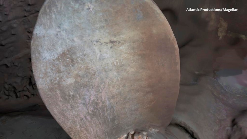
Geffen says previous images of the Titanic were often limited by low light levels, and only allowed viewers to see one area of the wreck at a time. He said the new photorealistic 3D model captures both the bow and stern section, which had separated upon sinking, in clear detail — including the serial number on the propeller.
Researchers have spent seven months rendering the large amount of data they gathered, and a documentary on the project is expected to come out next year. But beyond that, Geffen says he hopes the new technology will help researchers work out details of how the Titanic met its fate and allow people to interact with history in a fresh way.
“All our assumptions about how it sank, and a lot of the details of the Titanic, comes from speculation, because there is no model that you can reconstruct, or work exact distances,” he said. “I’m excited because this quality of the scan will allow people in the future to walk through the Titanic themselves … and see where the bridge was and everything else.”
Parks Stephenson, a leading Titanic expert who was involved in the project, called the modelling a “gamechanger.”
“I’m seeing details that none of us have ever seen before and this allows me to build upon everything that we have learned to date and see the wreck in a new light,” he said. “We’ve got actual data that engineers can take to examine the true mechanics behind the breakup and the sinking and thereby get even closer to the true story of Titanic disaster.”
Related Articles
Deep-sea craft carrying 5 people to Titanic wreckage reported missing, search underway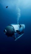

Advertisement Advertise With Us
Advertisement Advertise With Us