Mountainous Manitoba? Who knew?
U of M students get onsite lesson on province's geological history
Advertisement
Read this article for free:
or
Already have an account? Log in here »
To continue reading, please subscribe:

Digital Subscription
One year of digital access for only $205*
- Enjoy unlimited reading on winnipegfreepress.com
- Read the E-Edition, our digital replica newspaper
- Access News Break, our award-winning app
- Play interactive puzzles
*First annual payment billed as $205.00 + GST for one year. This annual subscription will automatically renew at $233.00 + GST every 52 weeks (10% off the regular annual price of $259.35). Offer available to new and qualified returning subscribers only. Cancel any time.
To continue reading, please subscribe:
Add Free Press access to your Brandon Sun subscription for only an additional
$1 for the first 4 weeks*
- Enjoy unlimited reading on winnipegfreepress.com
- Read the E-Edition, our digital replica newspaper
- Access News Break, our award-winning app
- Play interactive puzzles
*Your next Brandon Sun subscription payment will increase by $1.00 and you will be charged $17.95 plus GST for four weeks. After four weeks, your payment will increase to $24.95 plus GST every four weeks.
Read unlimited articles for free today:
or
Already have an account? Log in here »
Hey there, time traveller!
This article was published 10/05/2009 (6332 days ago), so information in it may no longer be current.
STAR LAKE — It’s a big mystery. What happened here 2.7 billion years ago?
And every spring, as many as 30 geology students from University of Manitoba scour the rocky landscape here looking for the answer.
It’s the U of M geological sciences field station, just west of West Hawk Lake in Whiteshell Provincial Park, where budding geologists go to learn to read rocks.
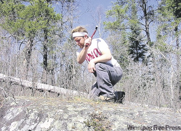
"(The field station) is a gem tucked away that not a lot of people know about," said Jeff Young, U of M geological sciences instructor.
It’s also a reminder that Manitoba actually had mountains at one time, before Riding and Duck mountains. But those mountains avalanched and eroded and the rock was strewn about by glaciers. The Canadian Shield is what remains.
Students bunk at the station for 12-day stints and spend their days in the wilderness mapping, chipping and interpreting rocks.
Their regimen sounds a bit like a boot camp. They have breakfast at 7 a.m., leave at 8 a.m., and don’t return to the field station until supper. Then there’s classroom time at 7 p.m. Their assignments need to be in by 11 p.m. each night.
And the students love it. "Who wouldn’t?" one student replied.
Seventeen sites in total serve as outdoor classrooms, yielding clues as to rocks and rock movements over several billion years. (At least one site had signs the layman could interpret: long claw marks in the rock cause by glaciers, called "glaciated striations.")
On this day, Young instructed students to follow the boundary between two layers of sedimentary rock, called a "strike." The sedimentary rock doesn’t lie flat anymore but is vertical, the result of the plate tectonics — what used to be called continental drift — pushing the rock up.
Volcanic activity and "continental collision"– tectonic plates colliding with each other like what’s still happening between the Indian subcontinent and Asia to create the Himalayas — produced the rock and mountains here.
The Whiteshell rock is a mix of volcanic rock and granite.
The volcanic rock was produced around 2.7 billion years ago. There were once small, spewing volcanoes across the area. The darker, volcanic rock is the predominant rock at West Hawk Lake, for example. It is called greenstone in geology jargon.
The really pink rocks you see in the Whiteshell are granite. They would have formed below ground on the continent that existed back then (that was surrounded by ocean), and were likely pushed to the surface by plate tectonics.
Or else erosion wore away the ground above the granite, but it would have to wear away many kilometres of overburden. For example, a form of granite found in the Thompson Nickel Belt is believed to have once been 26 kilometres below ground, said Young.
The granite is even older than volcanic rock: about 2.9 to 3.1 billion years old. Caddy Lake is predominantly granite.
Quartz and feldspar are the dominant minerals in granite. Iron and magnesium are dominant minerals in the volcanic rock.

Typically, geologists look to find places where minerals have accumulated, usually from a system of heat called a hydrothermal system.
The geologists looke for the accumulation of minerals in a geological anomaly. Metals like copper, zinc and particularly gold have been found in this area.
You’ve got to love student Matt Zago’s chutzpah. Zago plans to run his own junior mineral exploration company, once his studies are completed.
"Check it out. I’ll have my own company. It will be called Zagold Explorations. In 10 years, it will be listed on the TSX (Toronto Stock Exchange) as ZAG," said Zago.
Star Lake is more of a teaching facility today than the research station it started out as in the 1970s.
U of M’s geology field station was originally at Wallace Lake, east of Bissett.
Star Lake also happens to be the site of a former gold mine. Gold was first discovered in the area in 1890, but mining didn’t begin until 1913.
The mine shaft wasn’t very deep and little gold was recovered. It closed in 1917.
The concrete slabs closing the head frame can still be found, and make for a nice hike in the woods.
bill.redekop@freepress.mb.ca