

Three times more Quebec homes could be in flood zones when new maps released
Advertisement
Read this article for free:
or
Already have an account? Log in here »
To continue reading, please subscribe:
Monthly Digital Subscription
$0 for the first 4 weeks*
- Enjoy unlimited reading on winnipegfreepress.com
- Read the E-Edition, our digital replica newspaper
- Access News Break, our award-winning app
- Play interactive puzzles
*No charge for 4 weeks then price increases to the regular rate of $19.00 plus GST every four weeks. Offer available to new and qualified returning subscribers only. Cancel any time.
Monthly Digital Subscription
$4.75/week*
- Enjoy unlimited reading on winnipegfreepress.com
- Read the E-Edition, our digital replica newspaper
- Access News Break, our award-winning app
- Play interactive puzzles
*Billed as $19 plus GST every four weeks. Cancel any time.
To continue reading, please subscribe:
Add Free Press access to your Brandon Sun subscription for only an additional
$1 for the first 4 weeks*
*Your next subscription payment will increase by $1.00 and you will be charged $16.99 plus GST for four weeks. After four weeks, your payment will increase to $23.99 plus GST every four weeks.
Read unlimited articles for free today:
or
Already have an account? Log in here »
Hey there, time traveller!
This article was published 11/06/2024 (544 days ago), so information in it may no longer be current.
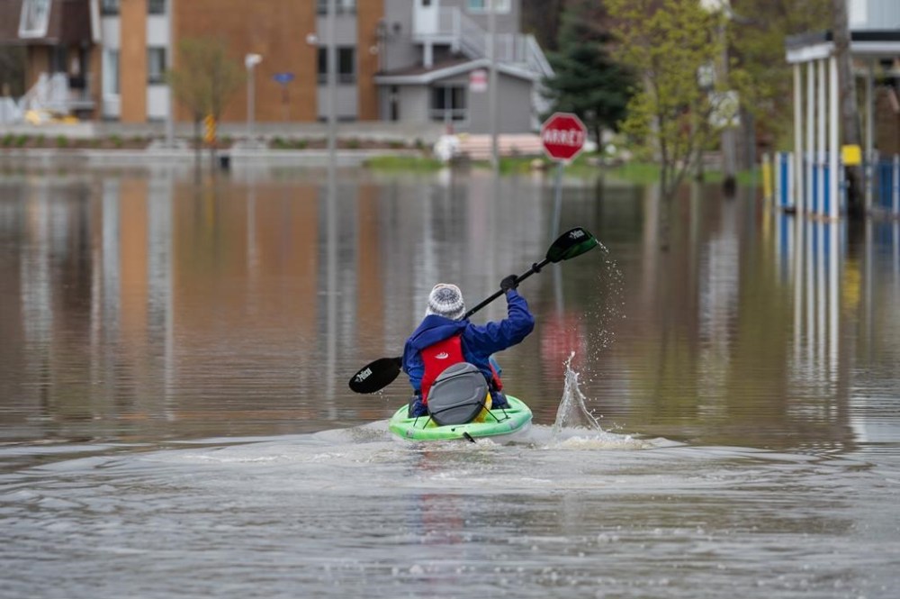
MONTREAL – The Quebec government estimates the number of homes located in flood zones could triple in the province when new flood maps are released.
The province’s environment minister discussed the figures today as he announced a public consultation on a proposal to modernize flood management rules.
Under the new framework, the number of residences located in flood zones would jump from 22,000 to 77,000, home to about two per cent of the province’s population.
The maps would also change the way flood risk is identified, from a system based on probability linked to years to one that designates risk as low, moderate, high and very high.
Nothing in the rules will force a person who lives near the water to relocate, but the various levels of risk involve new rules and restrictions around the construction and renovation of homes.
The province says the new rules are necessary due to climate change, and were put together after major flooding in 2017 and 2019 that caused an estimated more than $1 billion in total damages.
“These new maps, based on the most recent scientific knowledge, will take into account both the frequency of floods, their intensity depending on the water depth reached, the presence of ice jams, as well as the impacts of climate change,” read the documents released by the Environment department.
The proposed rules include limiting homeowners in very high-risk zones from building new homes or rebuilding a destroyed one. They would still be able to renovate the home, or modify it to make it more resistant to floods.
New construction will generally not be allowed in high-risk zones, with a few exceptions.
A number of mayors and groups representing municipalities expressed concern over the announcement on Tuesday, noting that the public consultations are being held before the maps are released.
“During the consultation, the first thing citizens will ask us is, ‘Am I in this zone?’ And unfortunately, we don’t have a concrete answer to give them,” said François Robillard, mayor of Ste-Marthe-sur-le-Lac, northwest of Montreal.

He said he was worried that citizens who were flooded in 2019 would suddenly find themselves in a zone that would impact their ability to rebuild.
The mayor of Pointe-Calumet, a town in the Laurentians, said she believes that almost her whole municipality will be considered a flood zone when the new maps are released, when almost none of it was before.
“We wake up one morning like that, with the value of our homes going down, mortgage uncertainty, insurance uncertainty,” Sonia Fontaine said, adding that the public consultation period is “another 90 days of uncertainty.”
Environment Minister Benoît Charette said Tuesday that not all the new maps are ready, but that 80 per cent of urban communities are expected to have completed them by spring 2025.
This report by The Canadian Press was first published June 11, 2024.