

Hurricane Erin strengthens into a Category 2 storm as it approaches the northeast Caribbean
Advertisement
Read this article for free:
or
Already have an account? Log in here »
To continue reading, please subscribe:
Monthly Digital Subscription
$1 per week for 24 weeks*
- Enjoy unlimited reading on winnipegfreepress.com
- Read the E-Edition, our digital replica newspaper
- Access News Break, our award-winning app
- Play interactive puzzles
*Billed as $4.00 plus GST every four weeks. After 24 weeks, price increases to the regular rate of $19.95 plus GST every four weeks. Offer available to new and qualified returning subscribers only. Cancel any time.
Monthly Digital Subscription
$4.99/week*
- Enjoy unlimited reading on winnipegfreepress.com
- Read the E-Edition, our digital replica newspaper
- Access News Break, our award-winning app
- Play interactive puzzles
*Billed as $19.95 plus GST every four weeks. Cancel any time.
To continue reading, please subscribe:
Add Free Press access to your Brandon Sun subscription for only an additional
$1 for the first 4 weeks*
*Your next subscription payment will increase by $1.00 and you will be charged $16.99 plus GST for four weeks. After four weeks, your payment will increase to $23.99 plus GST every four weeks.
Read unlimited articles for free today:
or
Already have an account? Log in here »
Hey there, time traveller!
This article was published 15/08/2025 (224 days ago), so information in it may no longer be current.
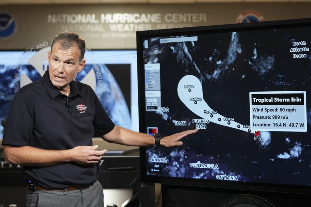
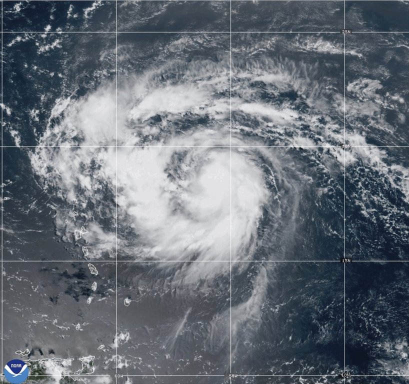
SAN JUAN, Puerto Rico (AP) — Hurricane Erin strengthened into a Category 2 storm on Friday as it approached the northeast Caribbean, prompting forecasters to warn of possible flooding and landslides.
The storm is expected to remain over open waters, although tropical storm watches were issued for Anguilla, Barbuda, St. Martin, St. Barts, Saba, St. Eustatius and St. Maarten.
Heavy rains were forecast to start late Friday in Antigua and Barbuda, the U.S. and British Virgin Islands and southern and eastern Puerto Rico. Up to 4 inches (10 centimeters) are expected, with isolated totals of up to 6 inches (15 centimeters), according to the National Hurricane Center in Miami.
The hurricane center also warned of dangerous swells but said the threat of direct impacts in the Bahamas and along the east coast of the United States “appears to be gradually decreasing.”
The storm was located 250 miles (405 kilometers) northeast of Anguilla as of the hurricane center’s 11 p.m. EDT advisory. It had maximum sustained wind speeds of 100 mph (160 kph) and was moving west north-west at 17 mph (27 kph).
Hurricane specialist and storm surge expert Michael Lowry said Erin is forecast to eventually take a sharp turn northeast that would put it on a path between the U.S. and Bermuda.
“All of our best consensus aids show Erin turning safely east of the United States next week, but it’ll be a much closer call for Bermuda, which could land on the stronger eastern side of Erin,” he said.
Erin is the Atlantic season’s first hurricane. It is forecast to become a major Category 3 storm late this weekend and pass some 200 miles (320 kilometers) north of Puerto Rico.
The U.S. government has deployed more than 200 employees from the Federal Emergency Management Agency and other agencies to Puerto Rico as a precaution as forecasters issued a flood watch for the entire U.S. territory from late Friday into Monday.
Puerto Rico Housing Secretary Ciary Pérez Peña said 367 shelters have been inspected and could be opened if needed.
The U.S. Coast Guard said Friday that it closed six seaports in Puerto Rico and two in the U.S. Virgin Islands to all incoming vessels unless they had received prior authorization.
Meanwhile, officials in the Bahamas said they prepared some public shelters as a precaution as they urged people to track the hurricane.
“These storms are very volatile and can make sudden shifts in movement,” said Aarone Sargent, managing director for the Bahamas’ disaster risk management authority.
Dangerous surf and rip currents are expected to affect the U.S. East Coast next week, with waves reaching up to 15 feet (5 meters) along parts of the North Carolina coast that could cause beach erosion, according to Accuweather.
“Erin is forecast to explode into a powerful Category 4 hurricane as it moves across very warm waters in the open Atlantic. Water temperatures at the surface and hundreds of feet deep are several degrees higher than the historical average,” said Alex DaSilva, Accuweather’s lead hurricane expert.

Erin is the fifth named storm of the Atlantic hurricane season, which runs from June 1 to Nov. 30.
This year’s season is once again expected to be unusually busy. The forecast calls for six to 10 hurricanes, with three to five reaching major status with winds of more than 110 mph (177 kph).