

Lorena is downgraded to a tropical storm but still poses a flooding and mudslide threat to Mexico
Advertisement
Read this article for free:
or
Already have an account? Log in here »
To continue reading, please subscribe:
Monthly Digital Subscription
$1 per week for 24 weeks*
- Enjoy unlimited reading on winnipegfreepress.com
- Read the E-Edition, our digital replica newspaper
- Access News Break, our award-winning app
- Play interactive puzzles
*Billed as $4.00 plus GST every four weeks. After 24 weeks, price increases to the regular rate of $19.00 plus GST every four weeks. Offer available to new and qualified returning subscribers only. Cancel any time.
Monthly Digital Subscription
$4.75/week*
- Enjoy unlimited reading on winnipegfreepress.com
- Read the E-Edition, our digital replica newspaper
- Access News Break, our award-winning app
- Play interactive puzzles
*Billed as $19 plus GST every four weeks. Cancel any time.
To continue reading, please subscribe:
Add Winnipeg Free Press access to your Brandon Sun subscription for only
$1 for the first 4 weeks*
*$1 will be added to your next bill. After your 4 weeks access is complete your rate will increase by $0.00 a X percent off the regular rate.
Read unlimited articles for free today:
or
Already have an account? Log in here »
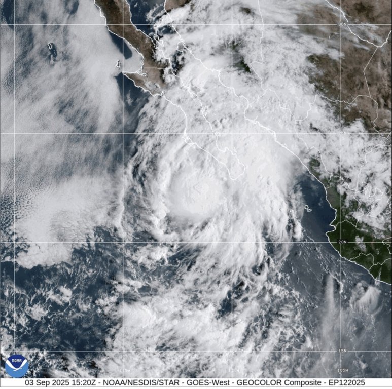
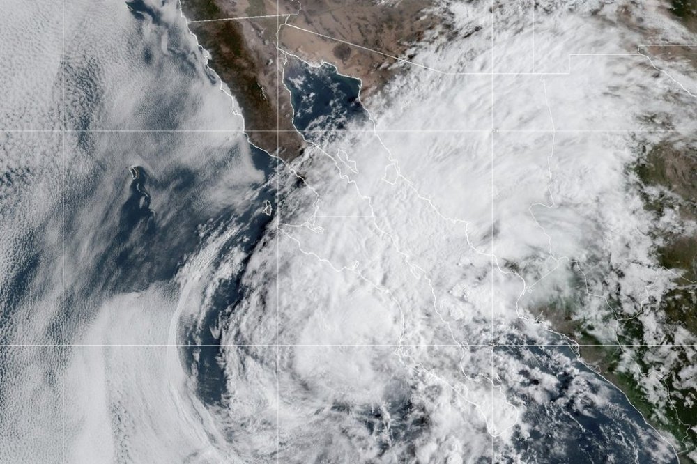
MIAMI (AP) — Hurricane Lorena weakened to a tropical storm Thursday but forecasters said a life-threatening risk of flash flooding and mudslides was still present for parts of Mexico’s Baja California peninsula.
Tropical Storm Lorena had maximum sustained winds of 45 mph (72 kph), the U.S. National Hurricane Center said. The storm was centered about 175 miles (280 kilometers) west of Cabo San Lazaro, Mexico, and traveling northwest at 5 mph (8 kph).
Lorena was expected to weaken further but could still bring isolated rainfall amounts up to 15 inches (38 centimeters) to parts of the Mexican states of Baja California Sur, Baja California and Sonora. The risk of flash flooding and mudslides was expected to remain into Friday.
The government of Mexico discontinued all watches and warnings associated with Lorena on Thursday afternoon.
Forecasters urged people on the Baja California peninsula and in northwestern Mexico to monitor the storm’s progress.
In Arizona and New Mexico, the weather center said that heavy rainfall up to 4 inches (10 centimeters) was possible and could potentially lead to isolated flash flooding into Saturday.

Lorena’s track was still uncertain, with the latest forecast suggesting the center of the storm would remain offshore just west of the Baja California peninsula. Lorena was expected to be a remnant low by Friday morning.
Meanwhile, Hurricane Kiko had weakened to a Category 3 storm on the Saffir-Simpson Hurricane Wind Scale with maximum sustained winds near 125 mph (201 kph), according to the hurricane center. It was centered about 1,360 miles (2,188 kilometers) east-southeast of Hilo, Hawaii, and was traveling west at 9 mph (14 kph).
Forecasters said that Kiko could strengthen Thursday night and into Friday, before a slow weakening through the weekend.
There was a risk of impacts for Hawaii from Kiko next week. It was too soon to determine the exact location or intensity of impacts, forecasters said, so people were encouraged to monitor the hurricane’s progress.
There were no watches or warnings associated with Kiko as of Thursday. Swells generated by the hurricane could begin reaching the Hawaiian Islands by the end of the weekend, forecasters said.