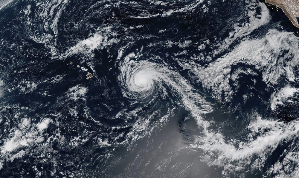
Hurricane Kiko is weakening on a forecast path expected to take it north of Hawaii
Advertisement
Read this article for free:
or
Already have an account? Log in here »
To continue reading, please subscribe:
Monthly Digital Subscription
$1 per week for 24 weeks*
- Enjoy unlimited reading on winnipegfreepress.com
- Read the E-Edition, our digital replica newspaper
- Access News Break, our award-winning app
- Play interactive puzzles
*Billed as $4.00 plus GST every four weeks. After 24 weeks, price increases to the regular rate of $19.95 plus GST every four weeks. Offer available to new and qualified returning subscribers only. Cancel any time.
Monthly Digital Subscription
$4.99/week*
- Enjoy unlimited reading on winnipegfreepress.com
- Read the E-Edition, our digital replica newspaper
- Access News Break, our award-winning app
- Play interactive puzzles
*Billed as $19.95 plus GST every four weeks. Cancel any time.
To continue reading, please subscribe:
Add Free Press access to your Brandon Sun subscription for only an additional
$1 for the first 4 weeks*
*Your next subscription payment will increase by $1.00 and you will be charged $16.99 plus GST for four weeks. After four weeks, your payment will increase to $23.99 plus GST every four weeks.
Read unlimited articles for free today:
or
Already have an account? Log in here »
Hey there, time traveller!
This article was published 07/09/2025 (200 days ago), so information in it may no longer be current.
HONOLULU (AP) — A weakening Hurricane Kiko is expected to track north of Hawaii in coming days, reducing the threat of strong winds and heavy rain on the islands but still bringing potentially dangerous surf conditions, forecasters said Sunday.
Kiko was about 635 miles (1,025 kilometers) east of Hilo on the Big Island on Sunday and was forecast to pass north of the islands Tuesday and Wednesday, the National Hurricane Center in Miami said. The hurricane was moving west-northwest at 13 mph (20 kph).
Maximum sustained winds stood at 110 mph (175 kph) Sunday, down from 120 mph (195 kph) on Saturday, with more weakening forecast in coming days as the storm moves over cooler waters.


No coastal watches or warnings were in effect for Hawaii. The hurricane center said the risks of direct impacts on the islands appeared to be decreasing but it urged people in the islands to continue monitoring the storm’s progress.
Forecasters have warned of potentially life-threatening rip currents and surf along the islands’ east-facing shores with waves expected to reach 10 to 15 feet (3 to 4.5 meters) in some places.