

Priscilla nears major hurricane status in Pacific as new tropical storm swirls in the Atlantic
Advertisement
Read this article for free:
or
Already have an account? Log in here »
To continue reading, please subscribe:
Monthly Digital Subscription
$0 for the first 4 weeks*
- Enjoy unlimited reading on winnipegfreepress.com
- Read the E-Edition, our digital replica newspaper
- Access News Break, our award-winning app
- Play interactive puzzles
*No charge for 4 weeks then price increases to the regular rate of $19.95 plus GST every four weeks. Offer available to new and qualified returning subscribers only. Cancel any time.
Monthly Digital Subscription
$4.99/week*
- Enjoy unlimited reading on winnipegfreepress.com
- Read the E-Edition, our digital replica newspaper
- Access News Break, our award-winning app
- Play interactive puzzles
*Billed as $19.95 plus GST every four weeks. Cancel any time.
To continue reading, please subscribe:
Add Free Press access to your Brandon Sun subscription for only an additional
$1 for the first 4 weeks*
*Your next subscription payment will increase by $1.00 and you will be charged $16.99 plus GST for four weeks. After four weeks, your payment will increase to $23.99 plus GST every four weeks.
Read unlimited articles for free today:
or
Already have an account? Log in here »
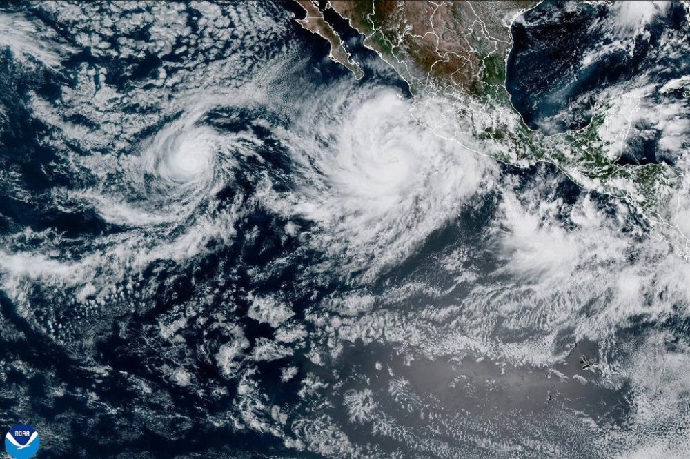
MIAMI (AP) — Hurricane Priscilla neared Category 3 status on Tuesday in the Pacific as a new tropical storm strengthened in the Atlantic, the U.S. National Hurricane Center said.
Just off the west coast of Mexico, Priscilla was spinning with maximum sustained winds around 105 mph (169 kph) and moving northwest at 9 mph (15 kph). It was centered Tuesday night about 185 miles (295 kilometers) southwest of the southern tip of Baja California, forecasters said.
On Tuesday, outer bands of the hurricane were extending across the Mexican state of Baja California Sur.
In the Atlantic Ocean, Tropical Storm Jerry maintained top winds of 50 mph (85 kph) early Wednesday. It was centered about 950 miles (1,530 kilometers) east-southeast of the northern Leeward Islands while moving west-northwest at 23 mph (37 kph).
Forecasters said Jerry is expected to strengthen into a hurricane in another day or two. Swells from Jerry were expected Thursday to reach the Leeward Islands with the core of the storm moving near or north of the northern Leeward Islands late Thursday and Friday.
A tropical storm watch was issued for Barbuda and Anguilla, St. Barthelemy and St. Martin and Sint Maarten.
In the Pacific, a tropical storm watch was in place for Baja California Sur from Cabo San Lucas to Cabo San Lazaro due to Hurricane Priscilla.
The government of Baja California Sur canceled classes at all educational centers starting Tuesday in Los Cabos and La Paz as a preventive measure. It also set up a dozen shelters in Los Cabos for people living in areas at risk.
Parts of southwestern Mexico could get up to 4 inches (10 centimeters) of rain from Priscilla through Wednesday, bringing a flash flooding risk to Michoacán and Colima states, forecasters said.
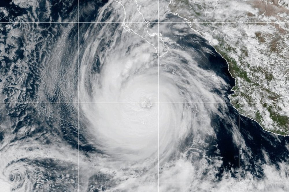
Priscilla was forecast to weaken starting Wednesday, the hurricane center said. A major hurricane is defined as Category 3 or higher and wind speeds of at least 111 mph (180 kph).
Swells from Priscilla were reaching the coast of Mexico. Life threatening surf and rip currents were likely, forecasters said.
Farther out in the Pacific, Tropical Storm Octave was weakening about 750 miles (1,205 kilometers) southwest of the southern tip of Baja California. Its maximum sustained winds were 45 mph (75 kph) and it was moving east-southeast at 7 mph (11 kph).