

Late season blast of winter headed for Nova Scotia and Newfoundland and Labrador
Advertisement
Read this article for free:
or
Already have an account? Log in here »
To continue reading, please subscribe:
Monthly Digital Subscription
$1 per week for 24 weeks*
- Enjoy unlimited reading on winnipegfreepress.com
- Read the E-Edition, our digital replica newspaper
- Access News Break, our award-winning app
- Play interactive puzzles
*Billed as $4.00 plus GST every four weeks. After 24 weeks, price increases to the regular rate of $19.95 plus GST every four weeks. Offer available to new and qualified returning subscribers only. Cancel any time.
Monthly Digital Subscription
$4.99/week*
- Enjoy unlimited reading on winnipegfreepress.com
- Read the E-Edition, our digital replica newspaper
- Access News Break, our award-winning app
- Play interactive puzzles
*Billed as $19.95 plus GST every four weeks. Cancel any time.
To continue reading, please subscribe:
Add Free Press access to your Brandon Sun subscription for only an additional
$1 for the first 4 weeks*
*Your next subscription payment will increase by $1.00 and you will be charged $16.99 plus GST for four weeks. After four weeks, your payment will increase to $23.99 plus GST every four weeks.
Read unlimited articles for free today:
or
Already have an account? Log in here »
HALIFAX – Parts of Nova Scotia got an early spring blast from Old Man Winter on Sunday, and Newfoundland and Labrador is next.
Environment Canada said snow was expected to fall in southwest Nova Scotia in the afternoon and continue up the Atlantic coast into Monday.
Ten to 15 centimetres of heavy, wet snow was expected, with strong northeasterly gusts as the weather system moves north along the Atlantic coast.
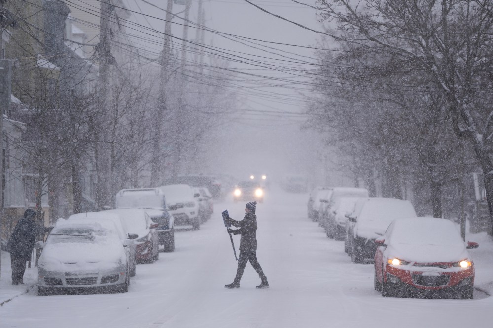
The storm is set to move into Newfoundland on Monday evening, with 20 to 30 centimetres expected in the central and northeastern regions of the island.
Between 30 and 50 centimetres is expected for the southeast, including the Avalon Peninsula, with easterly wind gusts of up to 60 kilometres per hour and snowfall rates exceeding five centimetres per hour at times.
A second period of poor visibility in blowing snow is possible Tuesday night as temperatures fall and precipitation changes back to snow.
A blowing snow advisory that had been in effect in parts of Labrador on Sunday has ended.