

Send us your Google Street Views
Advertisement
Read this article for free:
or
Already have an account? Log in here »
To continue reading, please subscribe:
Monthly Digital Subscription
$1 per week for 24 weeks*
- Enjoy unlimited reading on winnipegfreepress.com
- Read the E-Edition, our digital replica newspaper
- Access News Break, our award-winning app
- Play interactive puzzles
*Billed as $4.00 plus GST every four weeks. After 24 weeks, price increases to the regular rate of $19.95 plus GST every four weeks. Offer available to new and qualified returning subscribers only. Cancel any time.
Monthly Digital Subscription
$4.99/week*
- Enjoy unlimited reading on winnipegfreepress.com
- Read the E-Edition, our digital replica newspaper
- Access News Break, our award-winning app
- Play interactive puzzles
*Billed as $19.95 plus GST every four weeks. Cancel any time.
To continue reading, please subscribe:
Add Free Press access to your Brandon Sun subscription for only an additional
$1 for the first 4 weeks*
*Your next subscription payment will increase by $1.00 and you will be charged $16.99 plus GST for four weeks. After four weeks, your payment will increase to $23.99 plus GST every four weeks.
Read unlimited articles for free today:
or
Already have an account? Log in here »
Hey there, time traveller!
This article was published 01/12/2009 (5969 days ago), so information in it may no longer be current.
WINNIPEG — An up-close view of almost any Winnipeg location is now only a click away.
Google Street View launched its picture view of Winnipeg Dec. 1.
The photos were recorded the images with cameras mounted on top of cars that drove through the city in early 2009
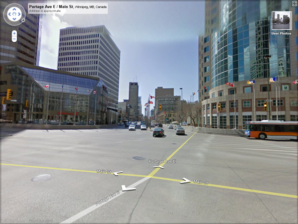
Web users can see the photos free of charge by going to any address in Google Maps and dragging the yellow Street View "pegman" icon onto the map — or try it out using the embedded map below.

For security reasons, the Street View application automatically blurs human faces and licence plates, but each image also includes a "report a problem" link where users can request to have images blurred more or removed.
Street View, launched in 2007 in the United States, is also available in areas of the U.K., Spain, Australia and Japan. Several Canadian cities, including Toronto, Ottawa, Montreal, Calgary, Banff National Park and Vancouver, were added in early October 2009.
View Larger Map