

Sandbagging efforts begin
Advertisement
Read this article for free:
or
Already have an account? Log in here »
To continue reading, please subscribe:

Digital Subscription
One year of digital access for only $205*
- Enjoy unlimited reading on winnipegfreepress.com
- Read the E-Edition, our digital replica newspaper
- Access News Break, our award-winning app
- Play interactive puzzles
*First annual payment billed as $205.00 + GST for one year. This annual subscription will automatically renew at $233.00 + GST every 52 weeks (10% off the regular annual price of $259.35). Offer available to new and qualified returning subscribers only. Cancel any time.
To continue reading, please subscribe:
Add Free Press access to your Brandon Sun subscription for only an additional
$1 for the first 4 weeks*
- Enjoy unlimited reading on winnipegfreepress.com
- Read the E-Edition, our digital replica newspaper
- Access News Break, our award-winning app
- Play interactive puzzles
*Your next Brandon Sun subscription payment will increase by $1.00 and you will be charged $17.95 plus GST for four weeks. After four weeks, your payment will increase to $24.95 plus GST every four weeks.
Read unlimited articles for free today:
or
Already have an account? Log in here »
Hey there, time traveller!
This article was published 24/03/2009 (6385 days ago), so information in it may no longer be current.
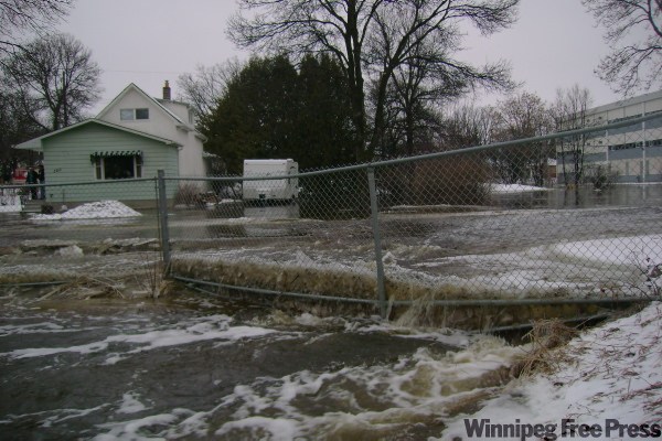
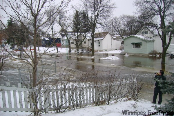
Sandbagging has started at 34 homes in Winnipeg as levels rise on the Red River, the city said today.
Grant Mohr, the city’s land drainage and flood protection planning engineer, said the homes, many along Scotia Avenue in West Kildonan, must be sandbagged this week as river comes up.
Mohr said sandbags are now being delivered to these homes. It’s estimated that about 24,000 sandbags will be needed.
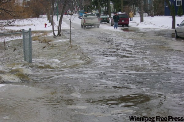
Mohr also said overall only about 70 homes in Winnipeg are at risk of flooding this spring, down from 292 forecasted last week.
He said the reason why fewer homes are threatened is that the forecasted flow of water from the U.S. is now reduced.
Still, the Red River is expected to come up quickly over the next few days as ice on the river has yet to break up. Once ice does start to move the level will come down. The ice break-up will also allow for the opening of the floodway gates diverting water around the city.
The James Avenue level is currently at 13.9 feet and is expected to reach 20 feet by Thursday evening.
The most recent update from the province indicates that the peak in Winnipeg from the water flowing from the U.S. will be in the range of 19 to 20.5 feet James April 12 – 17. For comparison, the 2006 level was 20.4 at James Avenue.
Mohr said the city is monitoring the situation as more rain and snow is expected to fall this week.
Residents who live along the river are cautioned to move or secure any structures or equipment near the water’s edge, such as docks, sheds, gazebos, irrigation pumps, and recreational equipment. Other homeowners should check sump pumps and backwater valves on an on-going basis to prevent basement flooding.
Provincial road closures
The Highways Department closed several provincial roads on Tuesday because of overland flooding and restricted travel to local access only on some others.
Closures as of 8:30 p.m. Tuesday include:
- Provincial Road 201 is closed for two kilometres east of the junction of PR 201 and PTH 31;
- PR 564 between Bradwardine to Highway 21;
- PR 305 between PR 248 and PTH 13;
- PR 350 from 10 kilometres south of MacGregor to the junction of PR 242 and PR 350
The Highways Department says water is also flowing over portions of provincial roads 274, 12 kilometres south of Gilbert Plains, PR 364, two kilometres west of the junction of PR 481, and PR 481, four kilometres west of junction 276. These roads are not closed but motorists are advised to use caution and find alternative routes.
PR 261, seven kilometres east of Glenella, is down to one lane because of water on the road.
Travel is not being advised on PR 366 from Minitonas south to Duck Mountain Provincial Park because of extremely icy road conditions.
More information is available on the following web pages:
Winnipeg’s Primary Dike System