

Google to map Winnipeg bike routes
Advertisement
Read this article for free:
or
Already have an account? Log in here »
To continue reading, please subscribe:
Digital Subscription
One year of digital access for only $1.44 a week*
- Enjoy unlimited reading on winnipegfreepress.com
- Read the E-Edition, our digital replica newspaper
- Access News Break, our award-winning app
- Play interactive puzzles
*Billed as $5.77 plus GST every four weeks. After 52 weeks, price increases to the regular rate of $19.95 plus GST every four weeks. Offer available to new and qualified returning subscribers only. Cancel any time.
To continue reading, please subscribe:
Add Free Press access to your Brandon Sun subscription for only an additional
$1 for the first 4 weeks*
- Enjoy unlimited reading on winnipegfreepress.com
- Read the E-Edition, our digital replica newspaper
- Access News Break, our award-winning app
- Play interactive puzzles
*Your next Brandon Sun subscription payment will increase by $1.00 and you will be charged $17.95 plus GST for four weeks. After four weeks, your payment will increase to $24.95 plus GST every four weeks.
Read unlimited articles for free today:
or
Already have an account? Log in here »
Hey there, time traveller!
This article was published 22/11/2010 (5668 days ago), so information in it may no longer be current.
You may not be able to tell given the weather outside, but Winnipeg is about to become a little easier to navigate on a bicycle.
At the Sustainable Mobility Conference in Ottawa, Google announced it has added Winnipeg to its list of Canadian cities that will have bike routes available on Google Maps for those looking for the best path to take on two wheels.
Google Bike Directions are included among the Google Maps features, with city-fed bike routes clearly marked for viewing.
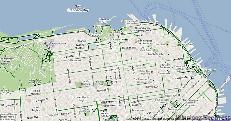
When clicking the feature, a dark green shade on a route indicates a bike-only path, while a lighter green line signals a dedicated bike lane. A dotted line shows a city street that doesn’t have a dedicated bike lane, but still could be suitable for biking.
The Winnipeg bike map should be available in a few days, Google said.
Ottawa, Toronto, Edmonton, Vancouver, Calgary, Gatineau and Waterloo are also involved in the initiative.