

Region’s flood risk decreases
But this spring's water woes unprecedented in their scale
Advertisement
Read this article for free:
or
Already have an account? Log in here »
To continue reading, please subscribe:

Digital Subscription
One year of digital access for only $205*
- Enjoy unlimited reading on winnipegfreepress.com
- Read the E-Edition, our digital replica newspaper
- Access News Break, our award-winning app
- Play interactive puzzles
*First annual payment billed as $205.00 + GST for one year. This annual subscription will automatically renew at $233.00 + GST every 52 weeks (10% off the regular annual price of $259.35). Offer available to new and qualified returning subscribers only. Cancel any time.
To continue reading, please subscribe:
Add Free Press access to your Brandon Sun subscription for only an additional
$1 for the first 4 weeks*
- Enjoy unlimited reading on winnipegfreepress.com
- Read the E-Edition, our digital replica newspaper
- Access News Break, our award-winning app
- Play interactive puzzles
*Your next Brandon Sun subscription payment will increase by $1.00 and you will be charged $17.95 plus GST for four weeks. After four weeks, your payment will increase to $24.95 plus GST every four weeks.
Read unlimited articles for free today:
or
Already have an account? Log in here »
Hey there, time traveller!
This article was published 14/04/2011 (5613 days ago), so information in it may no longer be current.
The Red River Valley won’t be inundated as badly as forecasters initially feared, but the 2011 flood remains unprecedented in terms of how much of Manitoba is affected.
The province’s latest hydrological projection calls for the Red River to crest in Winnipeg within three weeks at 20.1 to 22.8 feet above normal winter ice level at James Avenue.
The top of that range is 1.3 feet lower than a previous worst-case scenario of 24.1 feet James — only 0.2 feet above the crest of the 2009 flood, which peaked at 22.6 feet James. The 2009 flood was the second-worst in recent memory.
Steve Ashton, the province’s transportation and infrastructure minister, warned against complacency. “At times it may appear the severity of the flood is significantly less,” Ashton said Wednesday. “I want to stress this is a very serious flood.”
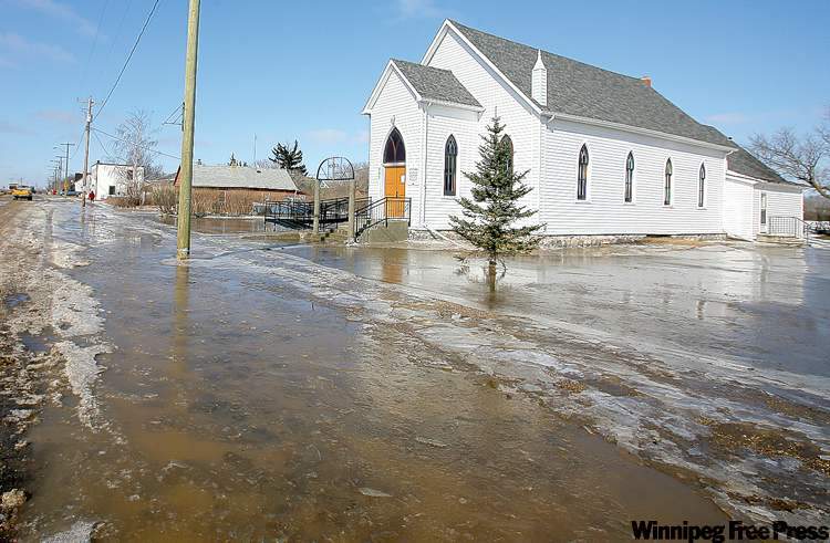
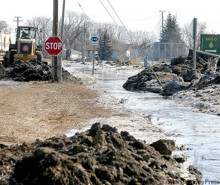
Ashton said the 2011 flood is “unprecedented on a geographic scale” because of the widespread distribution of saturated soils and heavy snowpacks across the province, which have led to river and overland flooding in most of Manitoba’s 197 municipalities.
Flooding is taking place or expected on the Red, Assiniboine, Roseau, Morris, Pembina, Souris, Qu’Appelle, Oak, Little Saskatchewan, Whitemud, Fisher, Icelandic, Vermilion and Saskatchewan rivers, among others. Overland flooding led officials to close a record 55 highways Tuesday, said spokesman Neil Gobelle.
Approximately 400 people have been evacuated from flood-affected communities, mostly as a precaution, Emergency Measures Organization director Chuck Sanderson said. The vast majority of evacuees have left First Nations.
In Winnipeg, however, the slight reduction in the Red River’s projected crest allows officials to reduce the number of properties on its flood-protection list to 129 from 560. Survey stakes must remain in place at all properties, however, in case the forecast changes.
Of the 129 now on the list, 35 already have sandbag dikes in place that can handle a crest of 22.8 feet James. Another 94 will need to build up their dikes. All but five of the latter properties are located on Kingston Crescent, Scotia Street and Glenwood Crescent, where homeowners need to build sandbag dikes atop existing berms.
The city plans to deliver 100,000 sandbags to complete these dikes and is continuing to ask volunteers to register by calling 311.
But some properties protected by sandbag dikes last week because of the ice-jam threat are in the clear, said Scott Payne, public works department flood co-ordinator.
Situations like this have led some residents south of Winnipeg to question whether the province inflated its flood predictions.
Bob Stefaniuk, mayor of the RM of Ritchot, said the province caused needless worry by talking up the threat of a major flood since January, well before flood preparations such as dike-building can begin. “The anxiety level, I’ve never seen it so high,” he said.
Ashton was unapologetic. “We would rather be blamed for over-preparing for the flood, rather than under-preparing for the flood,” he said.
There’s also plenty of time left in flood season for Red River Valley residents to see more water, said Manitoba Premier Greg Selinger.
“We hope that the flood waters do not come up as high as some of the forecasts have indicated,” Selinger said. “A lot will depend on the weather going forward. And the Assiniboine River has not let loose yet. We’re taking all measures necessary to protect people.”
Winnipeg Mayor Sam Katz also said there is a possibility of sewer backups and basement flooding in the coming weeks, as the city’s drainage system is more easily overwhelmed when river levels remain high.
— with files from Bruce Owen and Jen Skerritt
bartley.kives@freepress.mb.ca
Update on conditions throughout the province

Highway closures: 55 in Manitoba, 300 closures of municipal roads, plus sections of Interstate 29 in North Dakota and the Trans-Canada Highway in eastern Saskatchewan.
Evacuations: 400 people, mostly as a precaution, from Peguis, Sioux Valley, Dauphin River and Roseau River First Nations, Douglas settlement in the RM of Elton, a care home in Wawanesa and a hospital in Gladstone.
Ring-dike closures: Partial closures in Brunkild, Emerson, Gretna, Noyes, St. Adolphe, St. Jean Baptiste and Ste. Agathe.
Red River in Winnipeg: Expected to crest between April 30 and May 4 at 20.1 to 22.8 feet James. A preliminary crest of 20.8 feet James took place on April 7 due to an ice jam at the Redwood Bridge.
Flood-related fatalities: Two, both involving motor vehicles.
Related Articles
REPLAY: Flood update for April 15
Advertisement Advertise With Us
Advertisement Advertise With Us