

U.S. weather service continues to downgrade flood threat in Fargo
Advertisement
Read this article for free:
or
Already have an account? Log in here »
To continue reading, please subscribe:

Digital Subscription
One year of digital access for only $205*
- Enjoy unlimited reading on winnipegfreepress.com
- Read the E-Edition, our digital replica newspaper
- Access News Break, our award-winning app
- Play interactive puzzles
*First annual payment billed as $205.00 + GST for one year. This annual subscription will automatically renew at $233.00 + GST every 52 weeks (10% off the regular annual price of $259.35). Offer available to new and qualified returning subscribers only. Cancel any time.
To continue reading, please subscribe:
Add Free Press access to your Brandon Sun subscription for only an additional
$1 for the first 4 weeks*
- Enjoy unlimited reading on winnipegfreepress.com
- Read the E-Edition, our digital replica newspaper
- Access News Break, our award-winning app
- Play interactive puzzles
*Your next Brandon Sun subscription payment will increase by $1.00 and you will be charged $17.95 plus GST for four weeks. After four weeks, your payment will increase to $24.95 plus GST every four weeks.
Read unlimited articles for free today:
or
Already have an account? Log in here »
Hey there, time traveller!
This article was published 30/04/2013 (4880 days ago), so information in it may no longer be current.
For the third time in as many days, U.S. flood forecasters have downgraded the threat posed by the Red River in Fargo.
The U.S. National Weather Service expects the Red River to crest at 34 feet on Wednesday, a level that would represent the 12th-highest flood in Fargo’s recorded history.
Earlier in April, Fargo was preparing to fight a flood as high as 42 feet, which would have been a record crest.
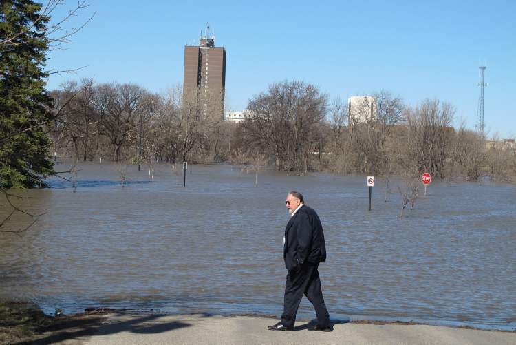
The improving flood scenario for the Red River in the United States is the result of several weeks of favourable weather.

It does not directly translate into an improved scenario for the Red River in Manitoba, as Fargo is located upstream of tributaries such as the Pembina, Roseau, Rat, Morris and Assiniboine rivers, some of which are still rising.
The Red in Winnipeg rose to 17 feet James as of 7 a.m. Tuesday but is expected to level off due to the operation of the Red River Floodway. The current level is unavailable due to missing data on the City of Winnipeg’s flood website.
Related Articles
Diversion protest 'irresponsible': province
Advertisement Advertise With Us