

Royal Canadian airborne police
Drones give RCMP investigators new perspective on crime scenes

Advertisement
Read this article for free:
or
Already have an account? Log in here »
To continue reading, please subscribe:
Digital Subscription
One year of digital access for only $1.44 a week*
- Enjoy unlimited reading on winnipegfreepress.com
- Read the E-Edition, our digital replica newspaper
- Access News Break, our award-winning app
- Play interactive puzzles
*Billed as $5.77 plus GST every four weeks. After 52 weeks, price increases to the regular rate of $19.95 plus GST every four weeks. Offer available to new and qualified returning subscribers only. Cancel any time.
To continue reading, please subscribe:
Add Free Press access to your Brandon Sun subscription for only an additional
$1 for the first 4 weeks*
- Enjoy unlimited reading on winnipegfreepress.com
- Read the E-Edition, our digital replica newspaper
- Access News Break, our award-winning app
- Play interactive puzzles
*Your next Brandon Sun subscription payment will increase by $1.00 and you will be charged $17.95 plus GST for four weeks. After four weeks, your payment will increase to $24.95 plus GST every four weeks.
Read unlimited articles for free today:
or
Already have an account? Log in here »
Hey there, time traveller!
This article was published 14/12/2015 (3827 days ago), so information in it may no longer be current.
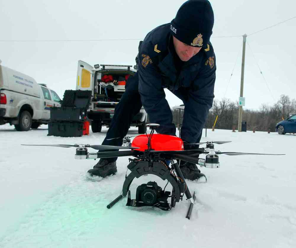
From traffic-crash reconstruction to forensic identification at crime scenes, Manitoba RCMP have found a new perspective for police work.
Nearly five years ago, the “D” Division followed Saskatchewan in becoming the second Canadian province to use drones — unmanned aerial vehicles — for traffic investigations. Since then, Manitoba RCMP have amassed 15 drones, for a total cost of about $150,000, that have flown on 314 missions to collect photographs overlooking the aftermath of car crashes and crime scenes in the province.
Now, the RCMP are hoping to expand its use of drones into search-and-rescue investigations, said Cpl. Byron Charbonneau, a traffic-collision reconstructionist based in Brandon who took a lead in Manitoba RCMP’s drone use.
“We’re always looking to the future. We’ve been doing some work with the search-and-rescue folks, and we’re hoping to move forward in that regard. We’re also looking at other sections within the RCMP in Manitoba that could possibly utilize this type of technology,” he said. “The only limit is your imagination.”
The RCMP drones have a flying time of 25 to 46 minutes, depending on the model.
Manitoba RCMP have a special-flight-operating certificate that allows officers to fly drones any time, anywhere in the province, as long as they’re following the many rules set out by Transport Canada.
One of those rules dictates drones can only be flown within the pilot’s line of sight unless the drone operator has been granted prior permission to do otherwise — permission that takes at least 20 days for the federal department to grant. That makes it difficult to use drones to search wooded areas, Charbonneau said.
But Transport Canada is in the midst of reviewing some of its policies around drones in light of the growing popularity of the devices, and Charbonneau said he’s hopeful changes will eventually allow police to use drones more often for various types of work, including three-dimensional mapping.
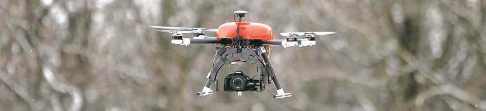
Currently, the camera-equipped drones — some quadcopters, some six-rotor machines — are used to help Manitoba RCMP officers reconstruct car crashes and survey crime scenes. They take photos from the air, and a real-time feed shows officers stationed on the ground what the drone sees.
The drones are only used by the traffic-collision reconstruction and forensic-identification units. They aren’t being used for surveillance, said Charbonneau, dismissing Orwellian fears by saying the RCMP’s surveillance rules are the same regardless of the equipment officers use.
‘We’re also looking at other sections within the RCMP in Manitoba that could possibly utilize this type of technology. The only limit is your imagination’
“Our policy is, and it’s written right into policy: you will not use the UAV for surveillance unless you have judicial authorization.”
When officers investigate car crashes, it can be hard for them to discern each tire track and scratches on the pavement, Charbonneau said.
“But when you look at the aerial image, you can put it all together in your head very quickly which tire marks belong to which vehicles and whether or not you’ve got all the vehicles that were involved in the crash, so it’s kind of handy in that regard,” he said.
They can’t be used at night, in high winds or in inclement weather, but the drones have gathered much more for police than officers on the ground could have, sometimes pointing them to new evidence they hadn’t noticed, Charbonneau said.

“I have more data and more evidence now than I ever did have before, and it’s not taking any longer to process that information,” Charbonneau said.
“It gives everyone a better picture of what happened and a better picture of the evidence. If we can collect evidence that is beneficial to Crown or defence, as far as I’m concerned, that’s a good thing. The less time we tie up our people as well as the prosecutors and court system in general, the better.”
But he doubts drones will ever replace traffic-collision reconstructionists on the ground.
“When vehicles stop crashing, then we won’t have to worry about it,” Charbonneau said.
katie.may@freepress.mb.ca
Katie May is a multimedia producer for the Free Press.
Our newsroom depends on a growing audience of readers to power our journalism. If you are not a paid reader, please consider becoming a subscriber.
Our newsroom depends on its audience of readers to power our journalism. Thank you for your support.
Advertisement Advertise With Us
Advertisement Advertise With Us