

Report recommends $1.1B to flood-proof part of Assiniboine River
Advertisement
Read this article for free:
or
Already have an account? Log in here »
To continue reading, please subscribe:

Digital Subscription
One year of digital access for only $205*
- Enjoy unlimited reading on winnipegfreepress.com
- Read the E-Edition, our digital replica newspaper
- Access News Break, our award-winning app
- Play interactive puzzles
*First annual payment billed as $205.00 + GST for one year. This annual subscription will automatically renew at $233.00 + GST every 52 weeks (10% off the regular annual price of $259.35). Offer available to new and qualified returning subscribers only. Cancel any time.
To continue reading, please subscribe:
Add Free Press access to your Brandon Sun subscription for only an additional
$1 for the first 4 weeks*
- Enjoy unlimited reading on winnipegfreepress.com
- Read the E-Edition, our digital replica newspaper
- Access News Break, our award-winning app
- Play interactive puzzles
*Your next Brandon Sun subscription payment will increase by $1.00 and you will be charged $17.95 plus GST for four weeks. After four weeks, your payment will increase to $24.95 plus GST every four weeks.
Read unlimited articles for free today:
or
Already have an account? Log in here »
Hey there, time traveller!
This article was published 20/01/2016 (3884 days ago), so information in it may no longer be current.
The Manitoba government is facing a stark choice for floodproofing the Assiniboine River — pay $1.16 billion now in prevention upgrades or billions more to clean up after a disaster.
A 1,600-page study, requested by the Manitoba government in the fall of 2012, examined flood protection issues in communities throughout the Assiniboine River basin as well as for several lakes, such as Lake Manitoba and Lake St. Martin.
The report, prepared by KGS Group Consulting Engineers, was posted on the province’s website late Tuesday, hours before a 90-day blackout on government announcements took effect because of the April 19 election.
The Assiniboine River and Lake Manitoba Basins Study final report is a massive document — 1,588 pages, including tables, appendices and background documents.
KGS was asked to recommend strategies to withstand a once-in-200-year flood in critical areas throughout the vast 246,000 square kilometre study region. The study identified 100 ‘vulnerabilities’ in the current flood protection system.
At the top of the list is a problem that’s been evident since the 2011 Assiniboine River flood — the vulnerability of the lower Assiniboine River east of Portage la Prairie to flooding. In 2011 and again in 2014, the province relied on relief from the Canadian Armed Forces to shore up leaky dikes along that stretch of the river.
During both floods, the Portage Diversion, which diverts water from the Assiniboine to Lake Manitoba, also required shoring up to withstand flows far beyond its 25,000 cubic feet per second (cfs) capacity.
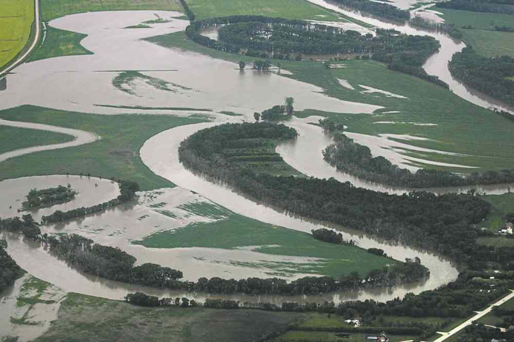
“The level of protection for the lower Assiniboine River area, including the Portage Diversion, is deficient …,” the report stated.
The existing diking system along the river between Portage and Headingley can reliably handle flows of just 15,000 cfs, according to KGS. With emergency patch-ups, it handled 18,000 cfs for two months in 2011 and for two weeks in July 2014.The report recommends that flow capacity be increased to 23,100 cfs, at a total cost of $336 million.
It further recommends that the Portage Diversion be retrofitted so that it can safely handle 34,000 cfs, an increase of 36 per cent from its current official capacity. The preliminary cost of the upgrade, which would increase dike heights, improve the existing control structure and other modifications, is estimated at $373 million.
Meanwhile, pumping more water into Lake Manitoba during big floods requires further major flood mitigation work downstream.
A new outlet channel for Lake Manitoba at a cost of $230 million is urged. As well, the report recommends that the emergency channel constructed a few years ago at Lake St. Martin be made permanent and enhanced at a cost of $220 million.
The report says that the shorelines of Lake St. Martin and Lake Pineimuta (situated between St. Martin Station and Fairford Reserve) are vulnerable to flooding and require urgent attention.
It said “there have already been significant strides” in upgrading flood protection in other parts of the Assiniboine River and Lake Manitoba basins,.
“A number of related flood mitigation studies and projects are ongoing or have been recently completed … Many areas are, therefore, already protected to the highest flood on record.”
In a news release issued Tuesday before the blackout, Premier Greg Selinger promised First Nations and other affected communities would “have a say” in how the province moves forward with flood protection. The government said full implementation of the report’s recommendations would be done “over a period of time.”
The Progressive Conservatives criticized the government Wednesday for dithering on needed upgrades along the Assiniboine River.
Brandon West MLA Reg Helwer, the PC infrastructure and transportation critic, said his party has been calling for upgrades for years. The work could have been done long ago — at a lower cost, he said.
“This is a file that the NDP have ignored for 16 years,” said Helwer, noting that the Tories have committed to spending at least $1 billion a year on infrastructure, if elected in April.
A spokesman for the Manitoba Liberals said the party recognizes that significant infrastructure investments will be needed in the coming years. “That is a big part of why we have not committed to rolling back the PST (increase) until we are able to bring the province into surplus,” he said in an email.
larry.kusch@frerepress.mb.ca
History
Updated on Wednesday, January 20, 2016 6:54 PM CST: writethrough