

U of M unveils its visionary plan for campus

Advertisement
Read this article for free:
or
Already have an account? Log in here »
To continue reading, please subscribe:

Digital Subscription
One year of digital access for only $205*
- Enjoy unlimited reading on winnipegfreepress.com
- Read the E-Edition, our digital replica newspaper
- Access News Break, our award-winning app
- Play interactive puzzles
*First annual payment billed as $205.00 + GST for one year. This annual subscription will automatically renew at $233.00 + GST every 52 weeks (10% off the regular annual price of $259.35). Offer available to new and qualified returning subscribers only. Cancel any time.
To continue reading, please subscribe:
Add Free Press access to your Brandon Sun subscription for only an additional
$1 for the first 4 weeks*
- Enjoy unlimited reading on winnipegfreepress.com
- Read the E-Edition, our digital replica newspaper
- Access News Break, our award-winning app
- Play interactive puzzles
*Your next Brandon Sun subscription payment will increase by $1.00 and you will be charged $17.95 plus GST for four weeks. After four weeks, your payment will increase to $24.95 plus GST every four weeks.
Read unlimited articles for free today:
or
Already have an account? Log in here »
Hey there, time traveller!
This article was published 29/09/2016 (3580 days ago), so information in it may no longer be current.
Remember today’s date — in 2046, we’ll all meet at the University of Manitoba Fort Garry campus to see how the university’s Visionary (re)Generation Master Plan for the next 30 years has worked out.
Now, two years into the planning and consulting process, the master plan was on display Thursday and today on the second floor of University Centre.
There are possible spaces for new housing, for trails and pedestrian and bicycle access, for tradition High Streets featuring stores, restaurants and residences, and for riverbanks to be fully accessible and connected. An indigenous focus will be paramount throughout.
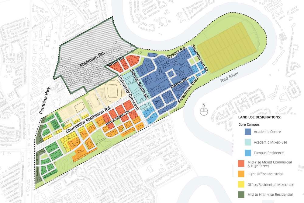
It’s all part of a plan over the next 30 years to make the U of M as much of a destination as The Forks or Osborne Village, communications manager John Danakas said Thursday.
Take a glance at what’s on display and you might conclude the U of M wants to compete with downtown Toronto and Vancouver to have the highest density. Not so.
The vision is what the U of M has decided could — not will — go on each parcel of the existing campus’s land, director of campus planning Rejanne Dupuis insisted Thursday.
“It’s a mixed use, complete community,” said Dupuis. “We’re showing site opportunities, as opposed to all those buildings happening.”
A similar plan is still to be developed for the adjoining green space that used to be the site of the Southwood golf course.
The only new building you can count on seeing in 2046 will be the National Centre for Truth and Reconciliation, which would stand alone at the eastern end of Markham Street at the riverbank, amid green space and visible from afar.
“An incredibly important location… it will have a very open space at the river’s edge, surrounded by natural space,” said Dupuis.
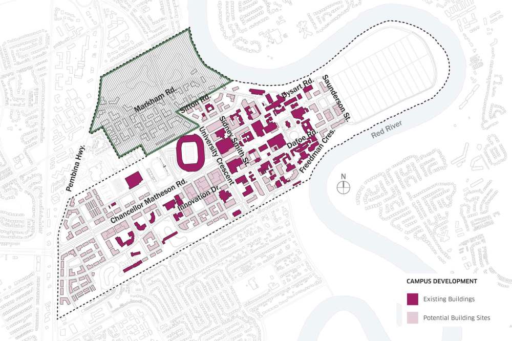
“We can’t predict what buildings will expand or grow,” but as faculties and departments develop plans, they’ll know what sites are available and what each spot can accommodate, she said.
Currently, an unmaintained riverbank trail follows the Red River for about 2.6 kilometres around the agricultural research land at the easternmost part of campus. The plan calls for the trail to be upgraded and become part of a campus-long trail. The university has pencilled in three potential spots for a footbridge connecting St. Vital at three spots.
Dupuis stressed that any decision on a bridge would be up to the city, where it has been bandied about at city hall for decades.
Rapid transit will enter through its own formal entranceway on Pembina Highway, she said.
A street south of and parallel to Markham will be one of the high streets, while Sidney Smith Street would be the second and indigenous in nature: “(There would be) businesses, lots of windows, you’re engaging with people, residences up above,” enthused Dupuis.
Cars travel and new student residences will be pushed to the periphery of the academic area, which will have even more streets closed to vehicle traffic.

The plan acknowledges the reality of a Manitoba’s cold and seeks ways to embrace that winter. Building entrances will be aligned to make it as easy as possible to get from one to the other, but don’t expect tunnels or elaborate walkways.
“We always will have service tunnels,” said Dupuis, “but the focus is to bring people above ground.”
nick.martin@freepress.mb.ca
Nick Martin
Former Free Press reporter Nick Martin, who wrote the monthly suspense column in the books section and was prolific in his standalone reviews of mystery/thriller novels, died Oct. 15 at age 77 while on holiday in Edinburgh, Scotland.
Our newsroom depends on a growing audience of readers to power our journalism. If you are not a paid reader, please consider becoming a subscriber.
Our newsroom depends on its audience of readers to power our journalism. Thank you for your support.
Advertisement Advertise With Us
Advertisement Advertise With Us