

Southern Manitoba and Winnipeg walloped by storm
Environment Canada issues winter storm warning for Winnipeg
Advertisement
Read this article for free:
or
Already have an account? Log in here »
To continue reading, please subscribe:
Monthly Digital Subscription
$0 for the first 4 weeks*
- Enjoy unlimited reading on winnipegfreepress.com
- Read the E-Edition, our digital replica newspaper
- Access News Break, our award-winning app
- Play interactive puzzles
*No charge for 4 weeks then price increases to the regular rate of $19.95 plus GST every four weeks. Offer available to new and qualified returning subscribers only. Cancel any time.
Monthly Digital Subscription
$4.99/week*
- Enjoy unlimited reading on winnipegfreepress.com
- Read the E-Edition, our digital replica newspaper
- Access News Break, our award-winning app
- Play interactive puzzles
*Billed as $19.95 plus GST every four weeks. Cancel any time.
To continue reading, please subscribe:
Add Free Press access to your Brandon Sun subscription for only an additional
$1 for the first 4 weeks*
*Your next subscription payment will increase by $1.00 and you will be charged $16.99 plus GST for four weeks. After four weeks, your payment will increase to $23.99 plus GST every four weeks.
Read unlimited articles for free today:
or
Already have an account? Log in here »
Hey there, time traveller!
This article was published 25/12/2016 (3301 days ago), so information in it may no longer be current.
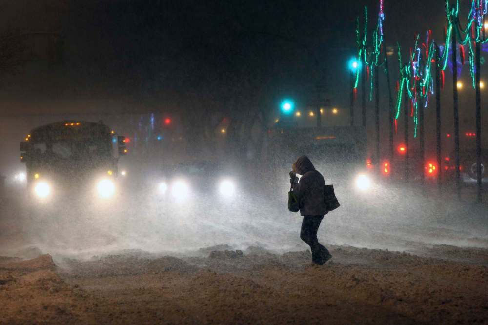
Manitobans in southern Manitoba and Winnipeg will wake to a thick blanket of snow on Boxing Day.
Environment Canada is forecasting between 20 to 30 centimetres of snow will blanket the city by Monday afternoon as a Colorado low from northeastward continues to develop and intensify,
Some areas of Manitoba near the U.S. border will potentially see 40 to 50 centimetres.
An update at 9:30 p.m. Saturday by Environment Canada said radar imagery shows the main area of snow stretches from southeastern Saskatchewan including Estevan and Moosomin, through most of Manitoba south of a line from Dauphin to Berens River, as well as North Dakota.
Strong, northerly winds gusting to 60 to 70 km/h will develop tonight and continue into Monday afternoon, creating near zero visibility and blowing snow over open areas Sunday night and Monday.
Blizzard conditions are likely over the Red River valley and southwestern Manitoba where the winds should be the strongest. Conditions should gradually improve from west to east starting Monday afternoon.
Environment Canada is telling Manitobans to consider postponing non-essential travel until conditions improve. Surfaces such as highways, roads, walkways and parking lots may become difficult to navigate due to accumulating snow.
Public Safety Canada encourages everyone to make an emergency plan and get an emergency kit with drinking water, food, medicine, a first-aid kit and a flashlight.

Related Articles
Boxing Day blizzard brings southern Manitoba to near standstill
Advertisement Advertise With Us
History
Updated on Sunday, December 25, 2016 10:34 AM CST: Adds flight info, quotes
Updated on Sunday, December 25, 2016 10:44 AM CST: fixes typo
Updated on Sunday, December 25, 2016 1:01 PM CST: Updates with more WAA info
Updated on Sunday, December 25, 2016 1:28 PM CST: Fixes typo
Updated on Sunday, December 25, 2016 5:02 PM CST: Fixes typo, updates
Updated on Sunday, December 25, 2016 10:56 PM CST: Updates