

Balmy January sets above-zero record of 67 straight hours
Advertisement
Read this article for free:
or
Already have an account? Log in here »
To continue reading, please subscribe:

Digital Subscription
One year of digital access for only $205*
- Enjoy unlimited reading on winnipegfreepress.com
- Read the E-Edition, our digital replica newspaper
- Access News Break, our award-winning app
- Play interactive puzzles
*First annual payment billed as $205.00 + GST for one year. This annual subscription will automatically renew at $233.00 + GST every 52 weeks (10% off the regular annual price of $259.35). Offer available to new and qualified returning subscribers only. Cancel any time.
To continue reading, please subscribe:
Add Free Press access to your Brandon Sun subscription for only an additional
$1 for the first 4 weeks*
- Enjoy unlimited reading on winnipegfreepress.com
- Read the E-Edition, our digital replica newspaper
- Access News Break, our award-winning app
- Play interactive puzzles
*Your next Brandon Sun subscription payment will increase by $1.00 and you will be charged $17.95 plus GST for four weeks. After four weeks, your payment will increase to $24.95 plus GST every four weeks.
Read unlimited articles for free today:
or
Already have an account? Log in here »
Hey there, time traveller!
This article was published 24/01/2017 (3474 days ago), so information in it may no longer be current.
Miami, Kauai, Los Angeles, Cabo San Lucas — we don’t need you.
Winnipeg has its own balmy weather and record-setting temperatures in January.
Last weekend, the city basked in just under 67 straight hours of above-zero temperatures.
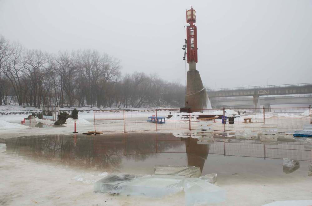
That’s the longest stretch on record in January, dating back to 1872 when records began, for the temperature to remain higher than 0 C.
That stretch ended on Sunday night at about 11 p.m.
“It was just shy of 67 hours. We do the observations on the hours and it had slipped below zero just before the 67th hour,” said Dan Fulton, a meteorologist with Environment Canada’s Winnipeg office. The regional normal temperatures for this time of year are an average low of -23 and high of -13.
The high for Tuesday will be -1 with a low of -6 and a 60 per cent chance of flurries.
Toss in the warmest November on record that Winnipeg just had in 2016 with an average temperature of a toasty 3.2. Mix in the second-snowiest December on record with a total snowfall of 68.8 centimetres.
“The snowy weather and the warmth, it is definitely unusual,” Fulton said, referring to the end of 2016 and the start of 2017.
Blend it all with a bit of freezing rain and some wet snow on Tuesday morning and you’ve got a slushy, slippery mess with shrinking mountains of snow but no outdoor skating.
So, go sit outside and bask in the relative January heat.

We’re getting a break from the cold and it came to us — no plane ticket required — so let’s soak it up.
It’s going to get sunny later this week, which will bring some colder temperatures that are closer to the seasonal normals. Highs later in the week are expected to be -5C to -8C with lows in the -8 to -11 range.
Environment Canada said there’s no impending weather systems and the sun will come out later in the week.
“We’ve got light snow for the next day or two because this system is just stuck over us,” said Fulton. “It’s just a bunch of cloud and there’s no real flow to push it on so it’s just staying here. This (snow) will continue on for the next couple of days and it will gradual peter out as we get clearing skies from the west as a ridge of high pressure builds in. The remainder of the week looks pretty good.”
ashley.prest@freepress.mb.ca
Related Articles
City scrambles to fill potholes revealed by unusual thaw
Advertisement Advertise With Us
Advertisement Advertise With Us
History
Updated on Tuesday, January 24, 2017 9:45 AM CST: Updates