

Think it’s spring? Guess again, as ‘major winter storm’ approaches

Advertisement
Read this article for free:
or
Already have an account? Log in here »
To continue reading, please subscribe:
Monthly Digital Subscription
$0 for the first 4 weeks*
- Enjoy unlimited reading on winnipegfreepress.com
- Read the E-Edition, our digital replica newspaper
- Access News Break, our award-winning app
- Play interactive puzzles
*No charge for 4 weeks then price increases to the regular rate of $19.95 plus GST every four weeks. Offer available to new and qualified returning subscribers only. Cancel any time.
Monthly Digital Subscription
$4.99/week*
- Enjoy unlimited reading on winnipegfreepress.com
- Read the E-Edition, our digital replica newspaper
- Access News Break, our award-winning app
- Play interactive puzzles
*Billed as $19.95 plus GST every four weeks. Cancel any time.
To continue reading, please subscribe:
Add Free Press access to your Brandon Sun subscription for only an additional
$1 for the first 4 weeks*
*Your next subscription payment will increase by $1.00 and you will be charged $16.99 plus GST for four weeks. After four weeks, your payment will increase to $23.99 plus GST every four weeks.
Read unlimited articles for free today:
or
Already have an account? Log in here »
Hey there, time traveller!
This article was published 05/03/2017 (3225 days ago), so information in it may no longer be current.
It appears that weather in March could be going out like lion, eh?
And we’re not talking about the Winnipeg Jets rookie sniper Patrik Laine, either.
Environment Canada is forecasting “a major winter storm” to hit parts of Saskatchewan and Manitoba on Monday and Tuesday.
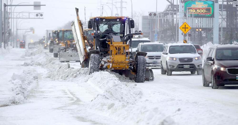
In Winnipeg, the snowfall is expected to be between five to 10 centimetres, said Rob Paola, a severe weather meteorologist for Environment Canada. But the main concern will be the potential perfect storm for poor travel conditions.
The forecast high in Winnipeg for Monday is 5 C with rain. Paola said the forecast temperature on Monday at 6 p.m. is 2 C, falling to -6 C at 10 p.m., with a possible 5-10 cm of snowfall and strong winds.
“We’ll actually have rain ahead of the storm on Monday,” said Paola, who also posts weather forecasts on his own Rob’s Obs website. “So any standing water from the rain and snow melt on Monday night will be freezing up. That’s bad news when you go from above freezing to below freezing. Not a good combo for travel.
“Plus, you’ll be having strong winds and falling and blowing snow. It could be pretty nasty.”
Roads and conditions just outside of Winnipeg could be the most treacherous in the early morning hours of Tuesday, he added.
The Environment Canada website said the storm system that is now developing over the western United States is forecast to track across the Dakotas Monday and intensify as it moves into northwest Ontario Monday night into Tuesday.
“This system is forecast to bring a widespread area of heavy snow from southeast Saskatchewan across western Manitoba and Interlake regions into central and northern Manitoba,” the forecast said. “Further east, precipitation will likely begin as rain or freezing rain over the Red River valley and east of Lake Winnipeg Monday morning before changing over to snow later in the day.
“Snowfall totals from this system will range from five centimetres in southeast Manitoba to 30 centimetres or more in a large swath from the Manitoba-Saskatchewan border through Norway House to Gillam and east.
“In addition, winds will be increasing Monday into Monday night with areas of blowing snow and poor visibility in open areas. Travel will become hazardous. Blizzard conditions are possible over the Manitoba lakes and much of northeast Manitoba Monday night into Tuesday.”

Paola said snowfalls in western and northern Manitoba — the cold side of the storm — could be higher. “They could easily be looking at 25 centimetres or more,” he said, referring to communities such as Dauphin, The Pas, Swan River, Thompson and Norway House.
The Environment Canada forecast noted there is “still some uncertainty on the exact track and intensity of this system, which will have an impact on precipitation type and overall snowfall amounts. But this will be a high impact storm for many areas, and the public should monitor forecasts and future watches and warnings as this system develops.”
Meanwhile, the forecast for temperatures in Winnipeg is expected to fall below normal levels later in the week, including lows of -21 C and -16 on Thursday and Friday night, respectively.
randy.turner@freepress.mb.ca
Twitter: @randyturner15
Randy Turner
Reporter
Randy Turner spent much of his journalistic career on the road. A lot of roads. Dirt roads, snow-packed roads, U.S. interstates and foreign highways. In other words, he got a lot of kilometres on the odometer, if you know what we mean.
Our newsroom depends on a growing audience of readers to power our journalism. If you are not a paid reader, please consider becoming a subscriber.
Our newsroom depends on its audience of readers to power our journalism. Thank you for your support.
Advertisement Advertise With Us
Advertisement Advertise With Us
History
Updated on Sunday, March 5, 2017 4:46 PM CST: corrects/clarifies forecast