

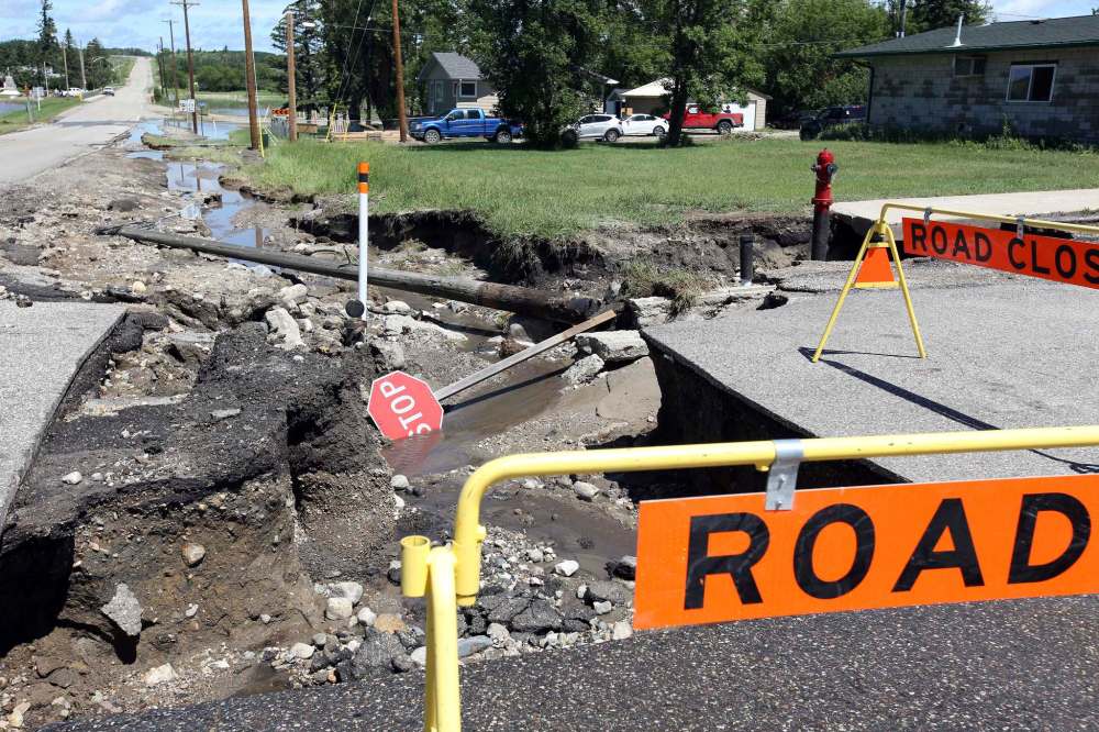
Surveying the infrastructure damage in Westman
Advertisement
Read this article for free:
or
Already have an account? Log in here »
To continue reading, please subscribe:
Monthly Digital Subscription
$1 per week for 24 weeks*
- Enjoy unlimited reading on winnipegfreepress.com
- Read the E-Edition, our digital replica newspaper
- Access News Break, our award-winning app
- Play interactive puzzles
*Billed as $4.00 plus GST every four weeks. After 24 weeks, price increases to the regular rate of $19.95 plus GST every four weeks. Offer available to new and qualified returning subscribers only. Cancel any time.
Monthly Digital Subscription
$4.99/week*
- Enjoy unlimited reading on winnipegfreepress.com
- Read the E-Edition, our digital replica newspaper
- Access News Break, our award-winning app
- Play interactive puzzles
*Billed as $19.95 plus GST every four weeks. Cancel any time.
To continue reading, please subscribe:
Add Free Press access to your Brandon Sun subscription for only an additional
$1 for the first 4 weeks*
*Your next subscription payment will increase by $1.00 and you will be charged $16.99 plus GST for four weeks. After four weeks, your payment will increase to $23.99 plus GST every four weeks.
Read unlimited articles for free today:
or
Already have an account? Log in here »
Hey there, time traveller!
This article was published 04/07/2020 (2109 days ago), so information in it may no longer be current.
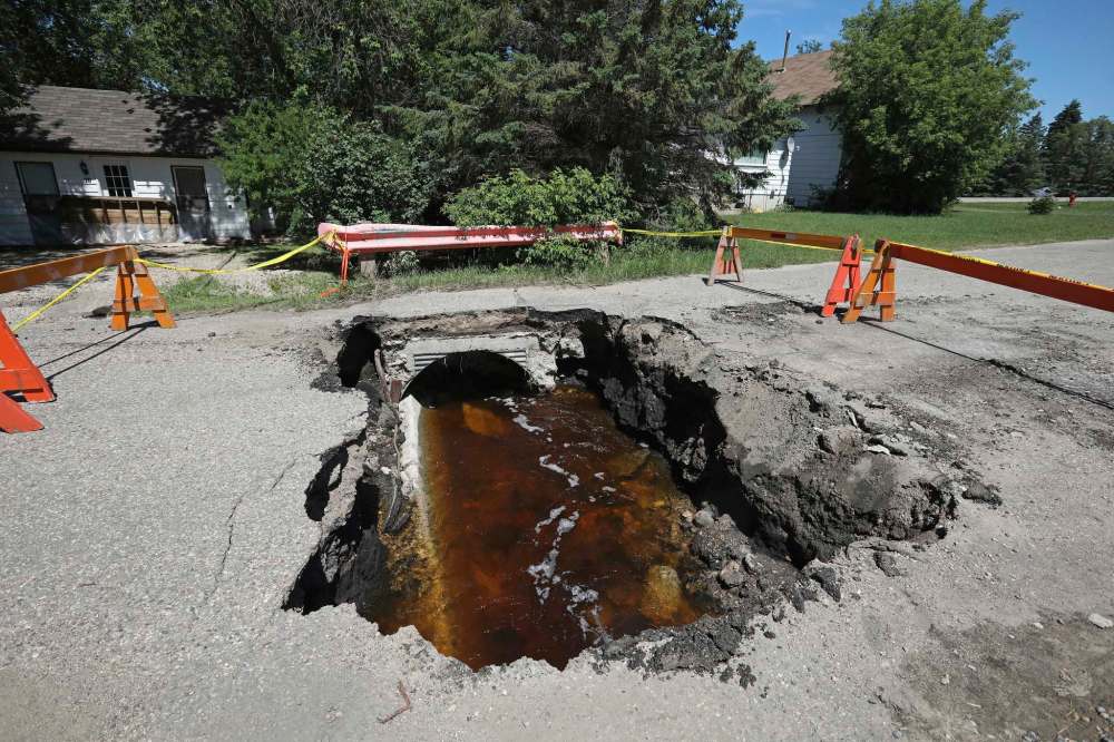
In the aftermath of the storm described by Infrastructure Minister Ron Schuler as being a once-in-a-1,000-year event, many crucial pieces of infrastructure remain damaged, flooded or closed.
A spokesperson from Schuler’s office told the Sun Friday morning that it is too early to provide a cost estimate of rainfall and flood damage to the region’s infrastructure.
The worst-case scenario of the Rivers dam bursting has not come to pass, but the province sent out a release Friday afternoon warning that parts of southwest, southern and southeast Manitoba could see up to 100 millimetres of heavy localized rain in the next five to seven days. That could lead to more overland flooding.
The Sun attempted to reach as many affected municipalities as possible Friday to discuss the current situation, but officials in some communities could not be reached because they were taking stock of the damage or holding emergency meetings.
Brandon
The peak water level for the Assiniboine River has passed, the city announced Friday. Furthermore, projections indicate that even if the Rivers dam were to burst, the city’s earthen dike system will be able to withstand the extra load.
Water levels in Brandon were highest on July 2, when the water reached 1,174.56 feet above sea level at First Street. By Friday at 3 p.m, the water level had dropped to 1,174.07 feet. The city’s earthen dike system is at a height of 1,186 feet above sea level. If the Rivers dam fails, the increased water level would be around 1,183 feet above sea level.
City spokesperson Allison Collins said much of the storm damage to Brandon has been repaired.
The only road remaining closed is a stretch of First Street, from Patricia Avenue to Maryland Avenue, to allow for the continued pumping of water from the Island Park retention pond.
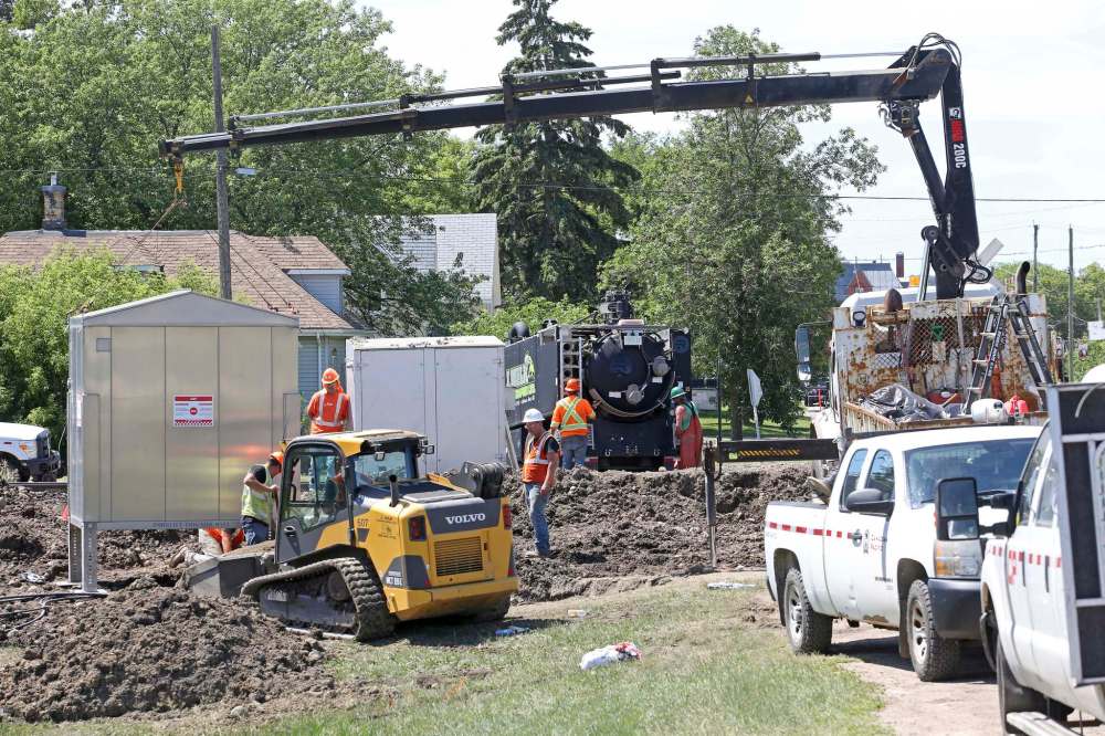
Five water-main breakages have happened since last Sunday’s storm. Only one breakage, which happened Friday morning, remains unrepaired. Two culverts on Braecrest Drive were impacted by the storm but have since been repaired and inspected.
The road to Brandon Municipal Airport was closed for several days after the entrance off Highway 10 was flooded, but it was reopened on Thursday. Collins said there is still some damage to the road, but it is up to the province to make repairs.
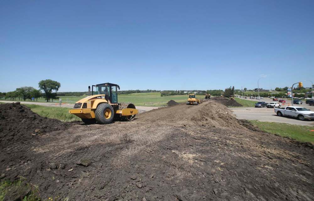
It is likely that the clay dike plug, a line of earth built up at the intersection of Grand Valley Road and 18th Street North to prevent overland flooding, will stay in place as long as the Rivers dam has a possibility of bursting and sending extra water down the Assiniboine River.
Because of the dike plug and remaining floodwater on the road, Grand Valley Road remains closed. Provincial Road 270 from the Trans-Canada Highway to Highway 25 northwest of Brandon is closed except for local traffic.
Queen Elizabeth and Dinsdale parks remained closed to the public for safety. Residents continue to be encouraged to stay off the city’s dike system.
Heading north from Brandon, Highway 10 is open again, but there is a reduced speed limit in effect around Forrest due to road damage.
Minnedosa and RM of Minto-Odanah
Repairs to roads in the RM will take the rest of the summer to complete, the municipality’s chief administrative officer Aaren Robertson told the Sun Friday morning.
“I couldn’t even give you a number of roads our guys are still working on and we still have the odd one washing out,” he said.
He said the main priority for municipal crews is to repair washed-out Provincial Road 466 because it being damaged has cut off the municipality from its waste facility.
Robertson said the municipality has declared a state of emergency and will be formally requesting assistance from the province during its next regular council meeting on July 9.
Minnedosa’s CAO Cindy Marzoff also said the town will be passing a resolution at their next council meeting July 7 asking the province to declare Minnedosa a disaster area and requesting financial assistance.
She said crews continued to work on repairing roads on Friday, with Main Street and the businesses along it having gotten a lot of water damage this week. The dam at Minnedosa Lake is in good shape and continues to be monitored by Manitoba Infrastructure.
Highway 16 is open with some water still on the road, but Highway 16A going through the centre of Minnedosa is flooded and closed.
Provincial Road 355 from Highway 16 to the junction with Provincial Road 270 is flooded and closed. Past the junction with 270 heading west to the junction with Provincial Road 250, the road is soft and muddy and open only to local traffic.
East of Minnedosa, Provincial Road 262 is closed from 3.7 kilometres north of the junction with Highway 16A to 3.5 km south of Clanwilliam. Provincial Road 471 is completely closed except for local traffic.
Neepawa
Chief administrative officer Colleen Synchyshyn said she “can’t believe” how strong the volunteer efforts have been in Neepawa as the town recovers from overland and rainfall-based flooding.
Other than around Park Lake where the dam burst on Wednesday, Synchyshyn said Hamilton Street bridge is the only road closure in town. All of the town’s major utilities and infrastructure enter through the bridge, so they’re waiting for it to be inspected before reopening it. That will likely happen next week.
She said if the bridge is taken out it might result in massive problems for the province’s electrical supply and impact operations at the nearby HyLife Foods processing plant.
Clay berms are being installed in the northeast and southeast corners of Neepawa to prevent further flooding. Three people remained evacuated from their homes
Carberry and the RM of North Cypress-Langford
North Cypress-Langford Reeve Bob Adriaansen said there are still a large number of bridges and roads washed out after the flooding.
“We’ve had at least 20 roads closed for a while,” he said.
Trish Fraser, the municipality’s CAO, said the majority of road washouts are located north of Ingelow and west of Highway 5.
“Basically everything north of (Highway 1), it’s bad,” she said. “I think there are two bridges for sure that are washed out. There were some residents that were landlocked, but now they do have access to get out. It was a little scary for a bit because we’ve never had it before.”
A state of local emergency has been in place since Tuesday in the RM and a resolution has been passed asking for provincial assistance.
Carberry Mayor Stuart Olmstead said the town has been lucky and doesn’t have any lingering problems. However, he did express concern over the effect on local crops.
RM of Oakview
“We’re trying to get things back together,” Reeve Brent Fortune said. “We’re just hoping we don’t get another downpour. It’s going to be a slow process.”
Fortune said more than 100 roads have water on them, with 25 per cent of them having serious damage. Also, two bridges have had water flowing around them instead of under them.
Municipal crews are prioritizing the repair of roads that lead to municipal wells as well as making sure that residents have an exit route from their property.
Rivers and the RM of Riverdale
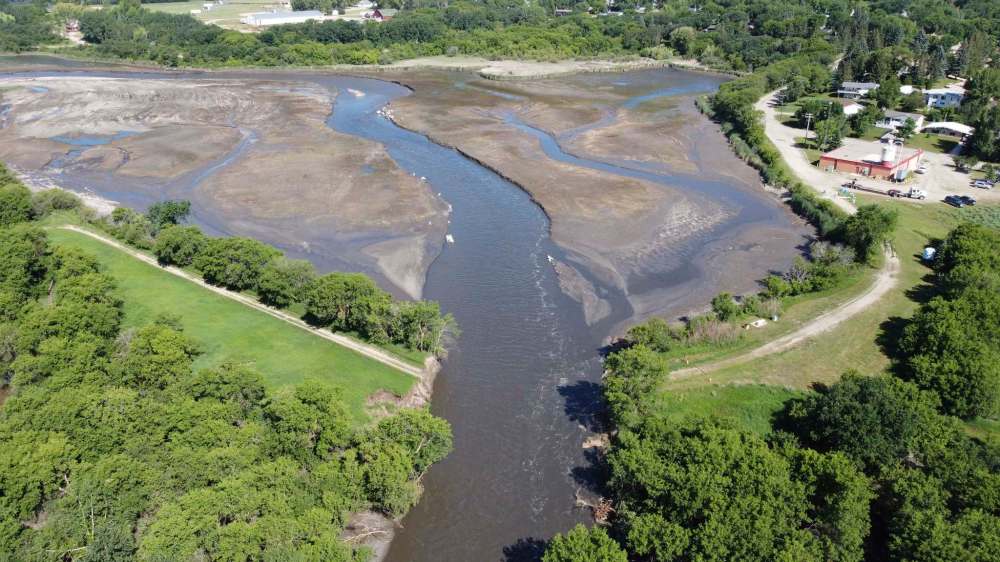
Though the government has publicly declared it doesn’t have confidence in the Rivers dam on Lake Wahtopanah, the 60-year-old structure is still holding.
Late Friday afternoon, the RM put out a statement via Facebook saying the evacuation orders in place for some residents will remain active for the next four to five days. The bridge on Highway 25 under the dam is closed except for emergency, home and health services.
The province said on Thursday that an engineer is watching the dam at all times and rocks are being placed on either side of the spillway to bolster the structure and prevent water exiting the lake via the spillway from reversing and flowing backwards.
At approximately noon on Wednesday, approximately 12,000 cubic feet per second was flowing through the dam.
However, by Friday, the flow had dropped to 8,500 cubic feet per second. The water level in Lake Wahtopanah decreased 1.5 feet from Thursday to Friday, but it is still at historically high levels.
In 1990, Brandon University’s Rural Development Institute published a user needs survey for Rivers Provincial Recreation Park — now Rivers Provincial Park — saying the dam’s spillway was designed for a discharge of 10,000 cubic feet of water per second with a 50 per cent greater flood capacity, which would be 15,000 cubic feet per second.
Eighty people remain evacuated from the municipality.
RM of Cornwallis
Reeve Bill Courtice said the area is in decent shape as long as the Rivers dam doesn’t burst. One or two families whose houses flooded have been moved to a hotel for the time being.
If the dam does burst, Courtice said the municipality will have approximately two hours to notify residents and get everyone to safety.
RM of Elton
Reeve Ross Farley said more than 180 roads in the RM have been washed out or flooded. A state of local emergency has been declared and the municipality is looking into requesting provincial assistance.

“The process has started to fix some,” he said. “I’m thinking that about 80 per cent of our road infrastructure has been compromised … some serious washouts, some not as bad.”
Elton Road, one of the RM’s most important traffic arteries, has two sizable washouts on it including a compromised culvert. Farley said it will be next week before a new culvert can be acquired and installed.
On Facebook, the municipality is posting an updated map of what roads are open every day.
» cslark@brandonsun.com
» Twitter: @ColinSlark
History
Updated on Saturday, July 4, 2020 3:45 PM CDT: A previous version of this story incorrectly listed what the water level of the Assiniboine River would be in Brandon if the Rivers dam were to burst.
Updated on Monday, July 6, 2020 9:26 AM CDT: An earlier version of this story had an incorrect name for the chief administrative officer for North Cypress-Langford.