

Slow moving polar vortex behind extended cold snap
Advertisement
Read this article for free:
or
Already have an account? Log in here »
To continue reading, please subscribe:
Monthly Digital Subscription
$1 per week for 24 weeks*
- Enjoy unlimited reading on winnipegfreepress.com
- Read the E-Edition, our digital replica newspaper
- Access News Break, our award-winning app
- Play interactive puzzles
*Billed as $4.00 plus GST every four weeks. After 24 weeks, price increases to the regular rate of $19.95 plus GST every four weeks. Offer available to new and qualified returning subscribers only. Cancel any time.
Monthly Digital Subscription
$4.99/week*
- Enjoy unlimited reading on winnipegfreepress.com
- Read the E-Edition, our digital replica newspaper
- Access News Break, our award-winning app
- Play interactive puzzles
*Billed as $19.95 plus GST every four weeks. Cancel any time.
To continue reading, please subscribe:
Add Free Press access to your Brandon Sun subscription for only an additional
$1 for the first 4 weeks*
*Your next subscription payment will increase by $1.00 and you will be charged $16.99 plus GST for four weeks. After four weeks, your payment will increase to $23.99 plus GST every four weeks.
Read unlimited articles for free today:
or
Already have an account? Log in here »
Hey there, time traveller!
This article was published 13/02/2021 (1874 days ago), so information in it may no longer be current.
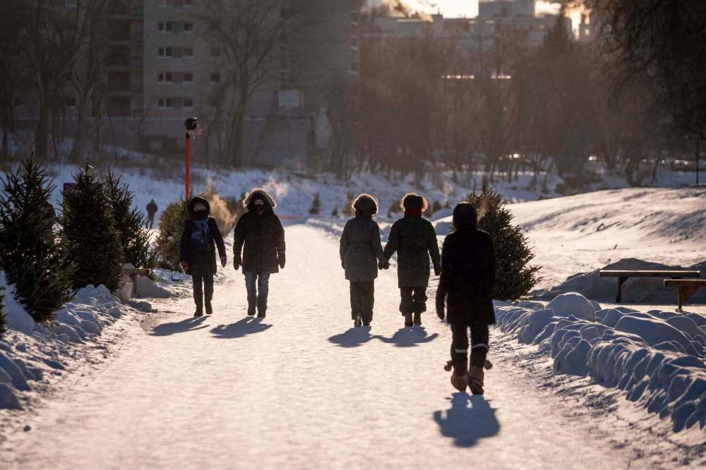
Climatologists equate the phenomenon causing Winnipeg’s biting weather this February to a large tarantula, slowly plodding over the Prairies and causing the longest cold snap in a quarter century.
The polar vortex might not exactly be a spider, but its “icy limbs” have certainly left all of Manitoba with extreme weather warnings for the last seven days, as of Saturday.
In Winnipeg, temperatures under -20 C have not been seen over a period of consecutive days since 1996, according to Environment and Climate Change Canada. Back then, it was 17 days from mid-January to early February. And before that, the record was set in 1968 at 11 days.

That’s why Winnipeggers hoping to get out of their homes this long weekend, as the province loosened business restrictions, were met with car engines sluggish to start and wind chill hovering around -40 to -50 C blowing over their facemasks.
“But the science behind this isn’t exactly something that’s new,” said David Barber, a Canada Research Chair in Arctic System Science, on Saturday. “We knew about this phenomenon around 40 years ago when I was just starting my research. Certainly, however, the polar vortex was more stable then.”
Barber, who is the director at the University of Mantoba’s Centre for Earth Observation Science, said the unusual climate activity that’s manifesting now with this cold weather was first detected around 10 to 15 years ago.
The polar vortex is a low-pressure area that exists over the north pole, he explained, with a mass of cold air circulating counter-clockwise that gives it the power to dictate weather across the Northern Hemisphere.
Temperature differences with air in the south and northernmost regions would previously force the polar vortex to stay in place and make its cycle generally predictable, said Barber.
Now, however, as the Arctic sea ice disappears and energy from the warming ocean is released, it’s forcing the vortex to spin in an unusual and unstable way.
“Though to be precise, these relatively unusual changes are a slow movement, and that’s why we’re experiencing a longer cold snap,” said Barber.
“It’s also why we’ve had a longer period of warm days in January, too.”
In January, Winnipeg was on the other side of what Barber calls the “lobes” of the vortex that reach down from the Arctic and bring freezing cold temperatures with them.
That meant warm air rushed over the city as it was headed north, creating average daily temperatures of a balmy -9.2 C, according to measurements from The Forks weather station.
“In fact, the average afternoon temperature in Winnipeg from Nov. 1 to Jan. 31 was the warmest on record, with records dating back to the 1870s,” said David Phillips, senior climatologist for Environment Canada.
Phillips said Saturday will likely go down in history as the coldest temperature on Feb. 13 in Winnipeg’s history. “This morning at Winnipeg International Airport, the temperature at 6 and 7 a.m. was -37.9 C,” he said.
The previous coldest temperarature recorded on Feb. 13 was at Winnipeg John’s College in 1879 and 1885 when the temperature was -37.8 C.

“If you take as truth (Saturday) and Sunday’s temperature forecast, this will make the following string of cold temperatures 13 days in a row with below -20 C, including six occasions in a row of -30 or lower,” said Phillips.
Barber believes the temperature could eventually even out this winter, depending on how the polar vortex moves.
“For now though,” he said, “our best guess is to expect this kind of variability in the future, from here on out.”
Twitter: @temurdur
Temur.Durrani@freepress.mb.ca