

Well, the city was already looking forward to a Winnipeg Whiteout, right?

Advertisement
Read this article for free:
or
Already have an account? Log in here »
To continue reading, please subscribe:
Monthly Digital Subscription
$0 for the first 4 weeks*
- Enjoy unlimited reading on winnipegfreepress.com
- Read the E-Edition, our digital replica newspaper
- Access News Break, our award-winning app
- Play interactive puzzles
*No charge for 4 weeks then price increases to the regular rate of $19.00 plus GST every four weeks. Offer available to new and qualified returning subscribers only. Cancel any time.
Monthly Digital Subscription
$4.75/week*
- Enjoy unlimited reading on winnipegfreepress.com
- Read the E-Edition, our digital replica newspaper
- Access News Break, our award-winning app
- Play interactive puzzles
*Billed as $19 plus GST every four weeks. Cancel any time.
To continue reading, please subscribe:
Add Free Press access to your Brandon Sun subscription for only an additional
$1 for the first 4 weeks*
*Your next subscription payment will increase by $1.00 and you will be charged $16.99 plus GST for four weeks. After four weeks, your payment will increase to $23.99 plus GST every four weeks.
Read unlimited articles for free today:
or
Already have an account? Log in here »
Hey there, time traveller!
This article was published 19/04/2023 (959 days ago), so information in it may no longer be current.
And, just when we thought it was safe to put away the snow shovels…
Winnipeg residents should expect to see snow begin to accumulate by midday Thursday as two weather systems converge over southern parts of the province, Environment and Climate Change Canada says.
Justin Shelley, a meteorologist at the federal agency, said a low-pressure system centred over North Dakota was producing widespread precipitation throughout southern Saskatchewan and portions of southern Manitoba Wednesday afternoon.
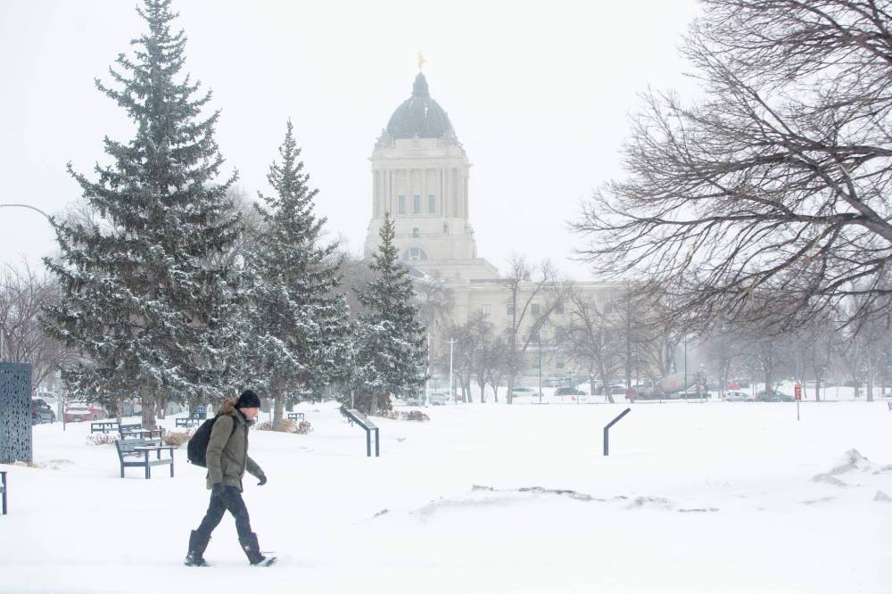
MIKE DEAL / FREE PRESS FILES
The current system will likely cause varied weather conditions in the Winnipeg area — likely a mix of rain and snow starting early Thursday, transitioning to heavy snow in Manitoba’s southeast later in the day.
The system created heavy wind gusts and high accumulations of snow, resulting in poor travel conditions in southern Saskatchewan, before it was expected to move further into Manitoba before weakening during the evening and overnight.
A second low-pressure system from the United States was expected to merge with the remnants of the first system, creating a risk of snowfall in southeastern Manitoba Thursday.
“We’re seeing the back end of the precipitation moving just north of the Winnipeg region… and we’re not really expecting too much in the southeast for the rest of the evening — maybe a few flurries,” Shelly said Wednesday afternoon.
“It’s going to move back into the region by tomorrow morning.”
He said the current system will likely cause varied weather conditions in the Winnipeg area — likely a mix of rain and snow starting early Thursday, transitioning to heavy snow in Manitoba’s southeast later in the day.
“While amounts will vary, we’re still looking somewhere in the 10 to 20 centimetre range by Friday,” said Shelley.
He said the system will hover over northwestern Manitoba Friday, continuing to weaken during the day.
“While the heaviest snow will fall Thursday to Thursday night, we’ll likely see some scattered flurries continue through the day on Friday, until eventually that system moves off east Friday evening,” Shelley said.
“A high pressure system (will) move in behind that, which will clear things out Friday night into Saturday.”
He said temperatures will be a complicating factor, hovering at about 0 C between late Wednesday and Friday evening.

“We won’t really get temperatures much above the freezing mark for the next couple of days,” the meteorologist said, adding overnight lows will likely drop below freezing Friday night.
He said temperatures aren’t expected to rise until early next week, with a forecast of 5 to 10 C in the Winnipeg area Monday.
A provincial spokesperson said the forecasters will get a better idea of how the system will affect the flood outlook once it passes over the province.
erik.pindera@freepress.mb.ca
Twitter: @erik_pindera
Erik Pindera is a reporter for the Free Press, mostly focusing on crime and justice. The born-and-bred Winnipegger attended Red River College Polytechnic, wrote for the community newspaper in Kenora, Ont. and reported on television and radio in Winnipeg before joining the Free Press in 2020. Read more about Erik.
Every piece of reporting Erik produces is reviewed by an editing team before it is posted online or published in print — part of the Free Press‘s tradition, since 1872, of producing reliable independent journalism. Read more about Free Press’s history and mandate, and learn how our newsroom operates.
Our newsroom depends on a growing audience of readers to power our journalism. If you are not a paid reader, please consider becoming a subscriber.
Our newsroom depends on its audience of readers to power our journalism. Thank you for your support.
Advertisement Advertise With Us
Advertisement Advertise With Us