

Avalanche closes stretch of Highway 99 north of Pemberton, B.C., risk remains high
Advertisement
Read this article for free:
or
Already have an account? Log in here »
To continue reading, please subscribe:
Monthly Digital Subscription
$1 per week for 24 weeks*
- Enjoy unlimited reading on winnipegfreepress.com
- Read the E-Edition, our digital replica newspaper
- Access News Break, our award-winning app
- Play interactive puzzles
*Billed as $4.00 plus GST every four weeks. After 24 weeks, price increases to the regular rate of $19.95 plus GST every four weeks. Offer available to new and qualified returning subscribers only. Cancel any time.
Monthly Digital Subscription
$4.99/week*
- Enjoy unlimited reading on winnipegfreepress.com
- Read the E-Edition, our digital replica newspaper
- Access News Break, our award-winning app
- Play interactive puzzles
*Billed as $19.95 plus GST every four weeks. Cancel any time.
To continue reading, please subscribe:
Add Free Press access to your Brandon Sun subscription for only an additional
$1 for the first 4 weeks*
*Your next subscription payment will increase by $1.00 and you will be charged $16.99 plus GST for four weeks. After four weeks, your payment will increase to $23.99 plus GST every four weeks.
Read unlimited articles for free today:
or
Already have an account? Log in here »
Hey there, time traveller!
This article was published 26/03/2025 (367 days ago), so information in it may no longer be current.
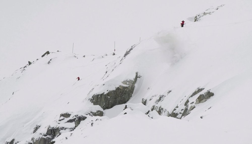
A stretch of highway north of Pemberton, B.C., is closed as crews work to clear avalanche debris from the route, while Avalanche Canada says the risk remains high in many popular backcountry areas throughout British Columbia.
A statement from the Transportation Ministry says a “partial avalanche” occurred along Highway 99, and given the high risk for additional slides, provincial crews performed a heli-bombing operation to trigger the release of the remaining snow.
With warmer temperatures and precipitation in the forecast, the province says there is a risk of further avalanche activity and the route will remain closed overnight.
It says the site will be reassessed Thursday morning to determine whether it is safe to reopen the route, which is also known as Duffey Lake Road.
Avalanche Canada mapping shows the danger is ranked at level four out of five in the mountains surrounding Pemberton and Whistler, as well as the Fraser Valley.

The danger is also set at “high” throughout southeastern B.C., near the Alberta boundary, while it’s ranked at level three in mountains on Metro Vancouver’s North Shore, the Sunshine Coast, Vancouver Island, and a large swath of the northwest.
This report by The Canadian Press was first published March 26, 2025.