
Step into our city’s past Hand-drawn 1884 map captures Winnipeg at moment when frontier hadn’t fully given way to a metropolis
Read this article for free:
or
Already have an account? Log in here »
To continue reading, please subscribe:
Digital Subscription
One year of digital access for only $1.44 a week*
- Enjoy unlimited reading on winnipegfreepress.com
- Read the E-Edition, our digital replica newspaper
- Access News Break, our award-winning app
- Play interactive puzzles
*Billed as $5.77 plus GST every four weeks. After 52 weeks, price increases to the regular rate of $19.95 plus GST every four weeks. Offer available to new and qualified returning subscribers only. Cancel any time.
To continue reading, please subscribe:
Add Free Press access to your Brandon Sun subscription for only an additional
$1 for the first 4 weeks*
- Enjoy unlimited reading on winnipegfreepress.com
- Read the E-Edition, our digital replica newspaper
- Access News Break, our award-winning app
- Play interactive puzzles
*Your next Brandon Sun subscription payment will increase by $1.00 and you will be charged $17.95 plus GST for four weeks. After four weeks, your payment will increase to $24.95 plus GST every four weeks.
Read unlimited articles for free today:
or
Already have an account? Log in here »
It’s a beautiful map drawn in 1884 by a man who moved from tropical St. Lucia to a self-built log cabin in Point Douglas, a decade before anyone ever called the city Winnipeg.
William Gomez da Fonseca’s name lives on today in the name of Gomez Street.
At first glance, the map is still. Ink on paper, streets drawn neatly in place, buildings rendered by a careful hand. Look more closely and it begins to loosen.
Step into the image, between the lines, and immerse yourself in a city of movement.
You are carried forward with the others, drawn into an enthusiastic current of people flowing along the timber boardwalks, the sound of footsteps refusing to fall into rhythm. Snow is packed hard beneath wheels and hooves.
Smoke clings to the rooftops, bringing with it the smell of coal and fresh-cut wood.
A sharp ringing travels along the newly built rails where streetcars pass, their motion steady and unbroken. For now, they are pulled by horses. Within a decade, they will be replaced by electric trolleys that will push the city into the future.

On Main Street, the saloons refuse to stay contained. Doors swing open and shut, releasing music, laughter and flashes of light into the cold Prairie air. Pianos clang, voices carry and the warmth of crowded rooms mixes with the smell of whisky, wool and smoke.
In the distance, from the rail yards come the squeal of engines, the strike of hammers and the shrill buzz of the sawmills. The page cannot contain the movement.
As you walk, notice what endures and what will be lost.
Only 28 buildings shown on the map will survive into our present.
Holy Trinity Anglican Church, just completed, rises magnificently above the surrounding wooden shanties. In time, it will stand in the shadow of what will become the Canada Life Centre.
Along Main Street, the Fortune Block and Winnipeg Hotel are familiar.
In what will become the Exchange District, the Telegram Building and Bathgate Block still stand, along with the historic facades now a part of Red River College Polytechnic.
Across the river in St. Boniface, the Grey Nuns’ Convent and the Archbishop’s Residence endure.
Once prominent new buildings of an optimistic city, they will become fragments of its civic memory.
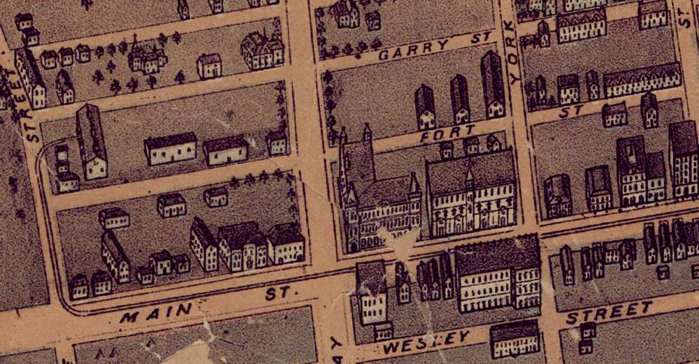
You reach Main Street and look for Fort Garry, a name known across the Dominion, a pivotal site in the history of the Canadian West, playing a central role in the Red River Resistance led by Louis Riel, which paved the way for Manitoba’s entry into Confederation.
Yet it’s gone. Closed only a few years earlier, it has already been erased from this map, save for a small gate and the street names Fort and Garry. Its symbolism and historical importance prove no match for the ambitions of a growing city, which has chosen to straighten Main Street rather than preserve the fort’s legacy.
The city is in transition, amid small winds swirling before the storm arrives.
Wooden settler buildings give way to brick and stone.
Main Street already carries the appearance of a metropolitan street, yet even these structures, built with such optimism, will soon be replaced by those of even greater ambition.
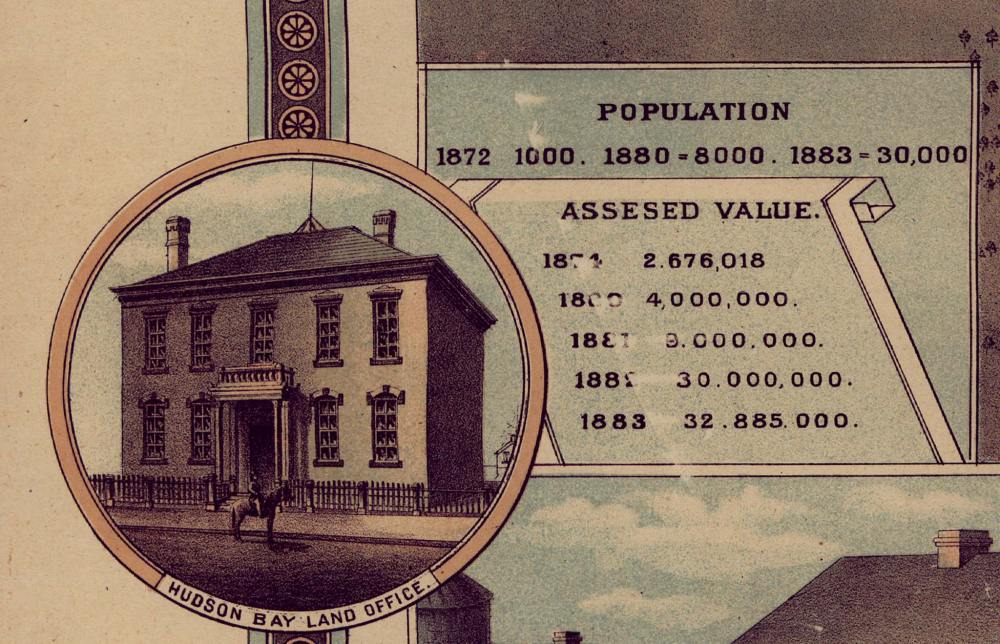
In 1884 year alone, $2.5 million is being spent on construction, nearly double the amount laid out in Toronto, and the most by any Canadian city that year.
The pace of change can be measured in a single lifetime. Someone born in Winnipeg in 1870 would have known a settlement of 30 buildings and 200 people. By age 15, they would live in a town of 20,000. By 30, a city of 50,000. By 45, a metropolis of nearly 200,000, the third largest in the country.
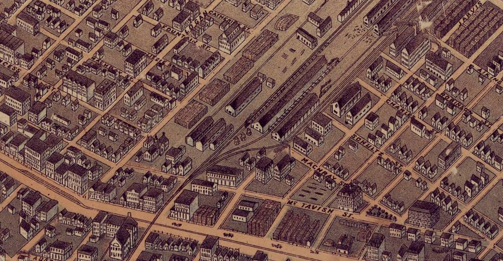
Pull of the railway
You begin to feel the pull of the railway before you see it.
Ten years before this moment, the Canadian Pacific Railway was meant to cross the Red River at Selkirk.
Winnipeg’s business elite fought to change that, understanding what it would mean for the city’s future. In 1881, they succeeded. The line would come through Winnipeg, but the price was steep. Land for a station, taxes permanently exempted, a cash payment and a free bridge built across the Red River.
The consequences are already visible.
Streets are cut by tracks, neighbourhoods separated. The yards reshape the city.
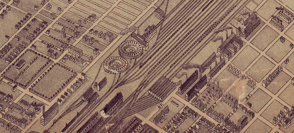
Shops and sawmills gather nearby, severing the area from the rest of the city, binding it to industry and ensuring its future as a working-class district.
By 1884, in a city of 17,000 people, almost 2,000 are working in the rail yards.
That same year, the first newspaper reference is made to the “North End,” calling it the foreign quarter. An irony since all settlers are foreign, but presumably a different kind of foreign in their eyes.
It’s easy, looking back, to imagine the railway as a single line drawn cleanly across the country, but it’s not built that way.
Instead, it grows in segments that slowly connect. By 1884, Winnipeg is linked south along the Pembina Line, west across the Prairies to Calgary, and east to Thunder Bay and a new shipping terminal on Lake Superior.
This would lead to the first direct Canadian export shipment of wheat from the Prairies to Europe, landing in Glasgow, Scotland, in the fall of 1884.
You walk further along Main Street and step onto one of the city’s first paved blocks, laid only months earlier.
Beneath your feet, the first complete sewer system is now active. Within a year, incidence of diseases like typhoid and diphtheria will drop by nearly half.
The new streetcar lines along Main and Queen tie the city together.
Nearby, the first provincial legislature building has just been completed, and construction has begun on the ornate “gingerbread” city hall, a building that will sadly not survive a push for modernization in the future.
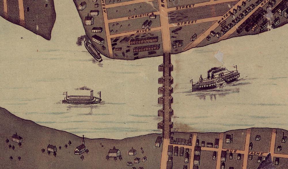
You turn toward the river, where another system of transportation comes to life.
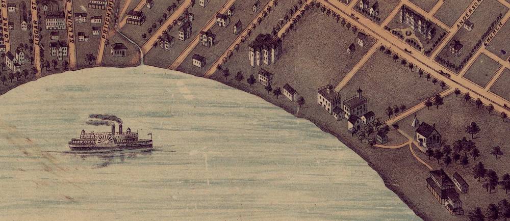
Steamboats bob along the Red, linking Winnipeg to Moorhead, Minn., and then to St. Paul on the Mississippi. For nearly 50 years, this has been the city’s primary connection to the outside world, bringing the city’s fuel supply from the Pennsylvania coal fields, lumber for construction, ocean seafood and California fruit.
In the reverse direction, wheat and furs are sent out to the world. The system began in 1858, when the St. Paul Chamber of Commerce offered a $1,000 prize to the first person to place a steamboat on the Red River.
Once proven successful, an explosion of companies would ply the lazy waters between the two cities, a downstream trip of four days, and a return voyage of 60 hours.
Name game
As you move through the streets, the names begin to tell their own stories.
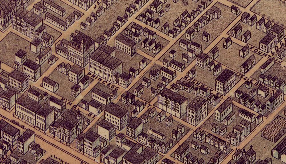
Portage Avenue was renamed Queen Street two years prior by a local councillor hoping to make the city more like Toronto. Largely ignored by residents, it will be changed back to Portage in February.
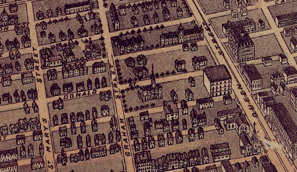
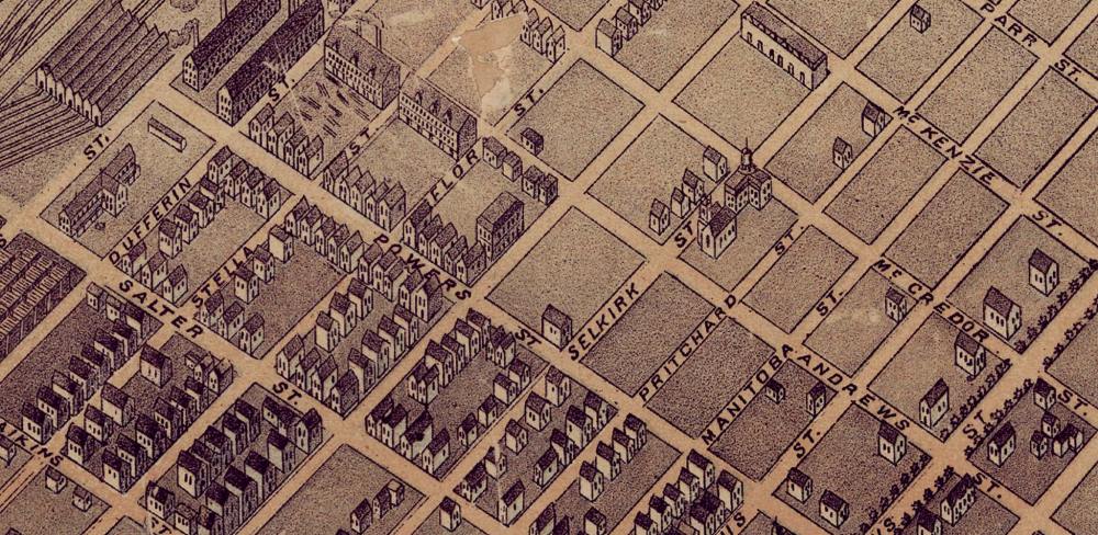
South of Portage, many street names reflect the Hudson’s Bay Company’s influence, like Donald and Smith streets, named for Donald Smith, chief commissioner of the company.
Along the river, the French-Canadian system of land division that created long and narrow homesteads extending from the banks, shapes the street patterns of the new city.
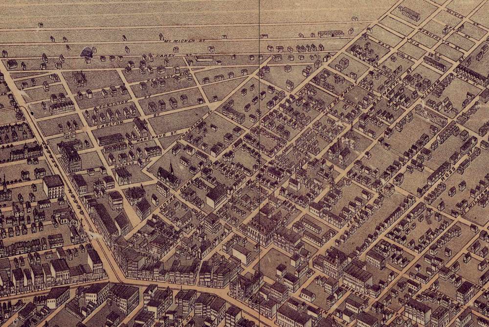
As streets are built along each side of these properties, the landowners’ names are often used. Andrew McDermot’s property is a neighbour to A.G.B Bannatyne, who is beside Alexander Ross, and his sons William and James. Beside them Robert Logan.
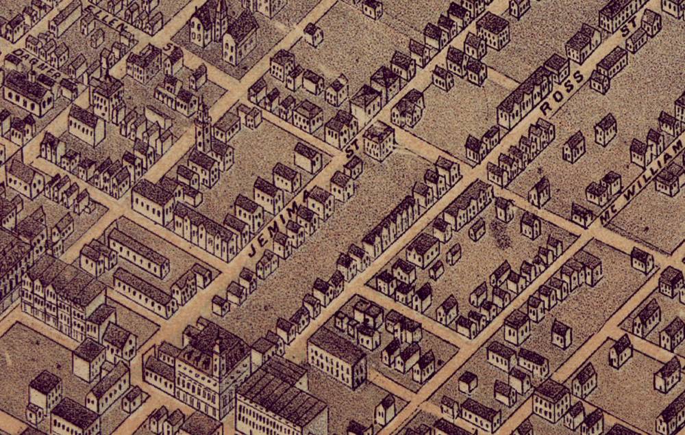
One name stands out, then fades. Jemima Street, named for Jemima Ross, a Métis matriarch of the Ross family who donated a large section of her land to the city. It becomes home to the public market and square behind city hall, later the site of the police headquarters, and eventually the Market Lands development.
To honour her gift, the street bears her name, but while she is still living there, it’s removed, yielding to public outcry against official civic recognition of an Indigenous woman. It’s replaced with Elgin Avenue, named for a long-dead governor general who never lived here.
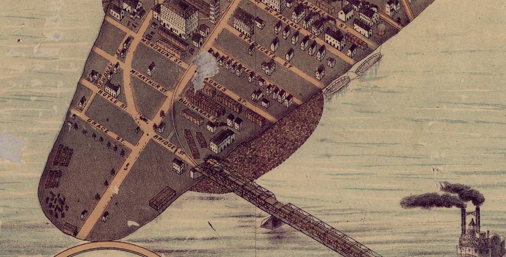
You have made it to the tip of Point Douglas and are standing in front of the bridge that tied Winnipeg to the world and ensured it would become the dominant city of the West.
It’s named Louise, after Princess Louise, daughter of Queen Victoria and wife of the governor general, John Campbell, who travelled to Winnipeg in 1882 to christen its opening. The event created such fanfare they also named a prominent street, Princess, in her honour.
Standing here and looking back on the city, nothing feels still anymore.
The rail yards hum, the muddy rivers flow, the streets fill and empty and fill again. Buildings rise with confidence, brick replacing wood, yet they already feel uncertain, their futures unwritten and their permanence an illusion.
Change is underway, but there is also a calmness, as if the city is gathering itself for the arrival of something much larger. It’s changing, but not yet transformed, held in a moment where the frontier has not fully given way to the metropolis.
The city is neither what it was nor what it will be. What’s coming will be faster, louder and more permanent, driven by an optimism and belief that it can become one of the great cities of the new world.

bbellamy@numberten.com
Brent Bellamy is creative director for Number Ten Architectural Group.


Brent Bellamy is creative director for Number Ten Architectural Group.
Our newsroom depends on a growing audience of readers to power our journalism. If you are not a paid reader, please consider becoming a subscriber.
Our newsroom depends on its audience of readers to power our journalism. Thank you for your support.


History
Updated on Friday, April 10, 2026 5:41 PM CDT: Adds detail images.