

Danger flows from calm
Qu'Appelle River Dam the western edge of drainage basin
Advertisement
Read this article for free:
or
Already have an account? Log in here »
To continue reading, please subscribe:
Digital Subscription
One year of digital access for only $1.44 a week*
- Enjoy unlimited reading on winnipegfreepress.com
- Read the E-Edition, our digital replica newspaper
- Access News Break, our award-winning app
- Play interactive puzzles
*Billed as $5.77 plus GST every four weeks. After 52 weeks, price increases to the regular rate of $19.95 plus GST every four weeks. Offer available to new and qualified returning subscribers only. Cancel any time.
To continue reading, please subscribe:
Add Free Press access to your Brandon Sun subscription for only an additional
$1 for the first 4 weeks*
- Enjoy unlimited reading on winnipegfreepress.com
- Read the E-Edition, our digital replica newspaper
- Access News Break, our award-winning app
- Play interactive puzzles
*Your next Brandon Sun subscription payment will increase by $1.00 and you will be charged $17.95 plus GST for four weeks. After four weeks, your payment will increase to $24.95 plus GST every four weeks.
Read unlimited articles for free today:
or
Already have an account? Log in here »
Hey there, time traveller!
This article was published 04/03/2011 (5572 days ago), so information in it may no longer be current.
DOUGLAS PROVINCIAL PARK, Sask. —- On a windy March morning at the Qu’Appelle River Dam, the only sign of life is a coyote crossing a snow-covered field below the spillway.
The lip of this dam — 27 metres high, 3.1 kilometres across — is the smaller of two embankments that created the artificial Lake Diefenbaker, the largest body of water in Saskatchewan below the Canadian Shield.
Lake Diefenbaker’s other major dam, the 64-metre-high Gardiner Dam on the South Saskatchewan River, is far more famous because it’s among the biggest embankments in the world.
But the Qu’Appelle River Dam is important to Winnipeggers because it represents the western edge of the Red River drainage basin, a massive expanse of relatively flat land where all the rivers and lakes are upstream of where you probably are right now.
The Red River drainage basin stretches far beyond the Red itself to cover 288,000 square kilometres of Manitoba, Saskatchewan, the Dakotas and Minnesota.
It’s roughly 925 kilometres wide, from a rivulet near Central Butte, Sask., to the marshes east of Red Lake, Minn. It’s also about 875 kilometres deep, stretching from the north in Saskatchewan’s Nut Hills — the source of the Assiniboine River — to Lake Traverse on the Minnesota-South Dakota border in the south.
The Assiniboine, Red Lake, Pembina, Roseau, Souris, Sheyenne and Pembina rivers all drain directly or indirectly into the Red.
And so does the Qu’Appelle, which spills out of Lake Diefenbaker as a trickle and then meanders through an impressive valley carved out of southern Saskatchewan by glacial meltwaters thousands of years ago before it drains into the Assiniboine River at St. Lazare.
Near the source of the Qu’Appelle, road maps suggest the existence of a town called Bridgeford. The tiny hamlet actually amounts to a couple of buildings at the junction of Saskatchewan Highways 19 and 367.
Happily, Douglas Provincial Park begins just north of the Qu’Appelle River Dam.
Even during the winter, you can pull off Highway 19 and drive up a short, icy loop road to a vantage point above the dam and the frozen surface of Lake Diefenbaker. Saskatchewan Highways & Infrastructure recently plowed the loop, apparently just for me.
The coyote at the spillway is the only living thing I spotted outdoors on a -18 C day in this relatively empty corner of south-central Saskatchewan, aside from pickup trucks and semi-trailers. I counted three coyotes in total on the drive up to the spill. The source of the Assiniboine River proved a little more lively. While the river’s source in the Nut Hills can only be reached by making a trek into the bush, within 40 kilometres it crosses Saskatchewan Highway 49 at the town of Preeceville, which not only exists but has 1,000 residents and will celebrate its centennial year in 2012.
The pesky anniversary led the town to cover its “Welcome to Preeceville, headwaters of the Assiniboine” signs with advertisements for next year’s centenary, depriving me of a cheap photo op.
The Assiniboine itself in Preeceville is a fraction of its flow in Winnipeg. The river valley is only a fraction of the depth of the grand post-glacial spillway that provides enough of a drop for downhill skiers at Asessippi Provincial Park.
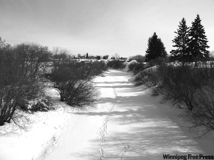
Plenty of Preeceville homes face the Assiniboine, but there were no people on the river itself. On the -26 C morning I visited, a pair of large, white-tailed deer scampered down the banks onto a surface already stapled with other deer tracks.

To canoe from here to The Forks would take a summer. To drive, about six hours.
It’s roughly eight hours by car from The Forks to the Qu’Appelle River Dam and the western edge of the Red River basin.
The snowpack in the region is deep, but there is little talk in southern Saskatchewan about the flood expected this spring, much further downstream, where the Qu’Appelle will deposit its burden.
bartley.kives@freepress.mb.ca