

Biggest flood ever
Water covers unprecedented area of the province, say flood officials

Advertisement
Read this article for free:
or
Already have an account? Log in here »
To continue reading, please subscribe:
Monthly Digital Subscription
$1 per week for 24 weeks*
- Enjoy unlimited reading on winnipegfreepress.com
- Read the E-Edition, our digital replica newspaper
- Access News Break, our award-winning app
- Play interactive puzzles
*Billed as $4.00 plus GST every four weeks. After 24 weeks, price increases to the regular rate of $19.95 plus GST every four weeks. Offer available to new and qualified returning subscribers only. Cancel any time.
Monthly Digital Subscription
$4.99/week*
- Enjoy unlimited reading on winnipegfreepress.com
- Read the E-Edition, our digital replica newspaper
- Access News Break, our award-winning app
- Play interactive puzzles
*Billed as $19.95 plus GST every four weeks. Cancel any time.
To continue reading, please subscribe:
Add Free Press access to your Brandon Sun subscription for only an additional
$1 for the first 4 weeks*
*Your next subscription payment will increase by $1.00 and you will be charged $16.99 plus GST for four weeks. After four weeks, your payment will increase to $23.99 plus GST every four weeks.
Read unlimited articles for free today:
or
Already have an account? Log in here »
Hey there, time traveller!
This article was published 17/04/2011 (5436 days ago), so information in it may no longer be current.
Water, water — almost everywhere.
It may not be the most severe or dramatic, but the flood of 2011 is turning out to be the biggest, the province said Saturday.
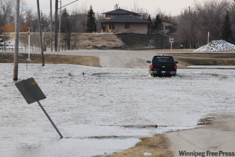
This year’s flooding covers an unprecedented area of the province from the Saskatchewan border to eastern Manitoba, and from The Pas, south to the U.S. border, flood officials said at a press conference Saturday.
So far, there are 693 evacuees, 41 provincial roads closed and at least 500 municipal roads closed because of high water levels, said Steve Ashton, minister of infrastructure and transportation and the minister responsible for emergency measures.
“Conditions are changing rapidly,” said Steve Topping, Manitoba Water Stewardship’s executive director.
Crews are working around the clock monitoring river and stream levels, Topping said. There are 11 crews checking flows right now when normally, at this time of year, there are just three, he said.
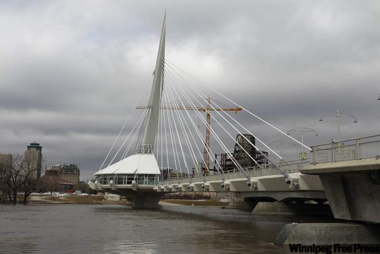
South of Winnipeg, Highway 75 to the United States border was still open Saturday. In Winnipeg, gradual increases in river levels were expected throughout the day. On the mighty Red, officials expected levels would be maintained at 20 feet at James Avenue by today.
The biggest concern right now is the Assiniboine River.
Floodway operations were being adjusted Saturday to accommodate increased flows from the Assiniboine, Topping said.
Overnight and this morning, there has been “significant activity” along the river, and “significant use” of the Portage Diversion to protect communities, he said.
Flows were recorded that have not been seen since the flood of 1976, Topping said. That year, the Assiniboine experienced its worst flood on record.
A high-water advisory issued for the Assiniboine River downstream of Portage la Prairie.
The province was keeping a close eye Saturday on an ice jam on the Assiniboine River near Poplar Point. No homes were at risk but officials were considering using the Amphibex to break the jam located near the Poplar Point Colony.
Friday night’s dump of snow, meanwhile, wasn’t expected to alter predictions for when rivers will crest but will affect how long it will take for water levels to fall.
“The snowfall in southern Manitoba is not expected to affect crest predictions,” said Chuck Sanderson, executive director of the Emergency Measures Organization. “It could provide for a longer period of flooding.”
And it will affect the province’s pocketbook.
“This flood will have a significant impact on flood disaster assistance,” Sanderson warned.
To try and keep a lid on the damage, 24-hour patrols are monitoring communities with ring dikes.
The province said Saturday it has delivered a sandbagging machine to Peguis First Nation.
Of the 693 evacuees in Manitoba, 576 are from the reserve north of Winnipeg. The sandbagging machine is in addition to provincial flood barrier tubes, trailers and pumps that are also in the community to support flood-fighting efforts.
carol.sanders@freepress.mb.ca
BY THE NUMBERS:
693

evacuees
41
provincial roads closed
500
municipal roads closed
Carol Sanders
Legislature reporter
Carol Sanders is a reporter at the Free Press legislature bureau. The former general assignment reporter and copy editor joined the paper in 1997. Read more about Carol.
Every piece of reporting Carol produces is reviewed by an editing team before it is posted online or published in print — part of the Free Press‘s tradition, since 1872, of producing reliable independent journalism. Read more about Free Press’s history and mandate, and learn how our newsroom operates.
Our newsroom depends on a growing audience of readers to power our journalism. If you are not a paid reader, please consider becoming a subscriber.
Our newsroom depends on its audience of readers to power our journalism. Thank you for your support.
Related Articles
REPLAY: Ice jam season over, says province at flood update
Advertisement Advertise With Us
Advertisement Advertise With Us