WEATHER ALERT

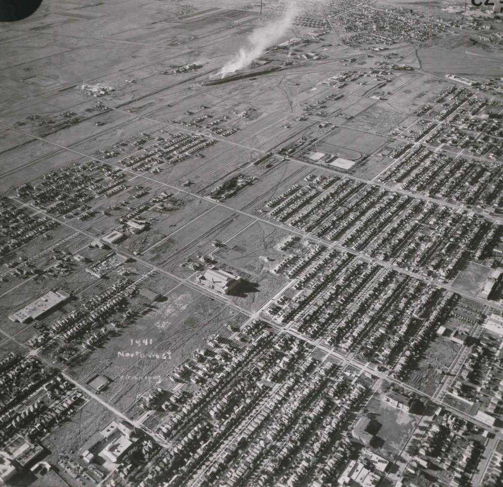
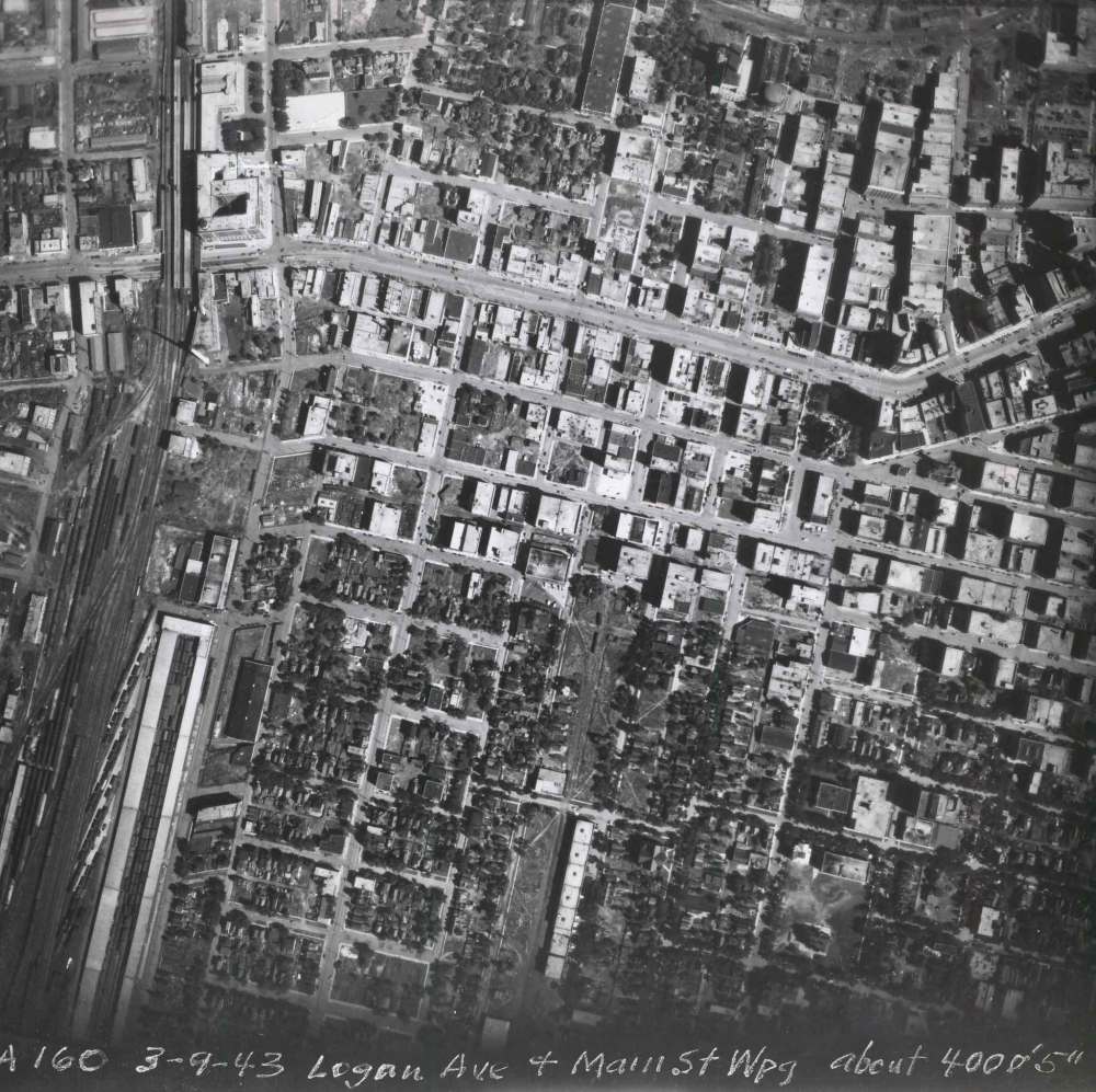
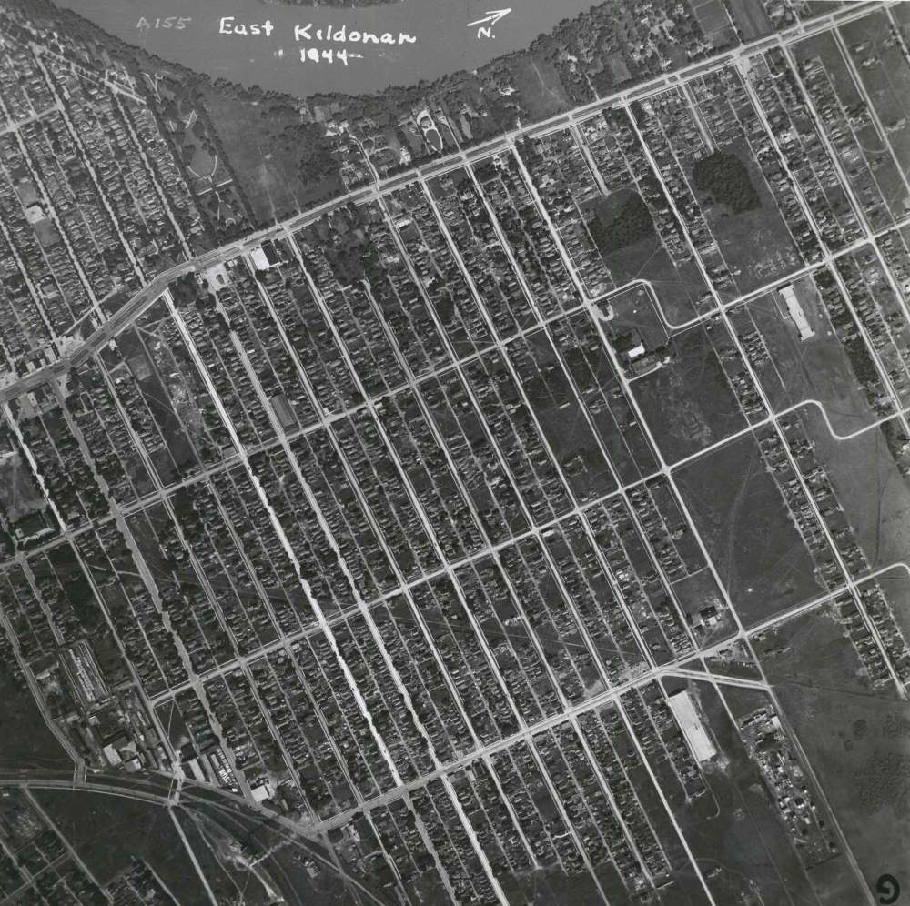
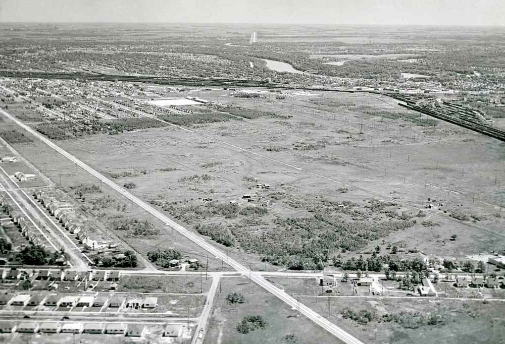
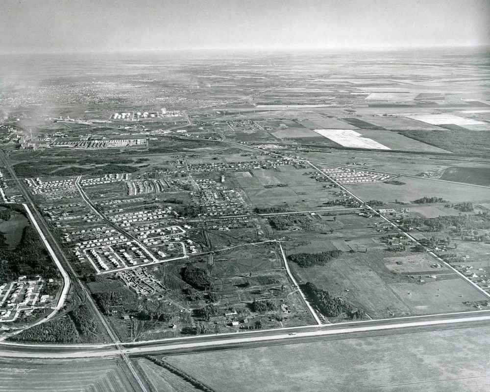
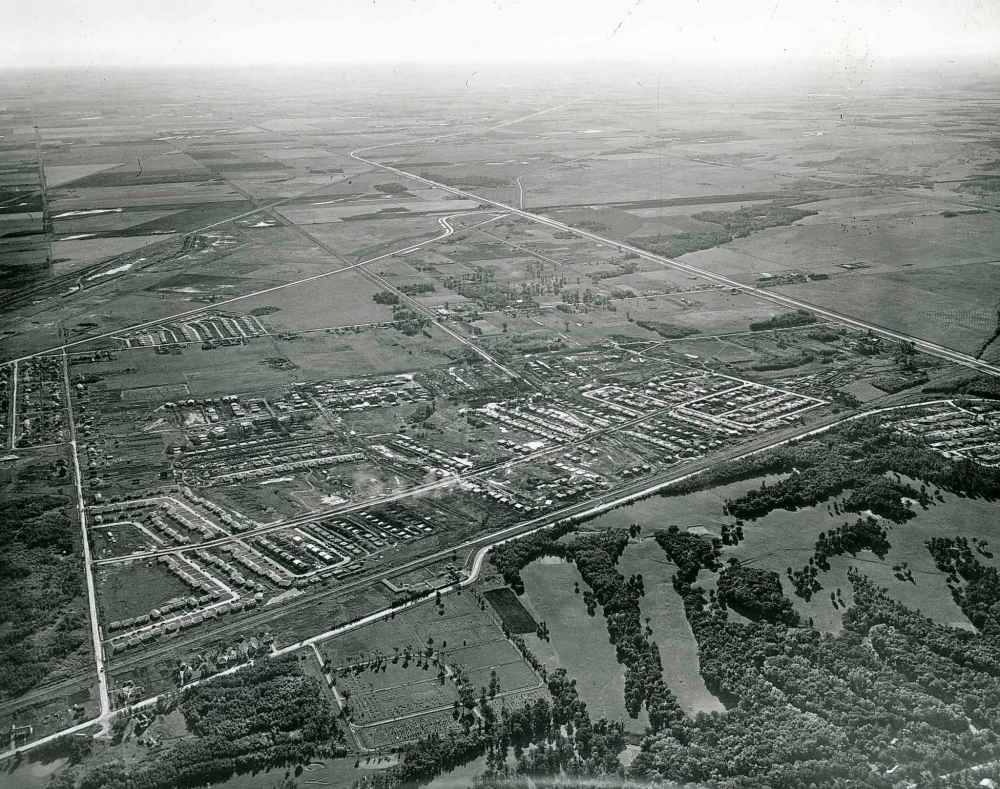
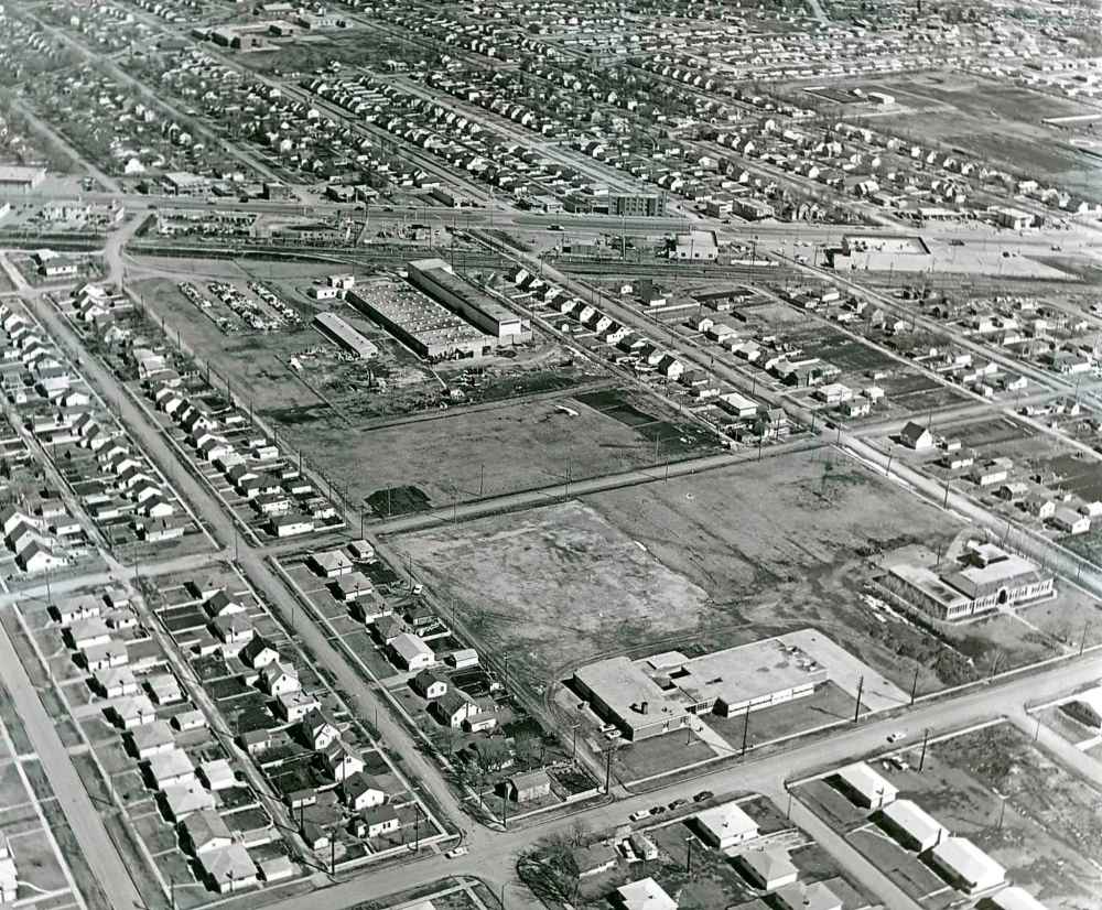
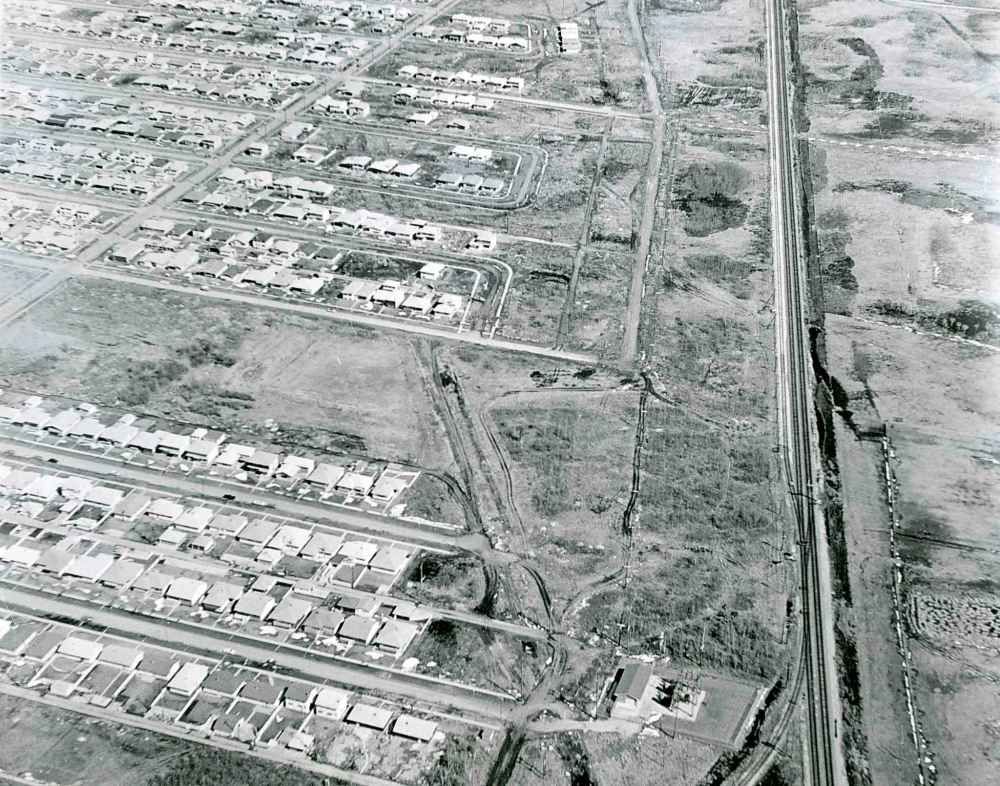
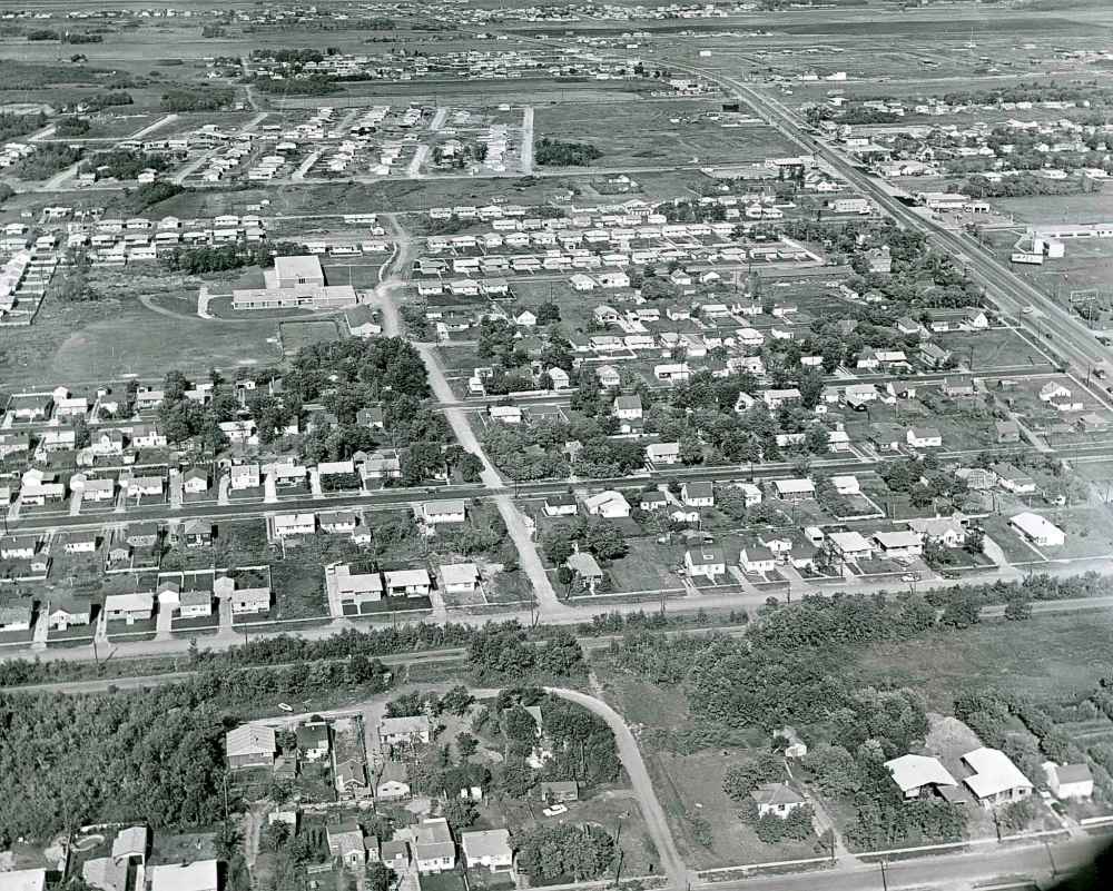
Winnipeg from the air, 1941-1976

Advertisement

Advertise with us

Read this article for free:

or

Already have an account? Log in here »

To continue reading, please subscribe:

Digital Subscription

One year of digital access for only $1.44 a week*

  • Enjoy unlimited reading on winnipegfreepress.com
  • Read the E-Edition, our digital replica newspaper
  • Access News Break, our award-winning app
  • Play interactive puzzles

*Billed as $5.77 plus GST every four weeks. After 52 weeks, price increases to the regular rate of $19.95 plus GST every four weeks. Offer available to new and qualified returning subscribers only. Cancel any time.

To continue reading, please subscribe:

Add Free Press access to your Brandon Sun subscription for only an additional

$1 for the first 4 weeks*

  • Enjoy unlimited reading on winnipegfreepress.com
  • Read the E-Edition, our digital replica newspaper
  • Access News Break, our award-winning app
  • Play interactive puzzles
Start now

*Your next Brandon Sun subscription payment will increase by $1.00 and you will be charged $17.95 plus GST for four weeks. After four weeks, your payment will increase to $24.95 plus GST every four weeks.

Hey there, time traveller!
This article was published 24/07/2020 (2144 days ago), so information in it may no longer be current.

The Hotel Fort Garry in 1939. (Royal Canadian Air Force)
A view of northwest Winnipeg in 1941. (Files)
Logan and Main and the surrounding area as seen from the air in 1943. (Files)
East Kildonan from the air in 1944. (Files)
Elmwood from the air in 1945. (Files)
The Scotland Avenue district in Fort Garry in 1954 where a shopping centre was soon to be built. Another photo from the time calls this the Harte Subdivision. (Jack Ablett / Winnipeg Free Press files)
Windsor Park in 1956 with Fermor Avenue at the bottom and Archibald Street on the left. (Winnipeg Free Press files)
A different view of Windsor Park in 1956. (Winnipeg Free Press files)
Fort Garry in 1961 looking southeast towards Pembina Highway from Beaumont Bay. (Winnipeg Free Press files)
Fort Garry in 1961 looking east along McGillivray Boulevard towards Pembina Highway. (Winnipeg Free Press files)
River Heights in 1961 looking east with the CN Rail tracks on the right. (Winnipeg Free Press files)
Westwood looking west in 1961 with Portage Avenue on the right. (Bill Rose / Winnipeg Free Press files)
Fort Richmond in 1976. (Gerry Cairns / Winnipeg Free Press files)
Report Error Submit a Tip

Photo Galleries

LOAD PHOTO GALLERIES ARTICLES