

Pacific storm moves over B.C. in latest wintry blast, bringing snow and wind warnings
Advertisement
Read this article for free:
or
Already have an account? Log in here »
To continue reading, please subscribe:
Monthly Digital Subscription
$1 per week for 24 weeks*
- Enjoy unlimited reading on winnipegfreepress.com
- Read the E-Edition, our digital replica newspaper
- Access News Break, our award-winning app
- Play interactive puzzles
*Billed as $4.00 plus GST every four weeks. After 24 weeks, price increases to the regular rate of $19.95 plus GST every four weeks. Offer available to new and qualified returning subscribers only. Cancel any time.
Monthly Digital Subscription
$4.99/week*
- Enjoy unlimited reading on winnipegfreepress.com
- Read the E-Edition, our digital replica newspaper
- Access News Break, our award-winning app
- Play interactive puzzles
*Billed as $19.95 plus GST every four weeks. Cancel any time.
To continue reading, please subscribe:
Add Free Press access to your Brandon Sun subscription for only an additional
$1 for the first 4 weeks*
*Your next subscription payment will increase by $1.00 and you will be charged $16.99 plus GST for four weeks. After four weeks, your payment will increase to $23.99 plus GST every four weeks.
Read unlimited articles for free today:
or
Already have an account? Log in here »
VANCOUVER – There’s another slight chance of sea-level snow in Metro Vancouver as a new weather system makes landfall in southwestern British Columbia, a day after flurries across much of the region.
But Environment Canada says in a special weather statement that any wet, low-level snowfall will only be brief.
Flurries on Tuesday failed to accumulate at Vancouver’s airport, keeping the city on track for its first official snow-free winter in 43 years.
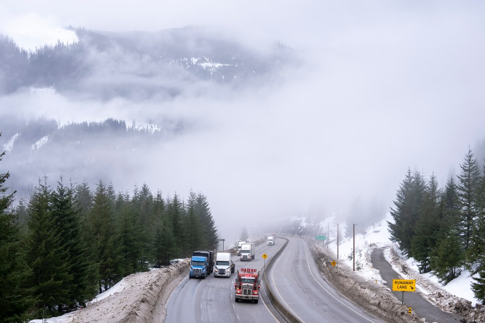
The new Pacific storm system is expected to bring up to 10 centimetres of snow to high-elevation areas of inland portions of Vancouver Island, while Whistler and parts of the Sea to Sky Highway may see 20 centimetres.
The storm is also expected to bring high winds, with a warning that Greater Victoria faces gusts up to 90 kilometres an hour, while Hope is forecast to see gusts up to 100 kilometres per hour.
The late winter blast continues in the Interior, where the Coquihalla Highway, the Okanagan Connector and Highway 3 from Grand Forks to Creston and from Hope to Princeton are all under winter storm warnings.
Heavy snowfall of up to 25 centimetres is also expected on Highway 1 from Sicamous to Golden, and drivers are warned that travel will likely be challenging with reduced visibility and snow accumulation on the roadway.
This report by The Canadian Press was first published March 11, 2026.