

Major winter storm expected to hit northern Ontario, central Quebec
Advertisement
Read this article for free:
or
Already have an account? Log in here »
To continue reading, please subscribe:
Monthly Digital Subscription
$1 per week for 24 weeks*
- Enjoy unlimited reading on winnipegfreepress.com
- Read the E-Edition, our digital replica newspaper
- Access News Break, our award-winning app
- Play interactive puzzles
*Billed as $4.00 plus GST every four weeks. After 24 weeks, price increases to the regular rate of $19.95 plus GST every four weeks. Offer available to new and qualified returning subscribers only. Cancel any time.
Monthly Digital Subscription
$4.99/week*
- Enjoy unlimited reading on winnipegfreepress.com
- Read the E-Edition, our digital replica newspaper
- Access News Break, our award-winning app
- Play interactive puzzles
*Billed as $19.95 plus GST every four weeks. Cancel any time.
To continue reading, please subscribe:
Add Free Press access to your Brandon Sun subscription for only an additional
$1 for the first 4 weeks*
*Your next subscription payment will increase by $1.00 and you will be charged $16.99 plus GST for four weeks. After four weeks, your payment will increase to $23.99 plus GST every four weeks.
Read unlimited articles for free today:
or
Already have an account? Log in here »
Environment Canada is warning residents to stay indoors and avoid travel as a major winter storm is expected to pummel a large swath of northern Ontario extending into Quebec.
The weather agency expects up to 80 centimetres of snow to fall in the hardest hit areas, with a risk of freezing rain and ice pellets that could bring visibility on the roads to near zero.
Environment Canada forecasts the storm will hit later today and continue through Monday night, bringing winds as fast as 80 km/h and raising risk of road closures and widespread power outages.
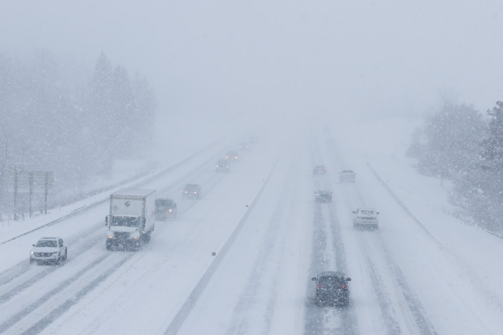
Environment Canada issued an orange winter storm warning from just east of Thunder Bay to Chibougamau in central Quebec, but the area around Sault Ste. Marie and Timmins is expected to be hit the hardest as the weather agency warns of “extreme” impact levels.
In that area, Environment Canada warned that snowfall accumulation could increase the risk of roofs collapsing.
In Toronto and parts of southwestern Ontario, Environment Canada has issued a special weather statement forecasting a patchy winter mix of high winds, freezing rain and snow that may extend into Monday and Tuesday.
This report by The Canadian Press was first published March 15, 2026.