

Major winter storm bearing down on northern Ontario, eastern Quebec
Advertisement
Read this article for free:
or
Already have an account? Log in here »
To continue reading, please subscribe:
Digital Subscription
One year of digital access for only $75*
- Enjoy unlimited reading on winnipegfreepress.com
- Read the E-Edition, our digital replica newspaper
- Access News Break, our award-winning app
- Play interactive puzzles
*Billed as $5.77 plus GST every four weeks. After 52 weeks, price increases to the regular rate of $19.95 plus GST every four weeks. Offer available to new and qualified returning subscribers only. Cancel any time.
Monthly Digital Subscription
$4.99/week*
- Enjoy unlimited reading on winnipegfreepress.com
- Read the E-Edition, our digital replica newspaper
- Access News Break, our award-winning app
- Play interactive puzzles
*Billed as $19.95 plus GST every four weeks. Cancel any time.
To continue reading, please subscribe:
Add Free Press access to your Brandon Sun subscription for only an additional
$1 for the first 4 weeks*
- Enjoy unlimited reading on winnipegfreepress.com
- Read the E-Edition, our digital replica newspaper
- Access News Break, our award-winning app
- Play interactive puzzles
*Your next Brandon Sun subscription payment will increase by $1.00 and you will be charged $17.95 plus GST for four weeks. After four weeks, your payment will increase to $24.95 plus GST every four weeks.
Read unlimited articles for free today:
or
Already have an account? Log in here »
A major winter storm is bearing down on a large swath of northern Ontario extending into Quebec.
Environment Canada says weather warnings are in place from east of Thunder Bay and Lake Superior, all the way to the city of Sept-Iles in eastern Quebec.
The weather agency says up to 60 centimetres of snow could fall in areas around Sault Ste. Marie and Timmins, with a risk of freezing rain and ice pellets that could bring visibility on the roads to near zero.
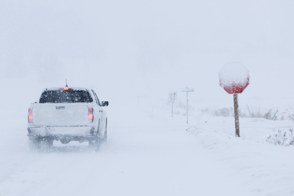
Environment Canada says the storm is expected to continue through the day, with winds as strong as 80 kilometres an hour in some areas.
In Toronto and parts of southwestern Ontario, Environment Canada has issued a special weather statement forecasting high winds, and perhaps a patchy mix of rain, freezing rain and snow that may extend into Tuesday.
In Sudbury, police say the northern city has already declared a significant weather event and is deploying all available resources to respond to the storm.
“We are asking all residents to remain at home and stay off the roadways until further notice. Municipal crews continue to work diligently to reduce the impact of this weather event on our community,” police said in a news release.
This report by The Canadian Press was first published March 16, 2026.