

B.C. glacial outburst ‘well into’ rapid drawdown, peak flows expected Monday
Advertisement
Read this article for free:
or
Already have an account? Log in here »
To continue reading, please subscribe:

Digital Subscription
One year of digital access for only $205*
- Enjoy unlimited reading on winnipegfreepress.com
- Read the E-Edition, our digital replica newspaper
- Access News Break, our award-winning app
- Play interactive puzzles
*First annual payment billed as $205.00 + GST for one year. This annual subscription will automatically renew at $233.00 + GST every 52 weeks (10% off the regular annual price of $259.35). Offer available to new and qualified returning subscribers only. Cancel any time.
To continue reading, please subscribe:
Add Free Press access to your Brandon Sun subscription for only an additional
$1 for the first 4 weeks*
- Enjoy unlimited reading on winnipegfreepress.com
- Read the E-Edition, our digital replica newspaper
- Access News Break, our award-winning app
- Play interactive puzzles
*Your next Brandon Sun subscription payment will increase by $1.00 and you will be charged $17.95 plus GST for four weeks. After four weeks, your payment will increase to $24.95 plus GST every four weeks.
Read unlimited articles for free today:
or
Already have an account? Log in here »
PEMBERTON, BRITISH COLUMBIA, CANADA – A glacial outburst near Pemberton, B.C., is “well into the rapid drawdown phase,” gushing water and debris downstream with flows expected to reach a peak on Monday.
The Squamish-Lillooet Regional District says in its latest update that people should stay away from Place Creek, Poole Creek, Gates Lake and other nearby water channels downstream from the Place Glacier, about 150 kilometres north of Vancouver.
Homes in the area have been under an evacuation order since late June over concerns that the lake, formed by melting glacial water, will let loose and damage properties along the waterways.
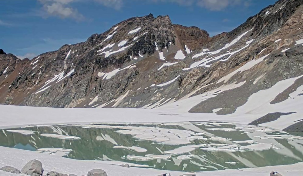
The Place Glacier lake has released water in the past, including in 2024 when 1.2 million cubic meters of meltwater and sediment flooded properties in the same area.
The regional district has said the current outburst is expected to have comparable flows, and the latest update says people should continue to be aware of the risk of “fast-moving water, debris, erosion and unstable stream banks.”
It also says that technical experts are monitoring the flow situation and were conducting visual ground assessments on Monday.
“The visual ground assessment (Sunday) identified overland flooding and increased flow in Poole Creek, including rising water levels at the Poole Creek Road culvert,” the update says.
The district says there are no travel restrictions on nearby Pemberton Portage Road, but people should not be travelling to the Place Creek and Gates Lake areas to look at outburst conditions.
This report by The Canadian Press was first published July 20, 2026.