

Floodwatch
Advertisement
Read this article for free:
or
Already have an account? Log in here »
To continue reading, please subscribe:

Digital Subscription
One year of digital access for only $205*
- Enjoy unlimited reading on winnipegfreepress.com
- Read the E-Edition, our digital replica newspaper
- Access News Break, our award-winning app
- Play interactive puzzles
*First annual payment billed as $205.00 + GST for one year. This annual subscription will automatically renew at $233.00 + GST every 52 weeks (10% off the regular annual price of $259.35). Offer available to new and qualified returning subscribers only. Cancel any time.
To continue reading, please subscribe:
Add Free Press access to your Brandon Sun subscription for only an additional
$1 for the first 4 weeks*
- Enjoy unlimited reading on winnipegfreepress.com
- Read the E-Edition, our digital replica newspaper
- Access News Break, our award-winning app
- Play interactive puzzles
*Your next Brandon Sun subscription payment will increase by $1.00 and you will be charged $17.95 plus GST for four weeks. After four weeks, your payment will increase to $24.95 plus GST every four weeks.
Read unlimited articles for free today:
or
Already have an account? Log in here »
Hey there, time traveller!
This article was published 16/04/2009 (6330 days ago), so information in it may no longer be current.
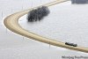
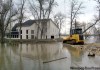
Trouble spots: THE Red and Assiniboine rivers are set to crest at the same time late this week in Winnipeg. Overland flooding continues in many parts of southern Manitoba, particularly in the Red River Valley and the Interlake, and will continue to do so through the coming weekend.
Newest developments:
Flood forecasters estimated the 2009 Red River flood — at least from St. Jean Baptiste to the floodway inlet — will be the second worst in more than 100 years. The projected crest this Saturday at James Avenue in Winnipeg is 22.6 feet, just two feet lower than during the 1997 flood. The province said that were it not for the floodway and other flood-mitigation measures, the Red River in downtown Winnipeg would have hit 30.3 feet on Wednesday — reaching the same level as during the 1950 flood.
Close to 170 residents of Peguis First Nation were relocated to Winnipeg, as the rising Fisher River flooded basements and crawl spaces. About 50 homes were flooded after sandbag dikes were breached. The First Nation declared a state of emergency late Tuesday. Manitoba Native Fire Fighters, along with 400 people, continued to sandbag and build up dikes in an effort to protect buildings.
About 40 people at the St. Adolphe personal care home were forced to leave Wednesday as a precautionary measure because of concern over flooding.
Sturgeon Creek overflowed its banks at Saskatchewan Avenue Wednesday for the first time since 1974.
The Rural Municipality of East St. Paul built dikes around storm sewers to prevent the river from backing up on the land drainage system. Overland flooding in the Bowen Avenue area damaged some private wells. Additional Aquadams were to be put in place to help build dikes in Highland Park and Whidbey Harbour.
Cities along the U.S. portion of the Red River prepared for second crests that could exceed earlier flood levels this spring, but the National Weather Service said most places won’t see rising water again.
Municipal officials reminded residents not to walk close to any creek or ditch due to fast-moving water.
The threat of ice jams on the Assiniboine River prompted 35 volunteers to help sandbag three low-lying homes in St. Francois Xavier Wednesday.
Weather impact:
SOME showers were expected over southern Manitoba Wednesday night and from Friday night to Saturday night, with amounts totalling in the five- to 10-millimetre range.
Quote of the day:
‘It now looks like this flood will be the second highest on record, since the 1800s anyway’

— Provincial flood forecaster Alf Warkentin
— Compiled by Larry Kusch and Jen Skerritt, with files from the Grand Forks Herald
Related Articles
From 'inconvenience' to second-biggest


Advertisement Advertise With Us
Advertisement Advertise With Us