

Ten to 20 cms of snow expected for southern Manitoba

Advertisement
Read this article for free:
or
Already have an account? Log in here »
To continue reading, please subscribe:

Digital Subscription
One year of digital access for only $205*
- Enjoy unlimited reading on winnipegfreepress.com
- Read the E-Edition, our digital replica newspaper
- Access News Break, our award-winning app
- Play interactive puzzles
*First annual payment billed as $205.00 + GST for one year. This annual subscription will automatically renew at $233.00 + GST every 52 weeks (10% off the regular annual price of $259.35). Offer available to new and qualified returning subscribers only. Cancel any time.
To continue reading, please subscribe:
Add Free Press access to your Brandon Sun subscription for only an additional
$1 for the first 4 weeks*
- Enjoy unlimited reading on winnipegfreepress.com
- Read the E-Edition, our digital replica newspaper
- Access News Break, our award-winning app
- Play interactive puzzles
*Your next Brandon Sun subscription payment will increase by $1.00 and you will be charged $17.95 plus GST for four weeks. After four weeks, your payment will increase to $24.95 plus GST every four weeks.
Read unlimited articles for free today:
or
Already have an account? Log in here »
Hey there, time traveller!
This article was published 08/12/2024 (626 days ago), so information in it may no longer be current.
Environment and Climate Change Canada warned people in Winnipeg to stay off the roads and brace for the season’s first significant winter storm this weekend, as gusting winds, freezing rain and heavy snow battered southern Manitoba.
The national weather agency issued snowfall and freezing rain warnings for a large swath of the province Saturday and Sunday, expecting a strong low pressure system to move in from southern Saskatchewan and bring mixed precipitation before giving way to falling snow.
Mild temperatures may initially limit blowing snow, but moderate snowfall rates combined with strong winds will create poor visibility with blowing and falling snow, Environment Canada said in a warning issued for Winnipeg early Sunday.
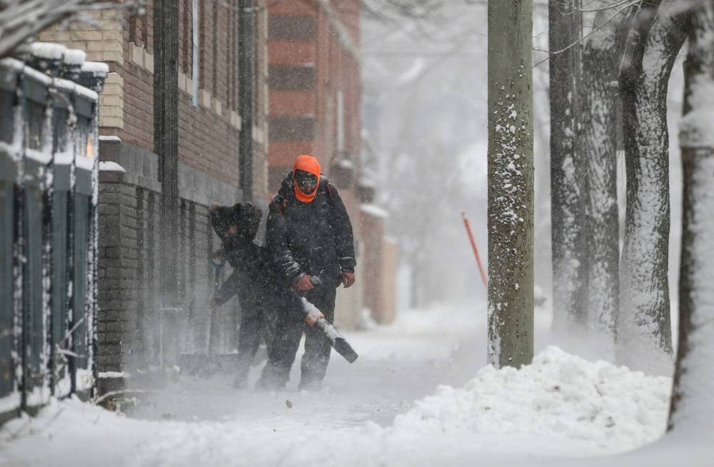
JOHN WOODS / FREE PRESS
People clear snow on a sidewalk along Westminster Avenue Sunday.
“We’ve had a few snowfalls so far, but they’ve all been pretty light and not very significant. This is probably one of our first significant ones this season,” meteorologist Rose Carlsen said by phone.
“Road conditions are probably going to be pretty significant factors that people are going to need to pay attention to. Because of the nature of the system — with the rain ahead of time, freezing precipitation — surfaces beneath the snow will probably be quite slippery.”
The forecast said snowfall rates as high as two centimetres per hour are expected, with total amounts between 10 to 20 centimetres slated to blanket the region.
The heaviest snow will cut a path diagonally through the province, traveling southeast from Dauphin, through Winnipeg, Steinbach and Sprague. It is projected to taper off Sunday night, but flurries will likely linger through Monday, Carlsen said.
The rapidly accumulating snow will likely make travel difficult in some locations, with visibility suddenly reduced at times, she said.
Manitoba 511 had already issued several advisories for highways along that path before noon, reporting they were partly snow-covered with varying degrees of visibility.
Road condition warnings included: Highway 5 near Dauphin; Highway 6 between Eriksdale and St. Laurent; Highway 1 from Headingley to Richer; The entire Perimeter Highway; and Highway 12 to Steinbach.
“The snow itself is going to be pretty heavy, wet snow to travel through as well, so any sort of precautions that people can take while travelling should be taken — even to the point of not travelling if they can help it,” Carlsen said.
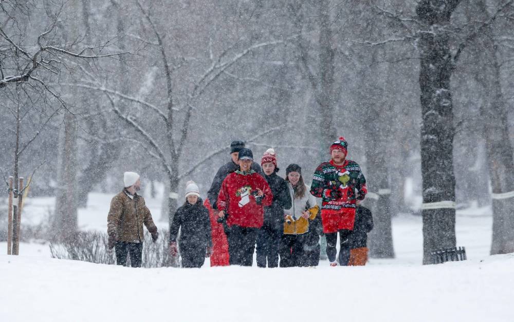
JOHN WOODS / FREE PRESS
Runners from the City Park Runners club, some wearing their Christmas sweaters, make their way down Wellington Crescent as heavy snowfall begins Sunday.
The City of Winnipeg provided an update on its website Sunday, assuring residents it was prepared for the storm.
“We are monitoring weather conditions and are ready to respond to the forecasted snowfall. We are ready to apply salt to improve traction on streets. We are also ready to plow if necessary,” it said.
Plowing of major routes was expected to begin at 7 p.m. Sunday, while clearing of back lanes was set to start on Monday morning, the city said. Major plowing operations are triggered when snow accumulation is five centimetres or more. Snow-clearing operations are following the city’s street priority system.
Annual winter route parking bans are in effect from 2 a.m. to 7 a.m. A map showing the status of city snow plow operations and current parking bans is available online. It also shows the conditions of bike paths and sidewalks.
Environment Canada projected temperatures to hover right around the freezing mark Sunday, before dipping overnight.
“We don’t really have much more in the way of snowfall in the near future behind this system, however, we are looking at probably going into the freezer after this,” Carlsen said.
The temperature is expected to plummet to -27 C overnight on Tuesday. It will likely warm slightly during the days on Wednesday and Thursday, but drop to similar lows again on both nights.

Friday is expected to see daytime highs of -17 C, warming slightly to -13 C into Saturday.
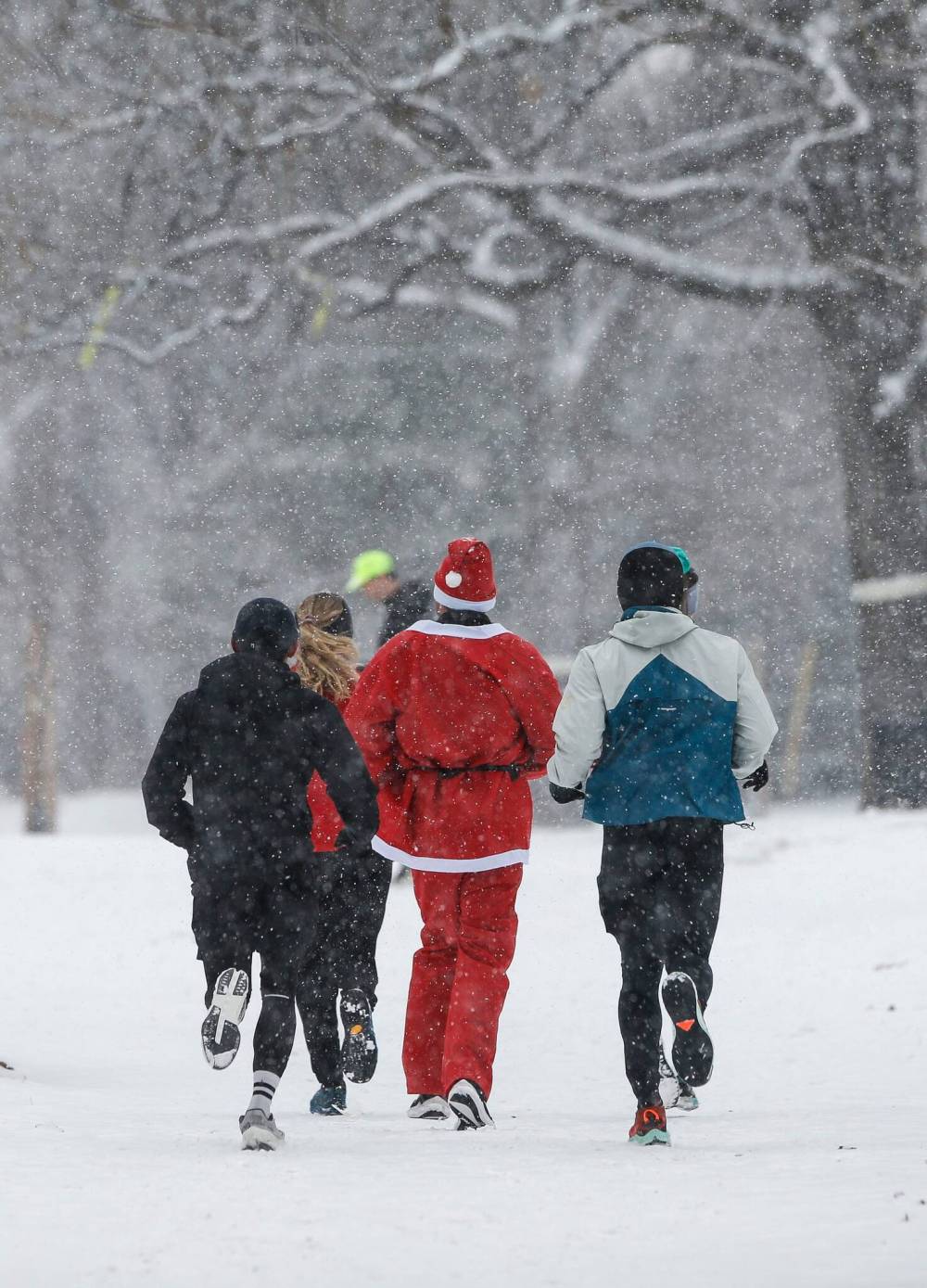
JOHN WOODS / FREE PRESS
Santa joins runners from the City Park Runners club as they make their way down Wellington Crescent on Sunday.
Weather warnings were in effect Sunday from as far north as Red Deer Lake, near the Saskatchewan border, east to the Ontario border and south to the U.S. border.
The Red River Valley and southeastern Manitoba were under snowfall warnings. Areas further west, including the Parlkand region, were under a winter storm warning, with freezing rain and heavy snow expected, Carlsen said.
In Winnipeg, snow began to fall around 11 a.m.
tyler.searle@freepress.mb.ca
Tyler Searle is a multimedia producer who writes for the Free Press’s city desk. A graduate of Red River College Polytechnic’s creative communications program, he wrote for the Stonewall Teulon Tribune, Selkirk Record and Express Weekly News before joining the paper in 2022. Read more about Tyler.
Every piece of reporting Tyler produces is reviewed by an editing team before it is posted online or published in print — part of the Free Press‘s tradition, since 1872, of producing reliable independent journalism. Read more about Free Press’s history and mandate, and learn how our newsroom operates.
Our newsroom depends on a growing audience of readers to power our journalism. If you are not a paid reader, please consider becoming a subscriber.
Our newsroom depends on its audience of readers to power our journalism. Thank you for your support.
Tyler Searle is a multimedia producer who writes for the Free Press’s city desk. A graduate of Red River College Polytechnic’s creative communications program, he wrote for the Stonewall Teulon Tribune, Selkirk Record and Express Weekly News before joining the paper in 2022. Read more about Tyler.
Every piece of reporting Tyler produces is reviewed by an editing team before it is posted online or published in print — part of the Free Press‘s tradition, since 1872, of producing reliable independent journalism. Read more about Free Press’s history and mandate, and learn how our newsroom operates.
Our newsroom depends on a growing audience of readers to power our journalism. If you are not a paid reader, please consider becoming a subscriber.
Our newsroom depends on its audience of readers to power our journalism. Thank you for your support.
Related Articles
City digs out after snowstorm
Advertisement Advertise With Us
Advertisement Advertise With Us
History
Updated on Sunday, December 8, 2024 1:39 PM CST: Adds details, quotes.
Updated on Sunday, December 8, 2024 4:18 PM CST: Additional photo added. Adds details on snow-clearing plans.