Massive winter storm prompts weather warnings across several provinces
Advertisement
Read this article for free:
or
Already have an account? Log in here »
To continue reading, please subscribe:

Digital Subscription
One year of digital access for only $205*
- Enjoy unlimited reading on winnipegfreepress.com
- Read the E-Edition, our digital replica newspaper
- Access News Break, our award-winning app
- Play interactive puzzles
*First annual payment billed as $205.00 + GST for one year. This annual subscription will automatically renew at $233.00 + GST every 52 weeks (10% off the regular annual price of $259.35). Offer available to new and qualified returning subscribers only. Cancel any time.
To continue reading, please subscribe:
Add Free Press access to your Brandon Sun subscription for only an additional
$1 for the first 4 weeks*
- Enjoy unlimited reading on winnipegfreepress.com
- Read the E-Edition, our digital replica newspaper
- Access News Break, our award-winning app
- Play interactive puzzles
*Your next Brandon Sun subscription payment will increase by $1.00 and you will be charged $17.95 plus GST for four weeks. After four weeks, your payment will increase to $24.95 plus GST every four weeks.
Read unlimited articles for free today:
or
Already have an account? Log in here »
Hey there, time traveller!
This article was published 12/02/2025 (591 days ago), so information in it may no longer be current.
HALIFAX – Environment Canada issued a flurry of weather warnings Wednesday as a huge winter storm was forecast to descend across parts of Ontario and Quebec and quickly spread to Atlantic Canada.
“The entire eastern half of the country is going to be seeing something from this by the time we reach Friday,” meteorologist Ian Hubbard said in an interview from the Atlantic storm prediction centre in Halifax.
The centre of the low-pressure system was expected to move over Toronto starting Wednesday afternoon, then move to Montreal and Quebec City early Thursday before travelling to Nova Scotia, New Brunswick and on to western Newfoundland.
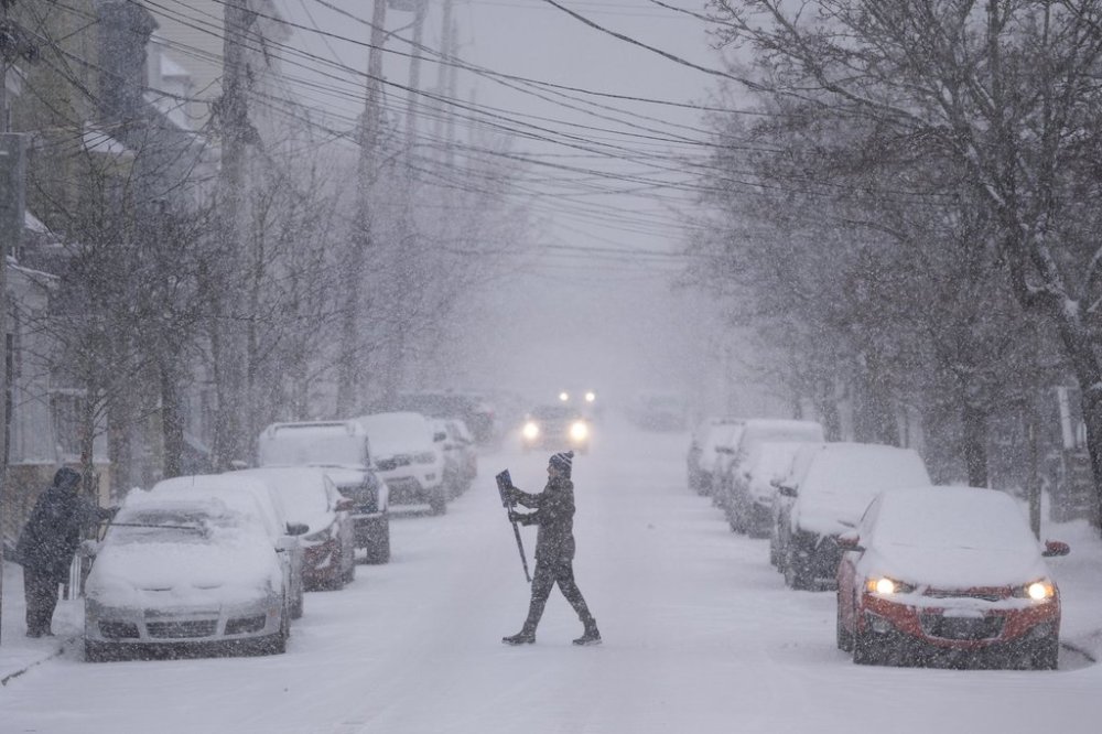
A large portion of Ontario, stretching from the Temiskaming-Temagami area in the north to the Sarnia area in the south, was under a snowfall warning, as was the southern half of Quebec.
Freezing rain warnings were issued for parts of southwestern Ontario, and snowfall warnings for the Toronto area, where up to 15 centimetres of snow was expected by Thursday morning. Farther north, up to 40 cm was forecast across cottage country and into eastern Ontario including Ottawa.
In southern Quebec, between 15 and 40 cm of snow was forecast to fall by Thursday afternoon, with the heaviest snowfall predicted for southern communities including Montreal and Quebec City.
“Quebec is right in that sweet spot … with up to 40 centimetres for some areas,” Hubbard said.
In New Brunswick, up to 25 cm of snow could pile up across central and northern New Brunswick, with snowfall rates reaching up to four centimetres per hour.
Meanwhile, residents of Nova Scotia were being warned to prepare for power outages and treacherous driving conditions as the snow was expected to change to ice pellets and periods of freezing rain on Thursday afternoon, followed by a changeover to light rain in southern sections of the province.
“The ice pellets will be the main thing followed by a brief period of freezing rain before the temperatures warm up and it goes over to rain,” Hubbard said, adding that Nova Scotia communities along the Atlantic coast, including Halifax, won’t have to worry about a prolonged stretch of freezing rain.
In P.E.I., the forecast was calling for 15 to 20 cm of snow on the west side of the Island, with ice pellets and freezing rain coating eastern and central areas on Thursday evening.
In Newfoundland, blowing snow was expected for the Friday morning commute, with up to 25 cm of snow in the forecast for the western edge of the island and lesser amounts farther east.

Elsewhere, extreme cold continued to grip southeastern B.C., the southern half of the Prairie provinces and northwestern Ontario. Wind chill values were reaching -35 C to -40 C on Wednesday and more extreme cold was on the way for Thursday and Friday.
In western Labrador, wind chill values were expected to plunge to -50 C overnight and into Thursday morning.
“Cover up,” Environment Canada said in a weather warning. “Frostbite can develop within minutes on exposed skin, especially with wind chill. If it’s too cold for you to stay outside, it’s too cold for your pet to stay outside.”
And on Labrador’s northern coast, a wind warning was issued for the remote community of Nain, where northwesterly gusts reaching 100 kilometres per hour risked causing property damage.
This report by The Canadian Press was first published Feb. 12, 2025.