For Northeast blizzard, everything was just right to roll up a monster snowfall
Advertisement
Read this article for free:
or
Already have an account? Log in here »
To continue reading, please subscribe:

Digital Subscription
One year of digital access for only $205*
- Enjoy unlimited reading on winnipegfreepress.com
- Read the E-Edition, our digital replica newspaper
- Access News Break, our award-winning app
- Play interactive puzzles
*First annual payment billed as $205.00 + GST for one year. This annual subscription will automatically renew at $233.00 + GST every 52 weeks (10% off the regular annual price of $259.35). Offer available to new and qualified returning subscribers only. Cancel any time.
To continue reading, please subscribe:
Add Free Press access to your Brandon Sun subscription for only an additional
$1 for the first 4 weeks*
- Enjoy unlimited reading on winnipegfreepress.com
- Read the E-Edition, our digital replica newspaper
- Access News Break, our award-winning app
- Play interactive puzzles
*Your next Brandon Sun subscription payment will increase by $1.00 and you will be charged $17.95 plus GST for four weeks. After four weeks, your payment will increase to $24.95 plus GST every four weeks.
Read unlimited articles for free today:
or
Already have an account? Log in here »
Hey there, time traveller!
This article was published 23/02/2026 (228 days ago), so information in it may no longer be current.
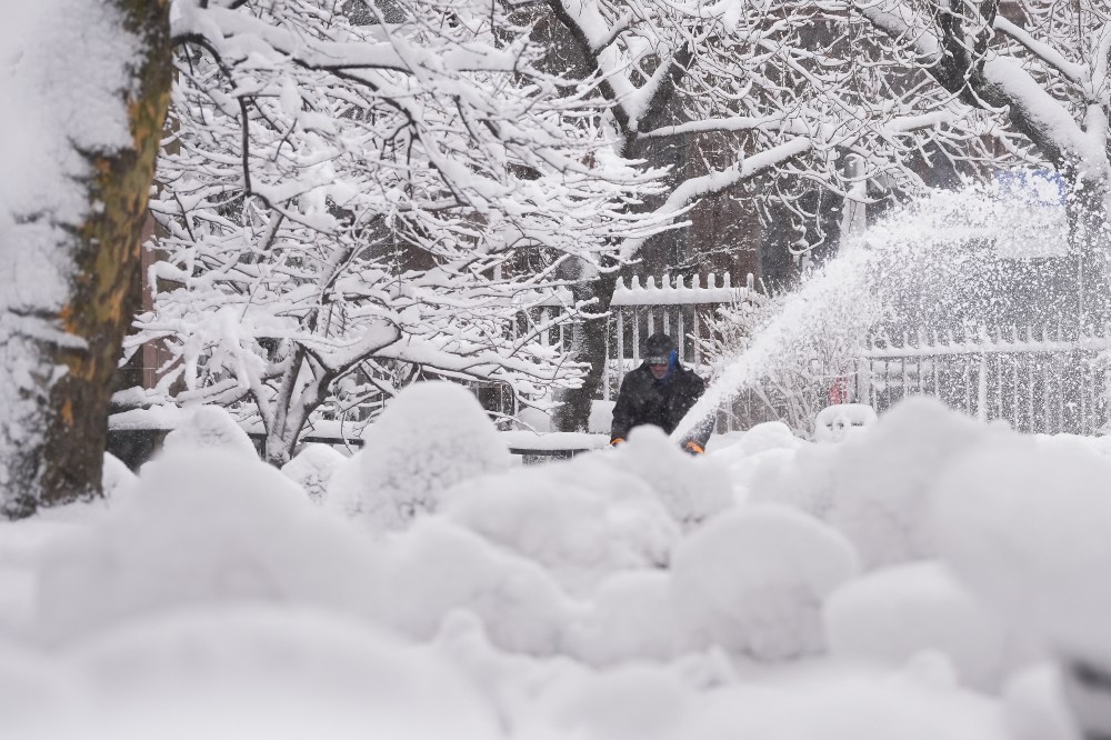
WASHINGTON (AP) — The nor’easter smacking much of the Northeast with nearly 3 feet of snow in places is as classic and powerful a blizzard as you can get, the strongest in a decade and up there with the most intense in history, meteorologists said.
The nor’easter quickly intensified to easily qualify as a “ bomb cyclone ” and featured thundersnow and lightning, two things rarely seen in snowstorms. And while it was paralyzing and potentially dangerous for millions along the Eastern Seaboard, meteorologists found themselves rhapsodizing over its combination of power and beauty.
The storm hit the “Goldilocks situation” of just the right temperature for wet, heavy snow — any warmer and its precipitation wouldn’t have fallen as snow. Any colder and there wouldn’t have been as much moisture in the air to feed that snowfall, said Owen Shieh, warning coordination meteorologist at the National Weather Service’s Weather Prediction Center in Maryland.
It also followed the ideal track for maximum snowfall. A little farther inland and it would have lost its warm ocean energy; a bit farther out to sea, and the heaviest snow would have fallen over the water, said Jeff Masters, co-founder of Weather Underground and now meteorologist at Yale Climate Connections.
“I’ve always been fascinated about how Mother Nature figures out how to put all the pieces together in order to maximize the most extreme outcome,” said private meteorologist Ryan Maue, a former chief scientist for the National Oceanic and Atmospheric Administration. ”I think you could make a pretty good case that this is on par with some of the most impressive blizzards in history.”
Snow sweet spot that adds up
“There’s this sweet spot that can generate your highest snow totals and that’s kind of where we’re at, so in a way that kind of adds to that classic-ness of it,” Shieh said.
At 33.5 inches (85.1 centimeters) by about midday Monday, Providence set its all-time record for snowfall, beating the previous record set in 1978, and it was still snowing, the National Weather Service office in Boston reported. But the highest total reported so far was in Warwick, Rhode Island, which barely passed 3 feet at 36.2 inches (92 centimeters).
Islip Airport in Long Island, New York, and Somerset and Berkeley, Massachusetts, all had 31 inches (78.7 centimeters), and at least 19 weather stations in five states recorded 2 feet (61 centimeters) or more of snow. Central Park in New York City had more than 19.1 inches (48.5 centimeters), while Philadelphia reached 14 inches (35.6 centimeters), according to preliminary weather service calculations.
Winds topped out at 83 mph (133.6 kilometers per hour) in Nantucket, Massachusetts, with several spots on Cape Cod measuring hurricane-force winds.
And it’s the type of wet heavy snow that often triggers heart attacks, Shieh said.
“Just a word of caution for those who are going to be out shoveling the snow, that this will be easy to overexert yourself on,” Shieh said. “So take frequent breaks.”
A superbomb developing
Meteorologists measure how strong a storm gets by the atmospheric pressure at its center. The lower it goes, the stronger. This storm intensified quickly, dropping 39 millibars in 24 hours, easily passing the threshold of 24 millibars per day drop to be classified as “bombogenesis” or a “bomb cyclone,” Shieh and Maue said.
“I guess you could call it a superbomb,” Maue said.
Winter storms like this get their energy from the contrast in temperature between the cold air on land and the warm moist air over the ocean along with heat energy from the seas themselves, Masters said.
“This is about as intense as you can get,” Maue said. Its lowest pressure of 966 millibars would be a Category 2 hurricane if it were tropical, he said. He called it “a hurricane with snow.”
“It is a classic in terms of not only the snowfall rates, but the intensity of the storm itself,” said former weather service director Louis Uccellini, who wrote meteorological textbooks on winter storms, comparing it to storms in 2016 and 1961. “It was just an amazing storm system.”
A study last summer found that in a warming world, the strongest nor’easters were becoming significantly stronger.
MIT’s Judah Cohen said that a stretched polar vortex — when ultra-cold air usually penned up near the North Pole pushes further south — started just before the storm and was a factor. And he had a separate study last year finding these polar vortex stretches are increasing with a warmer Arctic.
Thundersnow and lightning
An unusual combination of winter and summer weather — thundersnow and lightning — flashed at times with this storm, thrilling meteorologists on air. That’s because “you only see it in the most intense winter storms,” Masters said.
Weather Channel extreme weather meteorologist Jim Cantore was reporting live from Plymouth, Massachusetts, when lightning struck nearby — the same place he was at 11 years ago when lightning struck during a storm he was reporting on.
“Holy smokes. We got it again baby,” Cantore screamed. “In the same place. Unbelievable.”
Meteorologist Matthew Cappucci, who grew up in Plymouth and said he yearned for thundersnow, rhapsodized about how “really cool” it was that this winter storm sparked a lightning strike to a New York City skyscraper and to wind turbines off the Massachusetts coast. Shieh said the weather service doesn’t have reports of thundersnow in New York.
Exactly what a nor’easter should look like

Meteorologists like Cappucci, Cohen and Uccellini, who love snow and extreme weather, gushed over satellite images of the storm, where they could see all the features that made this one come together perfectly.
Shieh said it looked almost too good, like something from a disaster movie.
“It almost looks like CGI (computer generated image),” he said.
___
The Associated Press’ climate and environmental coverage receives financial support from multiple private foundations. AP is solely responsible for all content. Find AP’s standards for working with philanthropies, a list of supporters and funded coverage areas at AP.org.