

‘My yard is such a mess’
Homeowners deal with surge aftermath as river begins to subside

Advertisement
Read this article for free:
or
Already have an account? Log in here »
To continue reading, please subscribe:
Monthly Digital Subscription
$1 per week for 24 weeks*
- Enjoy unlimited reading on winnipegfreepress.com
- Read the E-Edition, our digital replica newspaper
- Access News Break, our award-winning app
- Play interactive puzzles
*Billed as $4.00 plus GST every four weeks. After 24 weeks, price increases to the regular rate of $19.95 plus GST every four weeks. Offer available to new and qualified returning subscribers only. Cancel any time.
Monthly Digital Subscription
$4.99/week*
- Enjoy unlimited reading on winnipegfreepress.com
- Read the E-Edition, our digital replica newspaper
- Access News Break, our award-winning app
- Play interactive puzzles
*Billed as $19.95 plus GST every four weeks. Cancel any time.
To continue reading, please subscribe:
Add Free Press access to your Brandon Sun subscription for only an additional
$1 for the first 4 weeks*
- Enjoy unlimited reading on winnipegfreepress.com
- Read the E-Edition, our digital replica newspaper
- Access News Break, our award-winning app
- Play interactive puzzles
*Your next Brandon Sun subscription payment will increase by $1.00 and you will be charged $17.95 plus GST for four weeks. After four weeks, your payment will increase to $24.95 plus GST every four weeks.
Read unlimited articles for free today:
or
Already have an account? Log in here »
Hey there, time traveller!
This article was published 01/04/2017 (3323 days ago), so information in it may no longer be current.
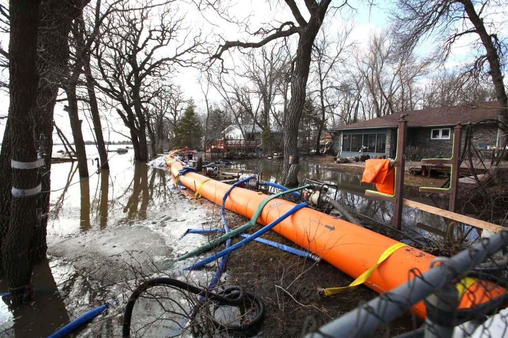
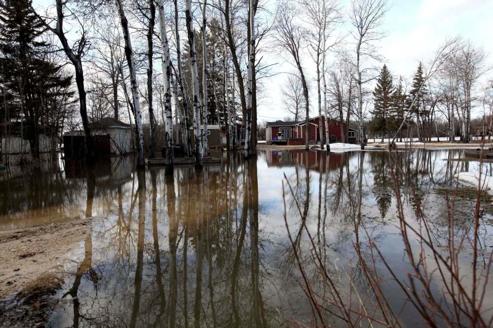
PETERSFIELD, Man. — The water surged into Joan Balcaen’s backyard late Friday night, flowing over the earthen berm that was supposed to hold Netley Creek in its banks. All night long, crews worked to keep the water at bay.
By Saturday afternoon, the water had subsided. Volunteer firefighters from the R.M. of St. Andrews had pumped much of the water back into the creek; the inflatable dike they installed helped keep more from pouring in.
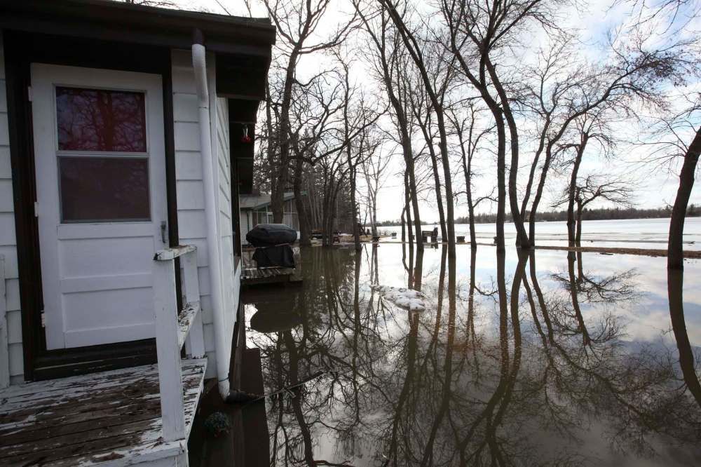
Still, the flood surge left its mark on Balcaen’s Petersfield property, situated on a tree-lined peninsula that juts into Netley Creek. The water came in from both sides, and lingered underneath her home and in a sodden backyard.
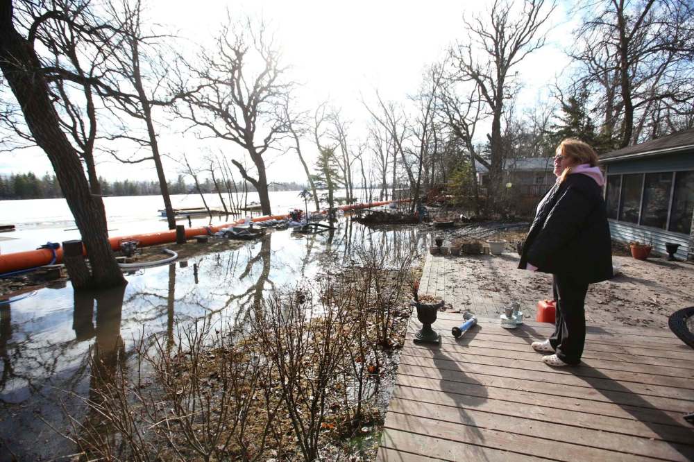
“At 6 a.m. this morning, it was coming into my veranda,” Balcaen said, surveying her waterlogged yard. “I’m going to have to get (the berm) higher I guess, because now my yard is such a mess. I don’t know what I’m going to do.”
In the 20 years Balcaen has lived at the spot, it is the worst spring flooding that she’s ever seen. It wasn’t only her property, either: her neighbours on Chesley Crescent and on the other side of the creek were also deluged.
“Last year was nothing, the year before was nothing,” she said. “I’ve had a couple of ring dikes, but nothing like this. Not this much water, this fast.”
The sudden surge came after the province opened the floodway on Friday morning, unusually early in the season. In 2013, it opened the floodway on April 29; in 2011, the last major flooding event, the floodway opened on April 9.
That may have caused some of the sudden surge in Petersfield, where about 20 homes were threatened. With much of the ground still frozen and even culverts still clogged with ice, there weren’t many places for the extra water to go.
“It came up overnight, and from different directions than it usually comes from,” R.M. mayor George Pike said.
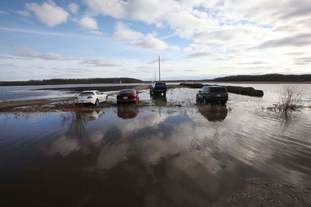
Yet other than that scramble to protect homes in Petersfield, southern Manitoba floodwater remained largely manageable, as the Red River neared its expected crest and overland flooding crept over the prairie.
Inside the Perimeter Highway, flood precautions flowed smoothly on Saturday, after the Red River rose over a foot overnight.
It hit a spring high of 19.4 feet above its typical winter ice level at James Avenue on early Saturday morning, before slightly subsiding to 19.3 ft.
That was within the range that city officials expected, Waste Water Services manager Chris Carroll said. Experts predict the Red River will crest at 20.8 ft. James, slightly higher than the 20.7 ft. high-water mark set during the 2011 flood.
Those levels put about 50 Winnipeg properties at risk of flooding. Twenty-five of those already have sandbag dikes in place, or were completing them Saturday. With the floodway open, the other 25 properties are now on standby.
Most of those properties are no strangers to flood risk; Carroll said the city had worked with most of them “on many occasions” before.
On Thursday, one homeowner told the Free Press that sandbagging is a “spring tradition.”

All told, Carroll said, Winnipeg is “very well prepared” to handle the risks, based on current water levels. That could change with a major rainfall, but some good news: there aren’t any walloping downpours forecasted on the horizon.
Meanwhile, overland flooding crept over large swaths of southern Manitoba, worsened by ice jams throughout drainage systems. Ice jams are building throughout major rivers and smaller tributaries, the province said.
In response, the province has partial ring dikes underway or completed at Gretna, St. Adolphe and Brunkild. The province said it expects Highway 75 to remain open, though it will build a ramp north of Morris as a precaution.
Flood warnings stood in effect for Fisher, Morris and Pembina rivers, with flood watches and high-water advisories in place across a number of other southern Manitoba waterways.
melissa.martin@freepress.mb.ca
Melissa Martin
Reporter-at-large
Melissa Martin reports and opines for the Winnipeg Free Press.
Every piece of reporting Melissa produces is reviewed by an editing team before it is posted online or published in print — part of the Free Press‘s tradition, since 1872, of producing reliable independent journalism. Read more about Free Press’s history and mandate, and learn how our newsroom operates.
Our newsroom depends on a growing audience of readers to power our journalism. If you are not a paid reader, please consider becoming a subscriber.
Our newsroom depends on its audience of readers to power our journalism. Thank you for your support.
Related Articles
Flood fears recede in Winnipeg; states of emergencies declared outside city


Advertisement Advertise With Us
Advertisement Advertise With Us
History
Updated on Saturday, April 1, 2017 10:11 PM CDT: changes headline