

Red River’s red flags: sediment threatens fish
Bacteria, phosphorus, nitrogen increasing: Minnesota river quality study

Advertisement
Read this article for free:
or
Already have an account? Log in here »
To continue reading, please subscribe:
Digital Subscription
One year of digital access for only $1.44 a week*
- Enjoy unlimited reading on winnipegfreepress.com
- Read the E-Edition, our digital replica newspaper
- Access News Break, our award-winning app
- Play interactive puzzles
*Billed as $5.77 plus GST every four weeks. After 52 weeks, price increases to the regular rate of $19.95 plus GST every four weeks. Offer available to new and qualified returning subscribers only. Cancel any time.
To continue reading, please subscribe:
Add Free Press access to your Brandon Sun subscription for only an additional
$1 for the first 4 weeks*
- Enjoy unlimited reading on winnipegfreepress.com
- Read the E-Edition, our digital replica newspaper
- Access News Break, our award-winning app
- Play interactive puzzles
*Your next Brandon Sun subscription payment will increase by $1.00 and you will be charged $17.95 plus GST for four weeks. After four weeks, your payment will increase to $24.95 plus GST every four weeks.
Read unlimited articles for free today:
or
Already have an account? Log in here »
Hey there, time traveller!
This article was published 27/02/2019 (2646 days ago), so information in it may no longer be current.
The Red River is not the greatest home for fish and more can be done to make it better, Minnesota’s first comprehensive study of river water quality and fish and insect communities says.
The study, produced by the Minnesota Pollution Control Agency, says the Red River, which forms the border between that U.S. state and North Dakota, has places where there is so much sediment in the water, it makes it hard for fish “to find food, detect predators and reproduce in cloudy water.”
As well, the study found fish can’t go into some areas because of high bacteria counts, and levels of both phosphorus and nitrogen are increasing.
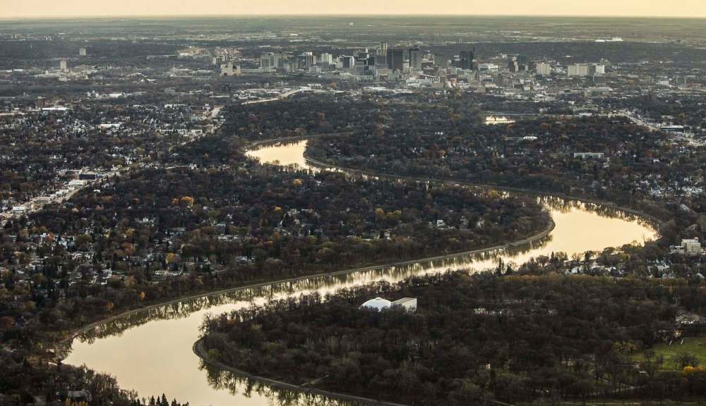
“Generally speaking, fish and aquatic insect communities are doing reasonably well, but decline as you go downstream,” the study says. “The high nutrient levels contribute to the severe algae downstream in Lake Winnipeg on the Canadian side of the basin.”
Jim Ziegler, the agency’s Detroit Lakes regional manager, said Tuesday the main problem is the Red River experiences a huge flow of water in the spring and during rainstorms, but the flow goes to a trickle or not at all during other times of the year.
“The water gets to the river very fast,” Ziegler said. “We have high flows, which raises the amount of sediment to the river and all the way north to Lake Winnipeg. But then you get low flows between the rain events and that causes problems with fish.”
Ziegler said the state has created places to store excess water so it can release it after flood and rain events, but it needs even more of them.
“It’s part of what can be done,” he said. “This is one of the most productive farming areas in the world, and we want our farmers to remain productive… our challenge isn’t to reduce drainage, but to have drainage, productive farming and water flow.”
The study looked at the river from Breckenridge, Minn., where the Bois de Sioux River joins the Otter Tail River to create the Red, north to the Manitoba border.
Other recommendations include: improving fertilizer and manure management, boosting soil health to help the ground absorb water during heavy rainstorms, investment in waste-water treatment so communities in the basin the Red River drains into can reduce the amount of phosphorus put into the river and flood-mitigation projects to prevent runoff that flushes pollutants from the land and into the river.
Nicole Armstrong, Manitoba Sustainable Development’s director of water science and watershed management, said she’s pleased the report mentions how problems in the Red River lead to problems in Lake Winnipeg.
“We recognize 50 per cent of the nutrient-loading to Lake Winnipeg comes from upstream,” Armstrong said.
“They recognize the impact of their actions and its effect on us… We share many of the same concerns on the Manitoba side. It really supports us working quite collaboratively with Minnesota.”
Meanwhile, the U.S. Army Corps of Engineers has announced it is draining water out of its reservoirs into the Red River in advance of this spring’s snowmelt.
In a statement, the agency said it is in the process of lowering the water level at several places, including Lake Ashtabula, near Valley City, N.D., by 1.5 metres; the level in the Homme Dam, near Park River, N.D., by almost four metres; and Orwell Lake, near Fergus Falls, Minn., by about 2.7 metres. The Corps warns the water release could “degrade” river ice downstream of the reservoirs, thus people should beware in those areas.
kevin.rollason@freepress.mb.ca
Kevin Rollason is a general assignment reporter at the Free Press. He graduated from Western University with a Masters of Journalism in 1985 and worked at the Winnipeg Sun until 1988, when he joined the Free Press. He has served as the Free Press’s city hall and law courts reporter and has won several awards, including a National Newspaper Award. Read more about Kevin.
Every piece of reporting Kevin produces is reviewed by an editing team before it is posted online or published in print — part of the Free Press‘s tradition, since 1872, of producing reliable independent journalism. Read more about Free Press’s history and mandate, and learn how our newsroom operates.
Our newsroom depends on a growing audience of readers to power our journalism. If you are not a paid reader, please consider becoming a subscriber.
Our newsroom depends on its audience of readers to power our journalism. Thank you for your support.
Kevin Rollason is a general assignment reporter at the Free Press. He graduated from Western University with a Masters of Journalism in 1985 and worked at the Winnipeg Sun until 1988, when he joined the Free Press. He has served as the Free Press’s city hall and law courts reporter and has won several awards, including a National Newspaper Award. Read more about Kevin.
Every piece of reporting Kevin produces is reviewed by an editing team before it is posted online or published in print — part of the Free Press‘s tradition, since 1872, of producing reliable independent journalism. Read more about Free Press’s history and mandate, and learn how our newsroom operates.
Our newsroom depends on a growing audience of readers to power our journalism. If you are not a paid reader, please consider becoming a subscriber.
Our newsroom depends on its audience of readers to power our journalism. Thank you for your support.
Advertisement Advertise With Us
Advertisement Advertise With Us
History
Updated on Wednesday, February 27, 2019 6:34 AM CST: Adds photo